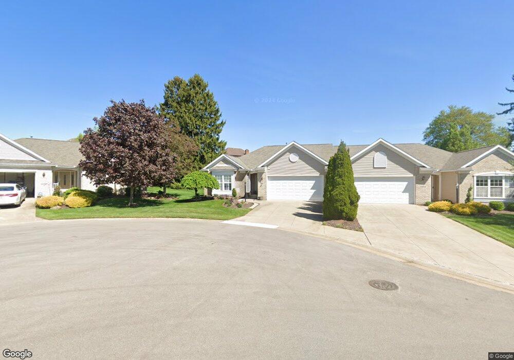
2247 Hampton Ln Uniontown, OH 44685
Estimated Value: $289,000 - $348,000
3
Beds
2
Baths
1,760
Sq Ft
$185/Sq Ft
Est. Value
About This Home
This home is located at 2247 Hampton Ln, Uniontown, OH 44685 and is currently estimated at $325,227, approximately $184 per square foot. 2247 Hampton Ln is a home located in Summit County with nearby schools including Greenwood Elementary School, Green Primary School, and Green Intermediate Elementary School.
Ownership History
Date
Name
Owned For
Owner Type
Purchase Details
Closed on
Nov 28, 2022
Sold by
Hannah Bruce D and Hannah Diana M
Bought by
Hannah Family Fortress Trust and Justice
Current Estimated Value
Purchase Details
Closed on
Feb 22, 2006
Sold by
Design Construction Services Llc
Bought by
Hannah Bruce D and Hannah Diana M
Home Financials for this Owner
Home Financials are based on the most recent Mortgage that was taken out on this home.
Original Mortgage
$125,000
Interest Rate
4.75%
Mortgage Type
Purchase Money Mortgage
Purchase Details
Closed on
Oct 31, 2005
Sold by
Mayfair East Developers Llc
Bought by
Design Construction Services Llc
Home Financials for this Owner
Home Financials are based on the most recent Mortgage that was taken out on this home.
Original Mortgage
$1,500,000
Interest Rate
5.8%
Mortgage Type
Purchase Money Mortgage
Create a Home Valuation Report for This Property
The Home Valuation Report is an in-depth analysis detailing your home's value as well as a comparison with similar homes in the area
Home Values in the Area
Average Home Value in this Area
Purchase History
| Date | Buyer | Sale Price | Title Company |
|---|---|---|---|
| Hannah Family Fortress Trust | -- | None Listed On Document | |
| Hannah Bruce D | $204,282 | Bond & Associates Title Agen | |
| Design Construction Services Llc | $38,000 | Bond & Associates Title Agen |
Source: Public Records
Mortgage History
| Date | Status | Borrower | Loan Amount |
|---|---|---|---|
| Previous Owner | Hannah Bruce D | $125,000 | |
| Previous Owner | Design Construction Services Llc | $1,500,000 |
Source: Public Records
Tax History Compared to Growth
Tax History
| Year | Tax Paid | Tax Assessment Tax Assessment Total Assessment is a certain percentage of the fair market value that is determined by local assessors to be the total taxable value of land and additions on the property. | Land | Improvement |
|---|---|---|---|---|
| 2025 | $4,322 | $91,032 | $19,089 | $71,943 |
| 2024 | $4,322 | $91,032 | $19,089 | $71,943 |
| 2023 | $4,322 | $91,032 | $19,089 | $71,943 |
| 2022 | $4,012 | $75,860 | $15,908 | $59,952 |
| 2021 | $3,764 | $75,860 | $15,908 | $59,952 |
| 2020 | $3,692 | $75,860 | $15,910 | $59,950 |
| 2019 | $3,458 | $66,510 | $9,750 | $56,760 |
| 2018 | $3,534 | $66,510 | $9,750 | $56,760 |
| 2017 | $3,379 | $66,510 | $9,750 | $56,760 |
| 2016 | $3,363 | $59,670 | $9,750 | $49,920 |
| 2015 | $3,379 | $59,670 | $9,750 | $49,920 |
| 2014 | $3,357 | $59,670 | $9,750 | $49,920 |
| 2013 | $3,396 | $60,000 | $9,750 | $50,250 |
Source: Public Records
Map
Nearby Homes
- 3598 Elmhurst Cir
- 3541 Elmhurst Cir
- 2189 E Park Dr
- 2518 Glenshire Cir Unit 36A
- 3514 Chanticleer Ct
- 2500 Marlborough Dr
- 3534 Chanticleer Ct
- 2511 Royal County Down
- 2535 Royal County Down Unit B
- 2538 Royal County Down
- 3523 Parfoure Blvd
- 4009 Troon Dr
- 2154 Prestwick Dr
- 1959 Fairway Dr
- 3117 Imrek Dr
- Northwood Plan at Spring Hill - Spring Hill Villas
- Kenai Plan at Spring Hill - Spring Hill Villas
- Bradbern Plan at Spring Hill - Spring Hill Villas
- Sarasota Plan at Spring Hill - Spring Hill Villas
- Holston Plan at Spring Hill - Spring Hill Villas
- 2255 Hampton Ln
- 2239 Hampton Ln
- 2263 Hampton Ln
- 3685 Elmhurst Cir
- 3677 Elmhurst Cir
- 2256 Hampton Ln
- 2229 Glenross Dr
- 2221 Glenross Dr
- 2237 Glenross Dr
- 2264 Hampton Ln
- 2245 Glenross Dr
- 3669 Elmhurst Cir
- 3458 Ashton Dr
- 2209 Glenross Dr
- 3664 Elmhurst Cir
- 2253 Glenross Dr
- 3661 Elmhurst Cir
- 3466 Ashton Dr
- 3450 Ashton Dr
- 2201 Glenross Dr