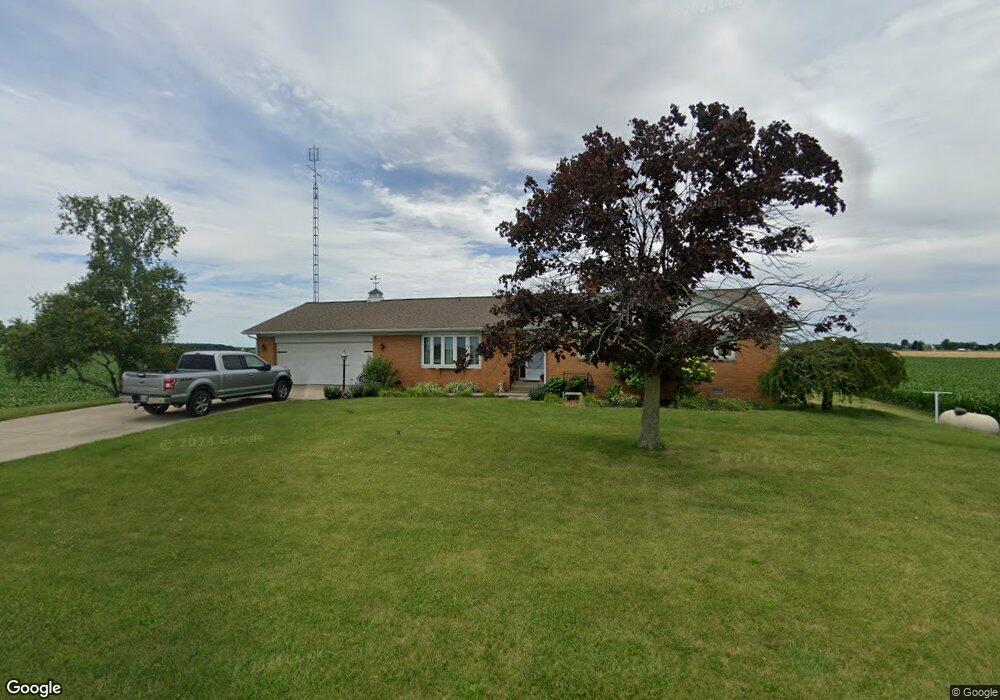
2248 Adams Ridge Rd Defiance, OH 43512
Estimated Value: $215,000 - $264,000
3
Beds
2
Baths
1,615
Sq Ft
$147/Sq Ft
Est. Value
About This Home
This home is located at 2248 Adams Ridge Rd, Defiance, OH 43512 and is currently estimated at $237,649, approximately $147 per square foot. 2248 Adams Ridge Rd is a home located in Defiance County with nearby schools including Tinora Elementary School, Noble Elementary School, and Tinora Middle School.
Ownership History
Date
Name
Owned For
Owner Type
Purchase Details
Closed on
Jul 12, 2011
Sold by
Buehrer Beverly J and Allen Beverly J
Bought by
Allen Brent W
Current Estimated Value
Home Financials for this Owner
Home Financials are based on the most recent Mortgage that was taken out on this home.
Original Mortgage
$25,450
Interest Rate
4.53%
Mortgage Type
Purchase Money Mortgage
Purchase Details
Closed on
Jan 1, 1992
Bought by
Allen Vivian J
Create a Home Valuation Report for This Property
The Home Valuation Report is an in-depth analysis detailing your home's value as well as a comparison with similar homes in the area
Home Values in the Area
Average Home Value in this Area
Purchase History
| Date | Buyer | Sale Price | Title Company |
|---|---|---|---|
| Allen Brent W | -- | -- | |
| Allen Vivian J | -- | -- |
Source: Public Records
Mortgage History
| Date | Status | Borrower | Loan Amount |
|---|---|---|---|
| Closed | Allen Brent W | $25,450 |
Source: Public Records
Tax History Compared to Growth
Tax History
| Year | Tax Paid | Tax Assessment Tax Assessment Total Assessment is a certain percentage of the fair market value that is determined by local assessors to be the total taxable value of land and additions on the property. | Land | Improvement |
|---|---|---|---|---|
| 2024 | $1,632 | $56,710 | $3,080 | $53,630 |
| 2023 | $1,632 | $56,710 | $3,080 | $53,630 |
| 2022 | $1,477 | $44,690 | $2,880 | $41,810 |
| 2021 | $1,477 | $44,690 | $2,880 | $41,810 |
| 2020 | $1,479 | $44,690 | $2,880 | $41,810 |
| 2019 | $1,412 | $43,810 | $3,760 | $40,050 |
| 2018 | $1,452 | $43,810 | $3,760 | $40,050 |
| 2017 | $1,403 | $43,806 | $3,755 | $40,051 |
| 2016 | $1,390 | $45,895 | $3,755 | $42,140 |
| 2015 | $728 | $45,895 | $3,755 | $42,140 |
| 2014 | $728 | $45,419 | $3,755 | $41,664 |
| 2013 | $728 | $45,419 | $3,755 | $41,664 |
| 2012 | $728 | $45,420 | $3,756 | $41,664 |
Source: Public Records
Map
Nearby Homes
- 29232 Coressel Rd
- 20401 U S 6
- 19972 County Road X
- 19950 County Road X
- 19913 County Road X
- 23648 County Rd S
- 26825 Behrens Rd
- 26761 Behrens Rd
- 6767 Independence Rd
- 0 Westmoreland Ave
- 00 Westmoreland Ave
- 1374 Clairmont Ave
- 75 Capri Dr
- 1113 Clairmont Ave
- 1314 Clairmont Ave
- 1214 Clairmont Ave
- 1354 Clairmont Ave
- 23132 Coressel Rd
- 209 Hawthorn Dr
- 1050 Indiana Ave
- 2348 Adams Ridge Rd
- 2065 Adams Ridge Rd
- 29213 Youngman Rd
- 29171 Youngman Rd
- 29250 Nagel Rd
- 29135 Youngman Rd
- 29573 Youngman Rd
- 28904 Youngman Rd
- 2717 Adams Ridge Rd
- 1650 Adams Ridge Rd
- 29327 Allen Rd
- 1549 Adams Ridge Rd
- 29561 Allen Rd
- 30018 Youngman Rd
- 3026 Adams Ridge Rd
- 1800 Walnut Grove Rd
- 1497 Adams Ridge Rd
- 29608 Allen Rd
- 1610 Walnut Grove Rd
- 28743 Allen Rd