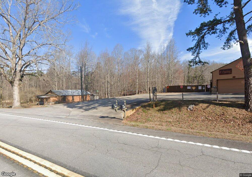
2248 Duncan Bridge Rd Cornelia, GA 30531
Estimated Value: $350,000
--
Bed
--
Bath
9,000
Sq Ft
$39/Sq Ft
Est. Value
About This Home
This home is located at 2248 Duncan Bridge Rd, Cornelia, GA 30531 and is currently priced at $350,000, approximately $38 per square foot. 2248 Duncan Bridge Rd is a home located in Habersham County with nearby schools including Level Grove Elementary School, South Habersham Middle School, and Habersham Success Academy.
Ownership History
Date
Name
Owned For
Owner Type
Purchase Details
Closed on
Sep 19, 2017
Sold by
Dorothy
Bought by
Brown Noel Dwight
Current Estimated Value
Purchase Details
Closed on
Dec 31, 2012
Sold by
Mountain Valley Community
Bought by
Smith Dorothy J
Purchase Details
Closed on
Sep 8, 2012
Sold by
Carney Rick
Bought by
Mountain Valley Community Bank
Purchase Details
Closed on
Sep 1, 2006
Sold by
Not Provided
Bought by
Carney Rick
Create a Home Valuation Report for This Property
The Home Valuation Report is an in-depth analysis detailing your home's value as well as a comparison with similar homes in the area
Home Values in the Area
Average Home Value in this Area
Purchase History
| Date | Buyer | Sale Price | Title Company |
|---|---|---|---|
| Brown Noel Dwight | $177,500 | -- | |
| Smith Dorothy J | $50,000 | -- | |
| Mountain Valley Community Bank | $104,500 | -- | |
| Carney Rick | -- | -- | |
| Carney Rick | $230,000 | -- |
Source: Public Records
Tax History Compared to Growth
Tax History
| Year | Tax Paid | Tax Assessment Tax Assessment Total Assessment is a certain percentage of the fair market value that is determined by local assessors to be the total taxable value of land and additions on the property. | Land | Improvement |
|---|---|---|---|---|
| 2020 | $1,374 | $51,016 | $0 | $51,016 |
| 2019 | $1,374 | $51,016 | $0 | $51,016 |
| 2018 | $1,290 | $48,280 | $0 | $48,280 |
| 2017 | $1,151 | $42,860 | $0 | $42,860 |
| 2016 | $1,118 | $107,150 | $0 | $42,860 |
| 2015 | $1,104 | $107,150 | $0 | $42,860 |
| 2014 | $525 | $50,000 | $0 | $20,000 |
| 2013 | -- | $20,000 | $0 | $20,000 |
Source: Public Records
Map
Nearby Homes
- 0 Hubert Harris
- 429 Hubert Harris Rd
- 240 Woodmont Dr
- 0 State Route 365 Unit 10496178
- 0 State Route 365 Unit 10496183
- 450 Beachwood Dr
- 434 Beachwood Dr
- 255 Laurel Place Dr
- 1246 Duncan Bridge Rd
- 324 Highland Pointe Dr
- 190 Sunset Oaks Dr
- 179 Sunset Oaks Dr
- 212 Fernbank Dr
- 752 Dawn Place
- 140 Highland Pointe Dr
- J Warren
- 0 J Warren Rd Unit 10429700
- 1307 Creasy Patch Rd
- 738 Wilbanks Rd
- 490 Magnolia Grove Place
- 2248 Duncan Bridge Rd
- 2248 Duncan Bridge Rd
- 2256 Duncan Bridge Rd
- 121 Cherry Cir
- 2209 Duncan Bridge Rd
- 2324 Duncan Bridge Rd
- 2324 Duncan Bridge Rd
- 169 Cherry Cir
- 124 Cherry Cir
- 2096 Duncan Bridge Rd
- 254 Cherry Cir
- 281 Cherry Cir
- 2117 Duncan Bridge Rd
- 170 Cherry Cir
- 405 Cherry Cir
- 350 Cherry Cir
- 172 Cherry Cir
- 304 Cherry Cir
- 310 Cherry Cir
- 2447 Duncan Bridge Rd