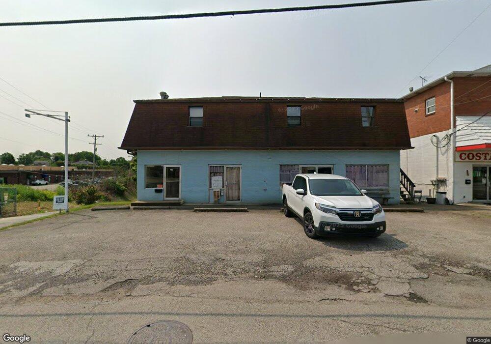
2248 Freeport Rd New Kensington, PA 15068
Estimated Value: $115,408 - $250,000
--
Bed
--
Bath
--
Sq Ft
8,930
Sq Ft Lot
About This Home
This home is located at 2248 Freeport Rd, New Kensington, PA 15068 and is currently estimated at $207,352. 2248 Freeport Rd is a home located in Westmoreland County with nearby schools including Mary Queen of Apostles School.
Ownership History
Date
Name
Owned For
Owner Type
Purchase Details
Closed on
Sep 21, 2015
Sold by
Carney Kimberlee Lynn
Bought by
Pulice John S and Pulice Frank S
Current Estimated Value
Home Financials for this Owner
Home Financials are based on the most recent Mortgage that was taken out on this home.
Original Mortgage
$100,800
Outstanding Balance
$79,091
Interest Rate
3.88%
Mortgage Type
Commercial
Estimated Equity
$128,261
Purchase Details
Closed on
Jan 22, 2009
Sold by
Carney William Todd and Carney Kimberlee Lynn
Bought by
Carney Kimberlee Lynn
Create a Home Valuation Report for This Property
The Home Valuation Report is an in-depth analysis detailing your home's value as well as a comparison with similar homes in the area
Home Values in the Area
Average Home Value in this Area
Purchase History
| Date | Buyer | Sale Price | Title Company |
|---|---|---|---|
| Pulice John S | $126,000 | None Available | |
| Carney Kimberlee Lynn | -- | None Available |
Source: Public Records
Mortgage History
| Date | Status | Borrower | Loan Amount |
|---|---|---|---|
| Open | Pulice John S | $100,800 |
Source: Public Records
Tax History Compared to Growth
Tax History
| Year | Tax Paid | Tax Assessment Tax Assessment Total Assessment is a certain percentage of the fair market value that is determined by local assessors to be the total taxable value of land and additions on the property. | Land | Improvement |
|---|---|---|---|---|
| 2025 | $3,920 | $22,960 | $4,090 | $18,870 |
| 2024 | $3,771 | $22,960 | $4,090 | $18,870 |
| 2023 | $3,518 | $22,960 | $4,090 | $18,870 |
| 2022 | $3,450 | $22,960 | $4,090 | $18,870 |
| 2021 | $3,369 | $22,960 | $4,090 | $18,870 |
| 2020 | $3,254 | $22,960 | $4,090 | $18,870 |
| 2019 | $3,179 | $22,960 | $4,090 | $18,870 |
| 2018 | $3,121 | $22,960 | $4,090 | $18,870 |
| 2017 | $3,029 | $22,960 | $4,090 | $18,870 |
| 2016 | $2,972 | $22,960 | $4,090 | $18,870 |
| 2015 | $2,972 | $22,960 | $4,090 | $18,870 |
| 2014 | $2,972 | $22,960 | $4,090 | $18,870 |
Source: Public Records
Map
Nearby Homes
- 715 Carl Ave
- 648 Earl Ave
- 103 Woodstone Ln Unit 34
- 2108 Hollingsworth St
- 2030 Kimball Ave
- 438 Esther Ave
- 613 Clyde St
- 1407 Drey St Unit 29
- 381 Camp Ave
- 1802 Kimball Ave
- 408 Craigdell Rd
- 2004 Woodmont Ave
- 1741 Freeport Rd Unit U
- 1810 Ridge Ave
- 2105 Victoria Ave
- 2004 Victoria Ave
- 1908 Woodmont Ave Unit 29
- 1735 Kimball Ave
- 1915 Woodmont Ave
- 1802 Alcoa Dr
- 2240 Freeport Rd
- 2239 Freeport Rd
- 2235 Freeport Rd
- 662 Carl Ave
- 700 Carl Ave Unit 102
- 660 Carl Ave
- 2300 Freeport Rd
- 2300 Freeport Rd Unit 3
- 2300 Freeport Rd Unit 9
- 2300 Freeport Rd
- 2300 Freeport Rd
- 2220 Freeport Rd
- 718 Carl Ave
- 656 Carl Ave
- 730 Valley St
- 2323 Freeport Rd
- 2224 Hollingsworth St
- 2300 Freeport Road Feldarelli Sq Ste 11
- 720 Carl Ave
- 2225 Freeport Rd