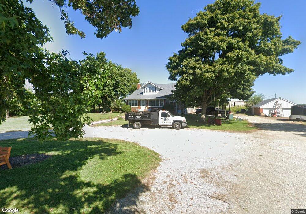
2248 W 500 N Franklin, IN 46131
Estimated Value: $393,775 - $1,373,000
3
Beds
1
Bath
2,308
Sq Ft
$322/Sq Ft
Est. Value
About This Home
This home is located at 2248 W 500 N, Franklin, IN 46131 and is currently estimated at $742,194, approximately $321 per square foot. 2248 W 500 N is a home located in Johnson County with nearby schools including Maple Grove Elementary School, Center Grove Middle School Central, and Center Grove High School.
Ownership History
Date
Name
Owned For
Owner Type
Purchase Details
Closed on
Dec 15, 2023
Sold by
Dougherty Matthew and Dougherty Amy
Bought by
Pulte Homes Of Indiana Llc
Current Estimated Value
Purchase Details
Closed on
Jan 31, 2022
Sold by
Bradley James L
Bought by
Dougherty Eric Alton and Dougherty Ethan James
Purchase Details
Closed on
Apr 26, 2017
Sold by
Baker June B and Baker Michael Eugene
Bought by
Bradley James L
Home Financials for this Owner
Home Financials are based on the most recent Mortgage that was taken out on this home.
Original Mortgage
$1,300,000
Interest Rate
4.1%
Mortgage Type
Commercial
Purchase Details
Closed on
Mar 29, 2017
Sold by
Baker June B and Baker Michael Eugene
Bought by
Dougherty Matthew D and Dougherty Amy L
Home Financials for this Owner
Home Financials are based on the most recent Mortgage that was taken out on this home.
Original Mortgage
$1,300,000
Interest Rate
4.1%
Mortgage Type
Commercial
Create a Home Valuation Report for This Property
The Home Valuation Report is an in-depth analysis detailing your home's value as well as a comparison with similar homes in the area
Home Values in the Area
Average Home Value in this Area
Purchase History
| Date | Buyer | Sale Price | Title Company |
|---|---|---|---|
| Pulte Homes Of Indiana Llc | -- | None Listed On Document | |
| Dougherty Eric Alton | -- | None Listed On Document | |
| Bradley James L | -- | None Available | |
| Dougherty Matthew D | -- | None Available |
Source: Public Records
Mortgage History
| Date | Status | Borrower | Loan Amount |
|---|---|---|---|
| Previous Owner | Dougherty Matthew D | $1,300,000 |
Source: Public Records
Tax History Compared to Growth
Tax History
| Year | Tax Paid | Tax Assessment Tax Assessment Total Assessment is a certain percentage of the fair market value that is determined by local assessors to be the total taxable value of land and additions on the property. | Land | Improvement |
|---|---|---|---|---|
| 2025 | $4,627 | $296,600 | $56,200 | $240,400 |
| 2024 | $4,627 | $231,100 | $55,900 | $175,200 |
| 2023 | $4,151 | $205,300 | $53,200 | $152,100 |
| 2022 | $4,116 | $205,300 | $53,200 | $152,100 |
| 2021 | $3,645 | $181,800 | $52,400 | $129,400 |
| 2020 | $3,339 | $166,700 | $52,400 | $114,300 |
| 2019 | $3,125 | $155,900 | $53,400 | $102,500 |
| 2018 | $3,256 | $153,500 | $53,500 | $100,000 |
| 2017 | $3,513 | $244,000 | $113,700 | $130,300 |
| 2016 | $3,485 | $246,900 | $118,400 | $128,500 |
| 2014 | $3,527 | $244,900 | $122,300 | $122,600 |
| 2013 | $3,527 | $232,600 | $109,900 | $122,700 |
Source: Public Records
Map
Nearby Homes
- 5467 Volanti Way
- 5467 Volanti Way
- 1039 Old Adobe Ln
- Cooper Plan at Scottsdale Estates - Arbor
- Palmetto Plan at Scottsdale Estates - Arbor
- Spruce Plan at Scottsdale Estates - Arbor
- Juniper Plan at Scottsdale Estates - Arbor
- Chestnut Plan at Scottsdale Estates - Arbor
- 1053 Old Adobe Ln
- Bradford Plan at Scottsdale Estates - Arbor
- Ironwood Plan at Scottsdale Estates - Arbor
- Norway Plan at Scottsdale Estates - Arbor
- Jefferson Plan at Scottsdale Estates
- Taylor Plan at Scottsdale Estates
- Arthur Plan at Scottsdale Estates
- Reagan Plan at Scottsdale Estates
- Monroe Plan at Scottsdale Estates
- Van Buren Plan at Scottsdale Estates
- 4445 N 225 W
- Henley Plan at Lone Pine Farms
- 4774 N 225 W
- 4599 N 225 W
- 2861 500 N
- 1629 W 500 N
- 4505 N 225 W
- 4504 N 225 W
- 1173 Old Adobe Ln
- 5602 Volanti Way
- 5531 Volanti Way
- 5677 Volanti Way
- 5554 Volanti Way
- 5612 Coulter Way
- 1700 W 500 N
- 1060 E Old Abode Ln Unit 38007030
- 4905 N State Road 135
- 39 N State Road 135
- 5691 Volanti Way
- 4302 N 225 W
- 1256 Little Rodeo Place
- 2144 W 425 N