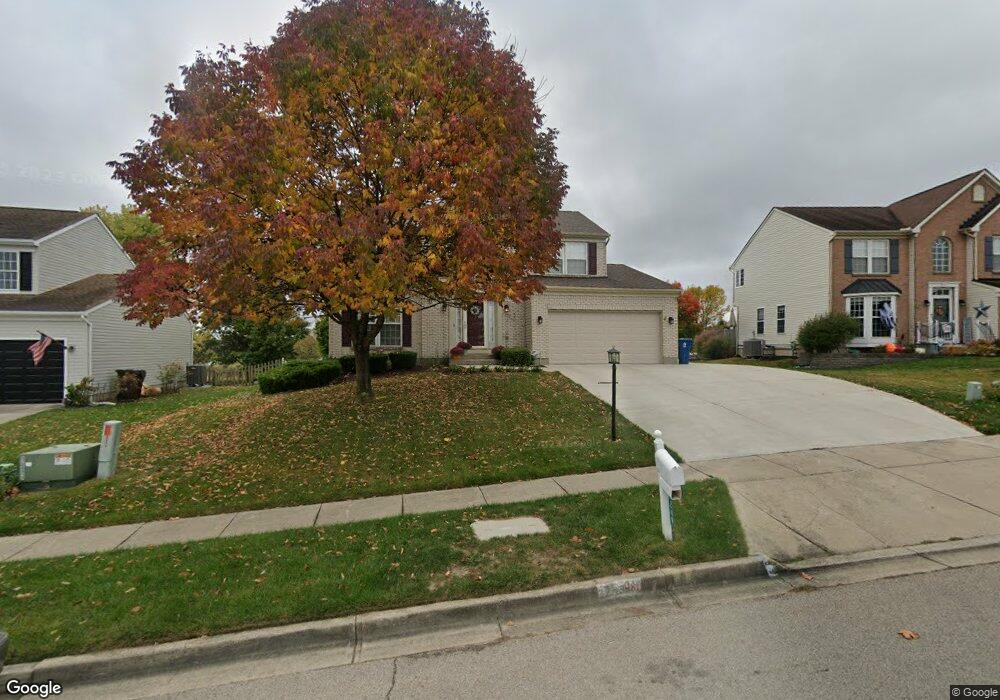
2249 Bandit Trail Dayton, OH 45434
Estimated Value: $381,904 - $426,000
4
Beds
4
Baths
1,958
Sq Ft
$207/Sq Ft
Est. Value
About This Home
This home is located at 2249 Bandit Trail, Dayton, OH 45434 and is currently estimated at $404,726, approximately $206 per square foot. 2249 Bandit Trail is a home located in Greene County with nearby schools including Trebein Elementary School, Jacob Coy Middle School, and Beavercreek High School.
Ownership History
Date
Name
Owned For
Owner Type
Purchase Details
Closed on
Oct 16, 2012
Sold by
Penrod Robert W and Penrod Kristen
Bought by
Wapelhorst Wayne Robert and Wapelhorst Susan M
Current Estimated Value
Home Financials for this Owner
Home Financials are based on the most recent Mortgage that was taken out on this home.
Original Mortgage
$189,000
Outstanding Balance
$131,000
Interest Rate
3.53%
Mortgage Type
Unknown
Estimated Equity
$273,726
Purchase Details
Closed on
Jun 25, 1999
Sold by
Nvr Inc
Bought by
Penrod Robert W and Penrod Kristin
Home Financials for this Owner
Home Financials are based on the most recent Mortgage that was taken out on this home.
Original Mortgage
$157,280
Interest Rate
7.29%
Purchase Details
Closed on
Mar 11, 1999
Sold by
Arnold Rhoads Morgan Development
Bought by
Nvr Inc
Create a Home Valuation Report for This Property
The Home Valuation Report is an in-depth analysis detailing your home's value as well as a comparison with similar homes in the area
Home Values in the Area
Average Home Value in this Area
Purchase History
| Date | Buyer | Sale Price | Title Company |
|---|---|---|---|
| Wapelhorst Wayne Robert | -- | None Available | |
| Penrod Robert W | $165,600 | -- | |
| Nvr Inc | $33,000 | -- |
Source: Public Records
Mortgage History
| Date | Status | Borrower | Loan Amount |
|---|---|---|---|
| Open | Wapelhorst Wayne Robert | $189,000 | |
| Previous Owner | Penrod Robert W | $157,280 |
Source: Public Records
Tax History Compared to Growth
Tax History
| Year | Tax Paid | Tax Assessment Tax Assessment Total Assessment is a certain percentage of the fair market value that is determined by local assessors to be the total taxable value of land and additions on the property. | Land | Improvement |
|---|---|---|---|---|
| 2024 | $5,945 | $105,700 | $20,080 | $85,620 |
| 2023 | $5,945 | $105,700 | $20,080 | $85,620 |
| 2022 | $5,310 | $82,760 | $16,070 | $66,690 |
| 2021 | $5,363 | $82,760 | $16,070 | $66,690 |
| 2020 | $5,389 | $82,760 | $16,070 | $66,690 |
| 2019 | $5,302 | $74,770 | $12,400 | $62,370 |
| 2018 | $4,621 | $74,770 | $12,400 | $62,370 |
| 2017 | $4,533 | $74,770 | $12,400 | $62,370 |
| 2016 | $4,320 | $68,970 | $12,400 | $56,570 |
| 2015 | $4,347 | $68,970 | $12,400 | $56,570 |
| 2014 | $4,245 | $68,970 | $12,400 | $56,570 |
Source: Public Records
Map
Nearby Homes
- 2331 Eastwind Dr
- 2162 Sulky Trail
- 1535 Stretch Dr
- 2073 Lincolnshire Dr
- 2507 Obetz Dr
- 2451 Dakem Dr
- 1238 Freedom Point
- 1155 Forest Dr
- 2170 Schmidt Dr N
- 2067 Codaz Way
- Hudson Plan at Nathanials Grove Estates
- Cumberland Plan at Nathanials Grove Estates
- Lehigh Plan at Nathanials Grove Estates
- Ballenger Plan at Nathanials Grove Estates
- Aviano Plan at Nathanials Grove Estates
- Allegheny Plan at Nathanials Grove Estates
- 1678 Fairground Rd
- 1957 John Bull W
- 2570 Mardella Dr
- 1247 Homestead Dr
- 2243 Bandit Trail
- 2255 Bandit Trail
- 2263 Bandit Trail
- 2252 Bandit Trail
- 2225 Bandit Trail
- 2269 Bandit Trail
- 2246 Bandit Trail
- 2219 Bandit Trail
- 2238 Bandit Trail
- 2452 Trotter Ct
- 2275 Bandit Trail
- 2453 Blacksmith Ln
- 2211 Bandit Trail
- 2444 Trotter Ct
- 2248 Horseshoe Ct
- 2252 Horseshoe Ct
- 2457 Trotter Ct
- 2283 Bandit Trail
- 2239 Sulky Ct
- 2205 Bandit Trail