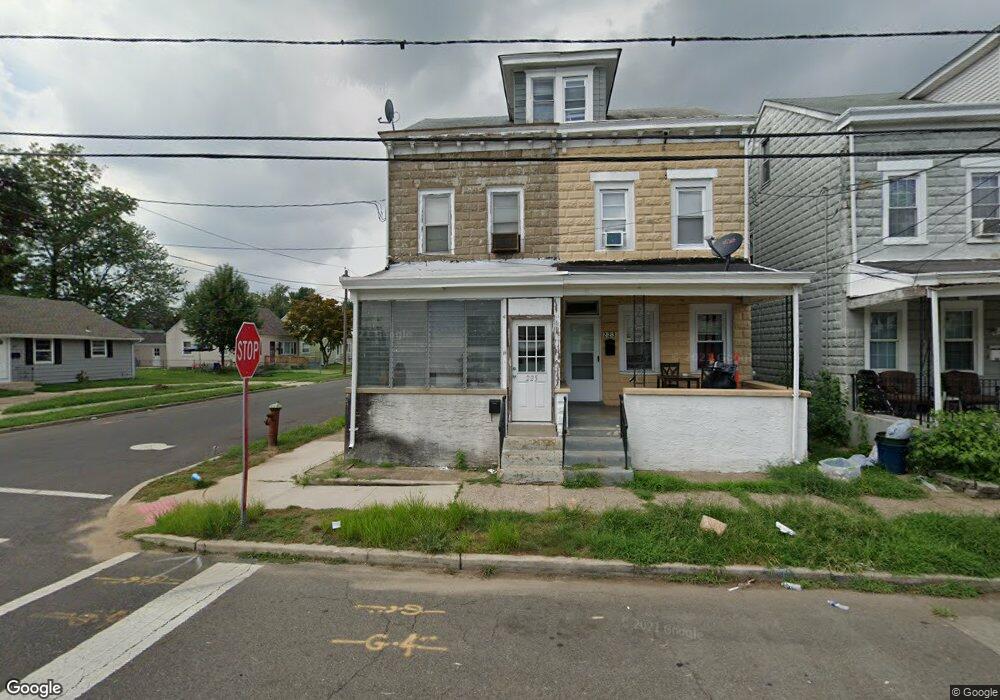
225 Buchanan Ave Trenton, NJ 08610
Franklin Park NeighborhoodEstimated Value: $131,000 - $266,799
--
Bed
--
Bath
1,388
Sq Ft
$138/Sq Ft
Est. Value
About This Home
This home is located at 225 Buchanan Ave, Trenton, NJ 08610 and is currently estimated at $190,950, approximately $137 per square foot. 225 Buchanan Ave is a home located in Mercer County with nearby schools including Lalor Elementary School, Richard C. Crockett Middle School, and Hamilton West-Watson High School.
Ownership History
Date
Name
Owned For
Owner Type
Purchase Details
Closed on
Jul 7, 2025
Sold by
Hansen Karen I
Bought by
Hansen Sonya B
Current Estimated Value
Home Financials for this Owner
Home Financials are based on the most recent Mortgage that was taken out on this home.
Original Mortgage
$173,126
Outstanding Balance
$172,835
Interest Rate
6.89%
Mortgage Type
FHA
Estimated Equity
$18,115
Purchase Details
Closed on
Mar 7, 1983
Bought by
Hansen Karen I
Create a Home Valuation Report for This Property
The Home Valuation Report is an in-depth analysis detailing your home's value as well as a comparison with similar homes in the area
Home Values in the Area
Average Home Value in this Area
Purchase History
| Date | Buyer | Sale Price | Title Company |
|---|---|---|---|
| Hansen Sonya B | $129,000 | Goldstone Title | |
| Hansen Sonya B | $129,000 | Goldstone Title | |
| Hansen Karen I | $30,000 | -- |
Source: Public Records
Mortgage History
| Date | Status | Borrower | Loan Amount |
|---|---|---|---|
| Open | Hansen Sonya B | $173,126 | |
| Closed | Hansen Sonya B | $173,126 |
Source: Public Records
Tax History Compared to Growth
Tax History
| Year | Tax Paid | Tax Assessment Tax Assessment Total Assessment is a certain percentage of the fair market value that is determined by local assessors to be the total taxable value of land and additions on the property. | Land | Improvement |
|---|---|---|---|---|
| 2025 | $3,573 | $101,400 | $25,400 | $76,000 |
| 2024 | $3,349 | $101,400 | $25,400 | $76,000 |
| 2023 | $3,349 | $101,400 | $25,400 | $76,000 |
| 2022 | $3,297 | $101,400 | $25,400 | $76,000 |
| 2021 | $4,079 | $101,400 | $25,400 | $76,000 |
| 2020 | $3,714 | $101,400 | $25,400 | $76,000 |
| 2019 | $3,605 | $101,400 | $25,400 | $76,000 |
| 2018 | $3,557 | $101,400 | $25,400 | $76,000 |
| 2017 | $3,399 | $101,400 | $25,400 | $76,000 |
| 2016 | $2,677 | $99,000 | $23,000 | $76,000 |
| 2015 | $4,318 | $82,900 | $23,500 | $59,400 |
| 2014 | $4,262 | $82,900 | $23,500 | $59,400 |
Source: Public Records
Map
Nearby Homes
- 604 Schiller Ave
- 1961 S Broad St
- 1857 S Broad St
- 218 Sewell Ave
- 2033 Genesee St
- 1856 S Broad St
- 34 Sewell Ave
- 316 W Park Ave
- 27 Westcott Ave
- 109 E Park Ave
- 1816 Chambers St
- 949 Schiller Ave
- 314 Joseph St
- 27 Annabelle Ave
- 238 Grand Ave
- 229 Parkinson Ave
- 429 Wilfred Ave
- 323 Wilfred Ave
- 229 Wilfred Ave
- 11 Panfili Ln
- 223 Buchanan Ave
- 260 Mcclellan Ave
- 219 Buchanan Ave
- 258 Mcclellan Ave
- 269 Mcclellan Ave
- 254 Mcclellan Ave
- 259 Mcclellan Ave
- 304 Mcclellan Ave
- 311 Buchanan Ave
- 567 Schiller Ave
- 205 Buchanan Ave
- 306 Mcclellan Ave
- 253 Mcclellan Ave
- 565 Schiller Ave
- 555 Schiller Ave
- 305 Mcclellan Ave
- 553 Schiller Ave
- 248 Mcclellan Ave
- 319 Buchanan Ave
- 249 Mcclellan Ave