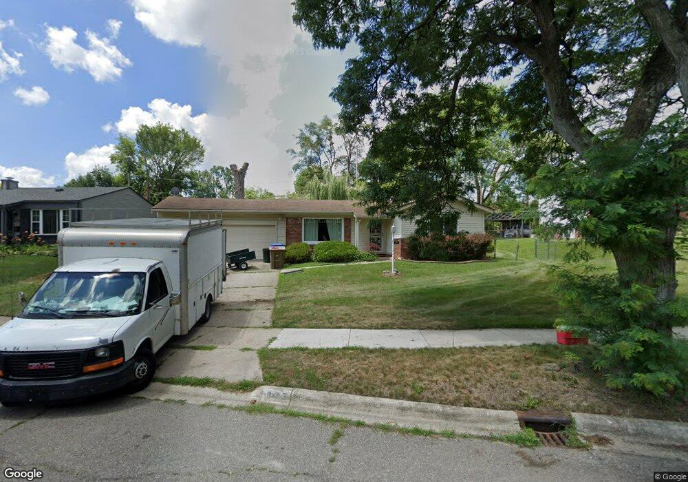
225 Carr St Pontiac, MI 48342
Estimated Value: $199,485 - $321,000
3
Beds
2
Baths
1,599
Sq Ft
$150/Sq Ft
Est. Value
About This Home
This home is located at 225 Carr St, Pontiac, MI 48342 and is currently estimated at $239,121, approximately $149 per square foot. 225 Carr St is a home located in Oakland County with nearby schools including Herrington Elementary School, Pontiac Middle School, and Pontiac High School.
Ownership History
Date
Name
Owned For
Owner Type
Purchase Details
Closed on
Mar 27, 2023
Sold by
Adams Debra
Bought by
Adams Debra and Green Lilnora Genese
Current Estimated Value
Purchase Details
Closed on
Dec 3, 2008
Sold by
Dixon Reginald T
Bought by
Dixon Debra and Adams Debra
Purchase Details
Closed on
Mar 21, 2007
Sold by
Dixon Reggie
Bought by
Dixon Debra Adams
Purchase Details
Closed on
Nov 14, 2006
Sold by
Dixon Debra Adams
Bought by
Dixon Reggie
Purchase Details
Closed on
Dec 13, 1996
Sold by
Johnson Ruben L
Bought by
Adamsgoodson Debra
Home Financials for this Owner
Home Financials are based on the most recent Mortgage that was taken out on this home.
Original Mortgage
$79,857
Interest Rate
7.81%
Create a Home Valuation Report for This Property
The Home Valuation Report is an in-depth analysis detailing your home's value as well as a comparison with similar homes in the area
Home Values in the Area
Average Home Value in this Area
Purchase History
| Date | Buyer | Sale Price | Title Company |
|---|---|---|---|
| Adams Debra | -- | None Listed On Document | |
| Dixon Debra | -- | None Available | |
| Dixon Debra Adams | -- | None Available | |
| Dixon Reggie | -- | None Available | |
| Adamsgoodson Debra | $80,000 | -- |
Source: Public Records
Mortgage History
| Date | Status | Borrower | Loan Amount |
|---|---|---|---|
| Previous Owner | Adamsgoodson Debra | $79,857 |
Source: Public Records
Tax History Compared to Growth
Tax History
| Year | Tax Paid | Tax Assessment Tax Assessment Total Assessment is a certain percentage of the fair market value that is determined by local assessors to be the total taxable value of land and additions on the property. | Land | Improvement |
|---|---|---|---|---|
| 2024 | $1,310 | $91,800 | $0 | $0 |
| 2023 | $1,249 | $79,130 | $0 | $0 |
| 2022 | $1,276 | $70,420 | $0 | $0 |
| 2021 | $1,238 | $60,520 | $0 | $0 |
| 2020 | $1,135 | $55,280 | $0 | $0 |
| 2019 | $1,210 | $48,330 | $0 | $0 |
| 2018 | $1,169 | $41,850 | $0 | $0 |
| 2017 | $1,108 | $40,910 | $0 | $0 |
| 2016 | $1,131 | $37,160 | $0 | $0 |
| 2015 | -- | $34,520 | $0 | $0 |
| 2014 | -- | $29,210 | $0 | $0 |
| 2011 | -- | $41,020 | $0 | $0 |
Source: Public Records
Map
Nearby Homes
- 514 Linda Vista Dr
- 472 University Dr
- 669 N Perry St
- 591 Brady Ln
- 597 Brady Ln
- Fairfiled Plan at Fairview Village
- Enclave II Plan at Fairview Village
- Enclave Plan at Fairview Village
- Carlyle Plan at Fairview Village
- 141 Oliver St
- 633 N Perry St
- 602 Brady Ln
- 608 Brady Ln
- 100 Oliver St
- 644 Brady Ln
- 667 Raskob St
- 0 Cesar Chavez Rd Unit 50166552
- 428 Jordon Rd
- 790 Parkwood Ave
- 663 Lenox Ave
- 597 Linda Vista Dr
- 219 Carr St
- 213 Carr St
- 224 Victory Dr
- 230 Victory Dr
- 605 Linda Vista Dr
- 218 Victory Dr
- 573 Linda Vista Dr
- 236 Victory Dr
- 207 Carr St
- 214 Victory Dr
- 586 Linda Vista Dr
- 592 Linda Vista Dr
- 596 Linda Vista Dr
- 210 Carr St
- 208 Victory Dr
- 201 Carr St
- 606 Linda Vista Dr
- 244 Victory Dr
- 574 Linda Vista Dr