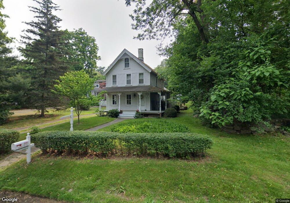
225 Compo Rd S Westport, CT 06880
Compo NeighborhoodEstimated Value: $1,460,000 - $2,230,000
3
Beds
3
Baths
1,505
Sq Ft
$1,238/Sq Ft
Est. Value
About This Home
This home is located at 225 Compo Rd S, Westport, CT 06880 and is currently estimated at $1,862,490, approximately $1,237 per square foot. 225 Compo Rd S is a home located in Fairfield County with nearby schools including Green's Farms School, Bedford Middle School, and Staples High School.
Ownership History
Date
Name
Owned For
Owner Type
Purchase Details
Closed on
Jul 27, 2017
Sold by
Thomas Kevin R
Bought by
Thomas Elizabeth
Current Estimated Value
Home Financials for this Owner
Home Financials are based on the most recent Mortgage that was taken out on this home.
Original Mortgage
$165,000
Outstanding Balance
$114,461
Interest Rate
3.9%
Mortgage Type
Credit Line Revolving
Estimated Equity
$1,748,029
Purchase Details
Closed on
Mar 17, 2011
Sold by
Thomas Elizabeth
Bought by
Thomas Elizabeth and Thomas Kevin R
Purchase Details
Closed on
Nov 28, 2001
Sold by
Allen Lester and Knapp Doris
Bought by
Hiltz Elizabeth
Create a Home Valuation Report for This Property
The Home Valuation Report is an in-depth analysis detailing your home's value as well as a comparison with similar homes in the area
Home Values in the Area
Average Home Value in this Area
Purchase History
| Date | Buyer | Sale Price | Title Company |
|---|---|---|---|
| Thomas Elizabeth | -- | -- | |
| Thomas Elizabeth | -- | -- | |
| Thomas Elizabeth | -- | -- | |
| Thomas Elizabeth | -- | -- | |
| Hiltz Elizabeth | $135,000 | -- | |
| Hiltz Elizabeth | $135,000 | -- | |
| Hiltz Elizabeth | $135,000 | -- |
Source: Public Records
Mortgage History
| Date | Status | Borrower | Loan Amount |
|---|---|---|---|
| Open | Hiltz Elizabeth | $165,000 | |
| Previous Owner | Hiltz Elizabeth | $391,075 |
Source: Public Records
Tax History Compared to Growth
Tax History
| Year | Tax Paid | Tax Assessment Tax Assessment Total Assessment is a certain percentage of the fair market value that is determined by local assessors to be the total taxable value of land and additions on the property. | Land | Improvement |
|---|---|---|---|---|
| 2025 | $10,873 | $576,500 | $502,700 | $73,800 |
| 2024 | $10,734 | $576,500 | $502,700 | $73,800 |
| 2023 | $10,579 | $576,500 | $502,700 | $73,800 |
| 2022 | $10,417 | $576,500 | $502,700 | $73,800 |
| 2021 | $10,417 | $576,500 | $502,700 | $73,800 |
| 2020 | $11,836 | $708,300 | $517,300 | $191,000 |
| 2019 | $11,942 | $708,300 | $517,300 | $191,000 |
| 2018 | $8,569 | $708,300 | $517,300 | $191,000 |
| 2017 | $8,410 | $708,300 | $517,300 | $191,000 |
| 2016 | $11,942 | $708,300 | $517,300 | $191,000 |
| 2015 | $11,201 | $619,200 | $418,000 | $201,200 |
| 2014 | $11,108 | $619,200 | $418,000 | $201,200 |
Source: Public Records
Map
Nearby Homes
- 11 Manitou Ct
- 23 Bridge St
- 115 Valley Rd
- 6 Stony Point Rd
- 24 Compo Pkwy
- 171 & 169 Compo Rd S
- 171 Compo Rd S
- 39 Compo Pkwy
- 33 Burnham Hill
- 5 Franklin Ave
- 5 Hidden Hill Rd
- 3 Laurel Ln
- 202 Bradley Ln Unit 202
- 11 Sterling Dr
- 14 Owenoke Park
- 29 Guyer Rd
- 26 Treadwell Ave
- 216 Hillspoint Rd
- 32 Edgewater Hillside
- 260 Hillspoint Rd
- 225 Compo Rd S Unit cottage
- 224 Compo Rd S
- 223 Compo Rd S
- 221 Compo Rd S
- 3 Tar Rock Rd
- 218 Compo Rd S
- 4 Rockland Place
- 222 Compo Rd S
- 219 Compo Rd S
- 220 Compo Rd S
- 3 Rockland Place
- 217 Compo Rd S
- 4 Ferry Ln E
- 10 Ferry Ln E
- 5 Rockland Place
- 2 Tar Rock Rd
- 216 Compo Rd S
- 216 Compo Rd S Unit 6880
- 4 Tar Rock Rd
- 213 Compo Rd S