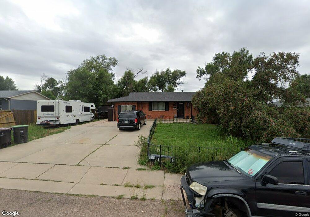
225 Cunningham Dr Colorado Springs, CO 80911
Security-Widefield NeighborhoodEstimated Value: $350,803 - $444,000
4
Beds
2
Baths
1,225
Sq Ft
$317/Sq Ft
Est. Value
About This Home
This home is located at 225 Cunningham Dr, Colorado Springs, CO 80911 and is currently estimated at $387,951, approximately $316 per square foot. 225 Cunningham Dr is a home located in El Paso County with nearby schools including Pinello Elementary School, Sproul Junior High School, and Widefield High School.
Ownership History
Date
Name
Owned For
Owner Type
Purchase Details
Closed on
Aug 19, 2013
Sold by
Sigala Manuel
Bought by
Sigala John P
Current Estimated Value
Purchase Details
Closed on
May 20, 1964
Bought by
Sigala John P
Purchase Details
Closed on
Feb 27, 1964
Bought by
Sigala John P
Purchase Details
Closed on
Apr 1, 1963
Bought by
Sigala John P
Create a Home Valuation Report for This Property
The Home Valuation Report is an in-depth analysis detailing your home's value as well as a comparison with similar homes in the area
Home Values in the Area
Average Home Value in this Area
Purchase History
| Date | Buyer | Sale Price | Title Company |
|---|---|---|---|
| Sigala John P | -- | None Available | |
| Sigala John P | -- | -- | |
| Sigala John P | -- | -- | |
| Sigala John P | -- | -- |
Source: Public Records
Tax History Compared to Growth
Tax History
| Year | Tax Paid | Tax Assessment Tax Assessment Total Assessment is a certain percentage of the fair market value that is determined by local assessors to be the total taxable value of land and additions on the property. | Land | Improvement |
|---|---|---|---|---|
| 2025 | $1,710 | $26,740 | -- | -- |
| 2024 | $1,654 | $26,730 | $4,820 | $21,910 |
| 2023 | $1,654 | $26,730 | $4,820 | $21,910 |
| 2022 | $1,468 | $19,660 | $3,340 | $16,320 |
| 2021 | $1,582 | $20,220 | $3,430 | $16,790 |
| 2020 | $1,177 | $14,610 | $3,000 | $11,610 |
| 2019 | $1,170 | $14,610 | $3,000 | $11,610 |
| 2018 | $1,066 | $12,420 | $2,250 | $10,170 |
| 2017 | $1,078 | $12,420 | $2,250 | $10,170 |
| 2016 | $938 | $13,200 | $2,390 | $10,810 |
| 2015 | $962 | $13,200 | $2,390 | $10,810 |
| 2014 | $846 | $11,660 | $2,150 | $9,510 |
Source: Public Records
Map
Nearby Homes
- 4570 Borden Dr
- 4790 Hennings Dr
- 308 Steven Dr
- 309 Davie Dr
- 405 Birch Dr
- 605 Birch Dr
- 4658 Hennings Dr
- 213 Sumac Dr
- 4613 Pleasant Port View Unit 2
- 257 Sherri Dr
- 4691 Pleasant Port View
- 4634 Cassidy St
- 217 Steven Dr
- 4226 Dooley Way
- 4950 Elm Grove Dr
- 1620 Widefield Dr
- 124 Sumac Dr
- 208 Davie Dr
- 4145 Dooley Way
- 105 Larch Dr
- 221 Cunningham Dr
- 229 Cunningham Dr
- 213 Cunningham Dr
- 217 Cunningham Dr
- 233 Cunningham Dr
- 244 Cunningham Dr
- 606 Leta Dr
- 209 Cunningham Dr
- 236 Cunningham Dr
- 240 Cunningham Dr
- 510 Leta Dr
- 702 Leta Dr
- 602 Leta Dr
- 237 Cunningham Dr
- 207 Cunningham Dr
- 207R Cunningham Dr
- 252 Cunningham Dr
- 232 Cunningham Dr
- 706 Leta Dr
- 228 Cunningham Dr