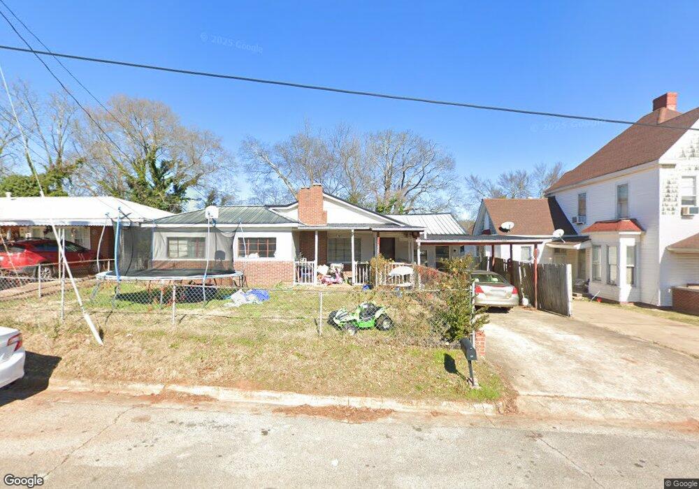
225 E 2nd St Oxford, AL 36203
Estimated Value: $110,356 - $147,000
Studio
--
Bath
1,597
Sq Ft
$82/Sq Ft
Est. Value
About This Home
This home is located at 225 E 2nd St, Oxford, AL 36203 and is currently estimated at $131,589, approximately $82 per square foot. 225 E 2nd St is a home located in Calhoun County with nearby schools including Oxford Middle School, Oxford High School, and Trinity Christian Academy.
Ownership History
Date
Name
Owned For
Owner Type
Purchase Details
Closed on
Jul 27, 2012
Sold by
Grizzard Randy K and Grizzard Kimberly A
Bought by
Grizzard Lindsay Ashton and Grizzard Tyler
Current Estimated Value
Home Financials for this Owner
Home Financials are based on the most recent Mortgage that was taken out on this home.
Original Mortgage
$7,000,000
Interest Rate
3.68%
Mortgage Type
Stand Alone Refi Refinance Of Original Loan
Purchase Details
Closed on
Oct 2, 2008
Sold by
Grizaard Billy D and Grizzard Danny G
Bought by
Grizzard Randy K and Grizzard Kimberly A
Create a Home Valuation Report for This Property
The Home Valuation Report is an in-depth analysis detailing your home's value as well as a comparison with similar homes in the area
Purchase History
| Date | Buyer | Sale Price | Title Company |
|---|---|---|---|
| Grizzard Lindsay Ashton | $1,000 | -- | |
| Grizzard Randy K | $1,000 | -- |
Source: Public Records
Mortgage History
| Date | Status | Borrower | Loan Amount |
|---|---|---|---|
| Closed | Grizzard Lindsay Ashton | $7,000,000 |
Source: Public Records
Tax History
| Year | Tax Paid | Tax Assessment Tax Assessment Total Assessment is a certain percentage of the fair market value that is determined by local assessors to be the total taxable value of land and additions on the property. | Land | Improvement |
|---|---|---|---|---|
| 2025 | $308 | $7,560 | $0 | $0 |
| 2024 | $308 | $7,566 | $1,000 | $6,566 |
| 2023 | $308 | $7,566 | $1,000 | $6,566 |
| 2022 | $308 | $7,566 | $1,000 | $6,566 |
| 2021 | $231 | $5,938 | $870 | $5,068 |
| 2020 | $231 | $5,938 | $870 | $5,068 |
| 2019 | $231 | $5,940 | $872 | $5,068 |
| 2018 | $231 | $5,940 | $0 | $0 |
| 2017 | $872 | $5,280 | $0 | $0 |
| 2016 | $202 | $5,320 | $0 | $0 |
| 2013 | -- | $5,360 | $0 | $0 |
Source: Public Records
Map
Nearby Homes
- 700 Luttrell St
- 200 W Oak St
- 1028 Mcpherson St
- 213 Main St
- 1208 Barry St
- 1214 Barry St
- 9 W 9th St
- 0 Friendship Rd Unit 1 acre 835862
- 0 Elm St Unit m&b 21432126
- 1112 Highway Dr
- 4 Donna Kay Ct Unit 4
- 2 Donna Kay Ct Unit 2
- 1 Donna Kay Ct Unit 1
- 30 Donna Kay Ct
- 3 Donna Kay Ct Unit 3
- 11 Blake Ave Unit 11
- 10 Blake Ave Unit 10
- 12 Blake Ave Unit 12
- 9 Blake Ave Unit 9
- 1413 Hamric Dr E
Your Personal Tour Guide
Ask me questions while you tour the home.