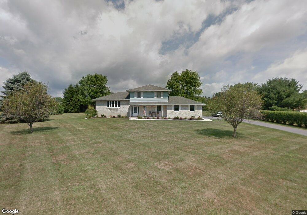
225 Earl Dr Brodheadsville, PA 18322
Brodheadsville NeighborhoodEstimated Value: $360,180 - $388,000
3
Beds
3
Baths
2,028
Sq Ft
$184/Sq Ft
Est. Value
About This Home
This home is located at 225 Earl Dr, Brodheadsville, PA 18322 and is currently estimated at $373,295, approximately $184 per square foot. 225 Earl Dr is a home located in Monroe County with nearby schools including Pleasant Valley Elementary School, Pleasant Valley Intermediate School, and Pleasant Valley Middle School.
Ownership History
Date
Name
Owned For
Owner Type
Purchase Details
Closed on
Aug 26, 2014
Sold by
The Cherry Hill Family Llc
Bought by
Roselli Matthew F
Current Estimated Value
Home Financials for this Owner
Home Financials are based on the most recent Mortgage that was taken out on this home.
Original Mortgage
$112,000
Outstanding Balance
$85,743
Interest Rate
4.14%
Mortgage Type
New Conventional
Estimated Equity
$287,552
Create a Home Valuation Report for This Property
The Home Valuation Report is an in-depth analysis detailing your home's value as well as a comparison with similar homes in the area
Home Values in the Area
Average Home Value in this Area
Purchase History
| Date | Buyer | Sale Price | Title Company |
|---|---|---|---|
| Roselli Matthew F | $140,000 | None Available |
Source: Public Records
Mortgage History
| Date | Status | Borrower | Loan Amount |
|---|---|---|---|
| Open | Roselli Matthew F | $112,000 |
Source: Public Records
Tax History Compared to Growth
Tax History
| Year | Tax Paid | Tax Assessment Tax Assessment Total Assessment is a certain percentage of the fair market value that is determined by local assessors to be the total taxable value of land and additions on the property. | Land | Improvement |
|---|---|---|---|---|
| 2025 | $1,254 | $154,150 | $38,680 | $115,470 |
| 2024 | $1,023 | $154,150 | $38,680 | $115,470 |
| 2023 | $4,668 | $154,150 | $38,680 | $115,470 |
| 2022 | $4,541 | $154,150 | $38,680 | $115,470 |
| 2021 | $4,328 | $154,150 | $38,680 | $115,470 |
| 2020 | $3,951 | $154,150 | $38,680 | $115,470 |
| 2019 | $5,472 | $30,700 | $3,500 | $27,200 |
| 2018 | $5,411 | $30,700 | $3,500 | $27,200 |
| 2017 | $5,349 | $30,700 | $3,500 | $27,200 |
| 2016 | $850 | $30,700 | $3,500 | $27,200 |
| 2015 | -- | $30,700 | $3,500 | $27,200 |
| 2014 | -- | $30,700 | $3,500 | $27,200 |
Source: Public Records
Map
Nearby Homes
- 219 W Scott Ct
- 2382 Pennsylvania 115
- 147 Countryside Dr
- 0 Lr 45003 Unit PM-132004
- 1547 Weir Creek Dr
- 1762 United States Route 209
- 232 Rodenbach Ln
- Lr 45003 Gilbert Rd
- 648 Marion Ln
- 44 Regency Ln
- 311 Switzgable Dr
- 122 Leisure Ln
- 2311 Long Acre Dr
- 2299 Long Acre Dr
- 0 Ashley Ct H15
- 558 Effort Neola Rd
- 131 Martindale Ct
- 3315 Aspen Rd Unit PVL
- 103 Silver Valley Rd
- 423 Cottontail Ln