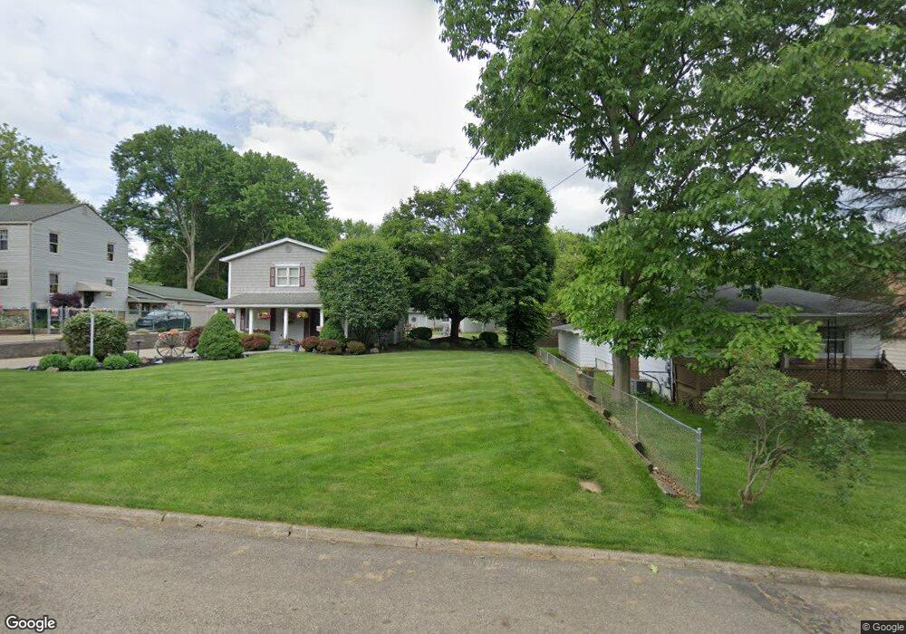
225 Hazelwood Ave Barberton, OH 44203
North Barberton NeighborhoodEstimated Value: $184,000 - $212,988
3
Beds
1
Bath
1,720
Sq Ft
$116/Sq Ft
Est. Value
About This Home
This home is located at 225 Hazelwood Ave, Barberton, OH 44203 and is currently estimated at $199,747, approximately $116 per square foot. 225 Hazelwood Ave is a home located in Summit County with nearby schools including Barberton Middle School, Barberton Intermediate School 3-5, and Barberton High School.
Ownership History
Date
Name
Owned For
Owner Type
Purchase Details
Closed on
Apr 28, 2006
Sold by
Hall Joseph B and Hall Rebecca J
Bought by
Hall Joseph B and Hall Rebecca J
Current Estimated Value
Home Financials for this Owner
Home Financials are based on the most recent Mortgage that was taken out on this home.
Original Mortgage
$86,500
Interest Rate
6.37%
Mortgage Type
Fannie Mae Freddie Mac
Create a Home Valuation Report for This Property
The Home Valuation Report is an in-depth analysis detailing your home's value as well as a comparison with similar homes in the area
Home Values in the Area
Average Home Value in this Area
Purchase History
| Date | Buyer | Sale Price | Title Company |
|---|---|---|---|
| Hall Joseph B | -- | Lake Erie Title Agency Inc |
Source: Public Records
Mortgage History
| Date | Status | Borrower | Loan Amount |
|---|---|---|---|
| Closed | Hall Joseph B | $86,500 |
Source: Public Records
Tax History Compared to Growth
Tax History
| Year | Tax Paid | Tax Assessment Tax Assessment Total Assessment is a certain percentage of the fair market value that is determined by local assessors to be the total taxable value of land and additions on the property. | Land | Improvement |
|---|---|---|---|---|
| 2025 | $2,933 | $58,563 | $14,613 | $43,950 |
| 2024 | $2,933 | $58,563 | $14,613 | $43,950 |
| 2023 | $2,933 | $58,563 | $14,613 | $43,950 |
| 2022 | $2,404 | $41,595 | $9,552 | $32,043 |
| 2021 | $2,402 | $41,595 | $9,552 | $32,043 |
| 2020 | $2,351 | $41,590 | $9,550 | $32,040 |
| 2019 | $2,267 | $36,330 | $7,220 | $29,110 |
| 2018 | $2,232 | $36,330 | $7,220 | $29,110 |
| 2017 | $2,262 | $36,330 | $7,220 | $29,110 |
| 2016 | $2,267 | $36,330 | $7,220 | $29,110 |
| 2015 | $2,262 | $36,330 | $7,220 | $29,110 |
| 2014 | $2,250 | $36,330 | $7,220 | $29,110 |
| 2013 | $2,351 | $39,340 | $7,220 | $32,120 |
Source: Public Records
Map
Nearby Homes
- 117 Fernwood Ave
- 0 Romig Ave
- 103 & 103 1/2 Fernwood Ave
- 143 Glenn St
- 277 Glenn St
- 76 Hazelwood Ave
- 818 N Summit St
- 1515 Grand Blvd
- 1150 Wooster Rd N
- 30 W Hiram St
- 137 Hermann St
- 146 Hermann St
- 2714 Romig Rd
- 1924 Caroline Ave
- 172 & 173 Belcher Ave
- 103 Mitchell St
- 1960 Newton St
- 213 Hermann St
- 690 Saint Clair Ave
- 1453 Woodbirch Ave
- 294 W State St
- 237 Hazelwood Ave
- 300 W State St
- 231 Hazelwood Ave
- 284 W State St
- 217 Hazelwood Ave
- 306 W State St
- 211 Hazelwood Ave
- 280 W State St
- 207 Hazelwood Ave
- 251 Hazelwood Ave
- 253 Hazelwood Ave
- 204 Hazelwood Ave
- 255 Hazelwood Ave
- 202 Hazelwood Ave
- 324 W State St
- 303 W State St
- 240 Hazelwood Ave
- 261 Hazelwood Ave
- 309 W State St