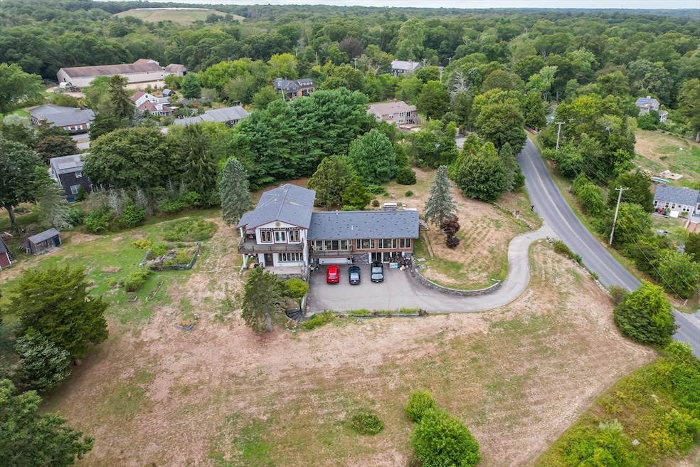
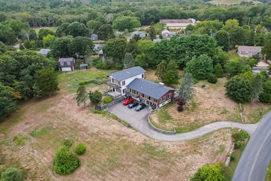

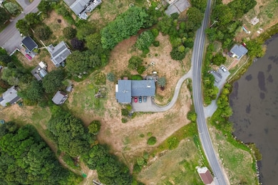

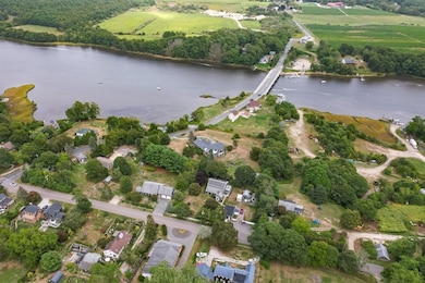
225 Hixbridge Rd Westport, MA 02790
Westport Point NeighborhoodEstimated payment $7,587/month
Highlights
- Barn or Stable
- River View
- 2.11 Acre Lot
- Spa
- Waterfront
- Landscaped Professionally
About This Home
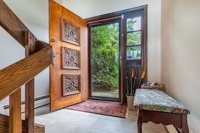
Nestled at 225 Hixbridge Rd, Westport, MA, awaits an AMAZING single-family residence, offering a serene retreat over looking the water from almost every window in the home!. This property presents a unique opportunity to embrace refined living within a spacious setting. The 2 primary bedrooms offers a serene escape, adorned with crown molding that adds a touch of classic sophistication, creating an ambiance of peaceful luxury. Indulge in the spa-like experience of the 2 primary bathrooms, complete with a walk-in shower that promises rejuvenation and relaxation. Enjoy the GREAT ROOM with heated radiant floors , a full bar, library, half bathroom and full kitchen , surrounded by windows ! AND SO MUCH MORE!!!
Home Details
Home Type
- Single Family
Est. Annual Taxes
- $8,882
Year Built
- Built in 1973
Lot Details
- 2.11 Acre Lot
- Waterfront
- Landscaped Professionally
- Property is zoned R1
Parking
- 4 Car Garage
- Driveway
- Open Parking
- Off-Street Parking
Property Views
- River
- Scenic Vista
Home Design
- Post and Beam
- Raised Ranch Architecture
- Slate Roof
- Concrete Perimeter Foundation
Interior Spaces
- 4,710 Sq Ft Home
- Crown Molding
- 5 Fireplaces
- Home Security System
Kitchen
- Oven
- Range
- Dishwasher
Flooring
- Wood
- Marble
- Tile
Bedrooms and Bathrooms
- 4 Bedrooms
Laundry
- Dryer
- Washer
Basement
- Walk-Out Basement
- Garage Access
Pool
- Spa
- Outdoor Shower
Outdoor Features
- Balcony
- Covered Deck
- Covered Patio or Porch
- Rain Gutters
Horse Facilities and Amenities
- Barn or Stable
Utilities
- Ductless Heating Or Cooling System
- Forced Air Heating and Cooling System
- 4 Cooling Zones
- Heating System Uses Natural Gas
- Baseboard Heating
- Generator Hookup
- 200+ Amp Service
- Power Generator
- Private Water Source
- Gas Water Heater
- Private Sewer
Community Details
- No Home Owners Association
Listing and Financial Details
- Tax Lot 47-47a
- Assessor Parcel Number M:55 L:4747A,3992771
Map
Home Values in the Area
Average Home Value in this Area
Tax History
| Year | Tax Paid | Tax Assessment Tax Assessment Total Assessment is a certain percentage of the fair market value that is determined by local assessors to be the total taxable value of land and additions on the property. | Land | Improvement |
|---|---|---|---|---|
| 2025 | $8,882 | $1,192,200 | $494,100 | $698,100 |
| 2024 | $8,874 | $1,148,000 | $459,700 | $688,300 |
| 2023 | $8,139 | $997,400 | $380,600 | $616,800 |
| 2022 | $8,154 | $961,500 | $380,600 | $580,900 |
| 2021 | $8,017 | $930,000 | $348,100 | $581,900 |
| 2020 | $7,730 | $917,000 | $335,100 | $581,900 |
| 2019 | $7,501 | $907,000 | $335,100 | $571,900 |
| 2018 | $5,289 | $647,400 | $139,200 | $508,200 |
| 2017 | $4,918 | $617,100 | $141,700 | $475,400 |
| 2016 | $4,653 | $588,300 | $146,700 | $441,600 |
| 2015 | $4,705 | $593,300 | $149,200 | $444,100 |
Property History
| Date | Event | Price | List to Sale | Price per Sq Ft |
|---|---|---|---|---|
| 09/22/2025 09/22/25 | For Sale | $1,299,000 | -- | $276 / Sq Ft |
Purchase History
| Date | Type | Sale Price | Title Company |
|---|---|---|---|
| Deed | -- | None Available | |
| Deed | $370,000 | -- |
Mortgage History
| Date | Status | Loan Amount | Loan Type |
|---|---|---|---|
| Previous Owner | $125,000 | No Value Available | |
| Previous Owner | $150,000 | No Value Available | |
| Previous Owner | $150,000 | Purchase Money Mortgage |
Source: MLS Property Information Network (MLS PIN)
MLS Number: 73433953
APN: 25002999847
Disclaimer: Certain information contained herein is derived from information provided by parties other than Homes.com. All information provided is deemed reliable, but is not guaranteed to be accurate and should be independently verified.
![]() The property listing data and information, or the Images, set forth herein were provided to MLS Property Information Network, Inc. from third party sources, including sellers, lessors and public records, and were compiled by MLS Property Information Network, Inc. The property listing data and information, and the Images, are for the personal, non-commercial use of consumers having a good faith interest in purchasing or leasing listed properties of the type displayed to them and may not be used for any purpose other than to identify prospective properties which such consumers may have a good faith interest in purchasing or leasing. MLS Property Information Network, Inc. and its subscribers disclaim any and all representations and warranties as to the accuracy of the property listing data and information, or as to the accuracy of any of the Images, set forth herein.
The property listing data and information, or the Images, set forth herein were provided to MLS Property Information Network, Inc. from third party sources, including sellers, lessors and public records, and were compiled by MLS Property Information Network, Inc. The property listing data and information, and the Images, are for the personal, non-commercial use of consumers having a good faith interest in purchasing or leasing listed properties of the type displayed to them and may not be used for any purpose other than to identify prospective properties which such consumers may have a good faith interest in purchasing or leasing. MLS Property Information Network, Inc. and its subscribers disclaim any and all representations and warranties as to the accuracy of the property listing data and information, or as to the accuracy of any of the Images, set forth herein.
- 920 Drift Rd
- 101 Adamsville Rd
- 8 Village Way
- 7 Village Way
- 15 Village Way
- 1346 Main Rd Unit B
- 99 Sylvia Ln
- 9 Division Rd
- 8 Strawberry Ln
- 73 White Oak Run
- 118 Charlotte White Rd Extension
- 0 Hidden Glen Ln
- 1580 Main Rd
- 7 Taber Ln
- 2 Slades Farm Ln
- 118 Charlotte White Rd
- 1702J Drift Rd
- 994 State
- 1702 Drift Rd
- 1749 Main Rd
- 53B Cummings Ln Unit WINTER RENT
- 1794-DR Drift Unit VAC Weeky
- 1815 Main Rd
- 76 Slades Corner Rd Unit 2
- 94 Cross Rd
- 94 Cross Rd
- 328 Tickle Rd
- 629 State Rd
- 32 Elk Dr
- 0 Tickle Rd Unit 73442626
- 46 Fairway Ave Unit 2
- 16 Pleasant View Dr
- 710 Elm St
- 6 Butts Rock Rd
- 11 Sunview Terrace Unit 1
- 67 Lawrence Ct
- 5 Bridge St Unit 2
- 871 Allen St
- 31 Bridge St
- 29 Davis St
