Estimated Value: $485,152 - $846,000
4
Beds
3
Baths
5,100
Sq Ft
$115/Sq Ft
Est. Value
About This Home
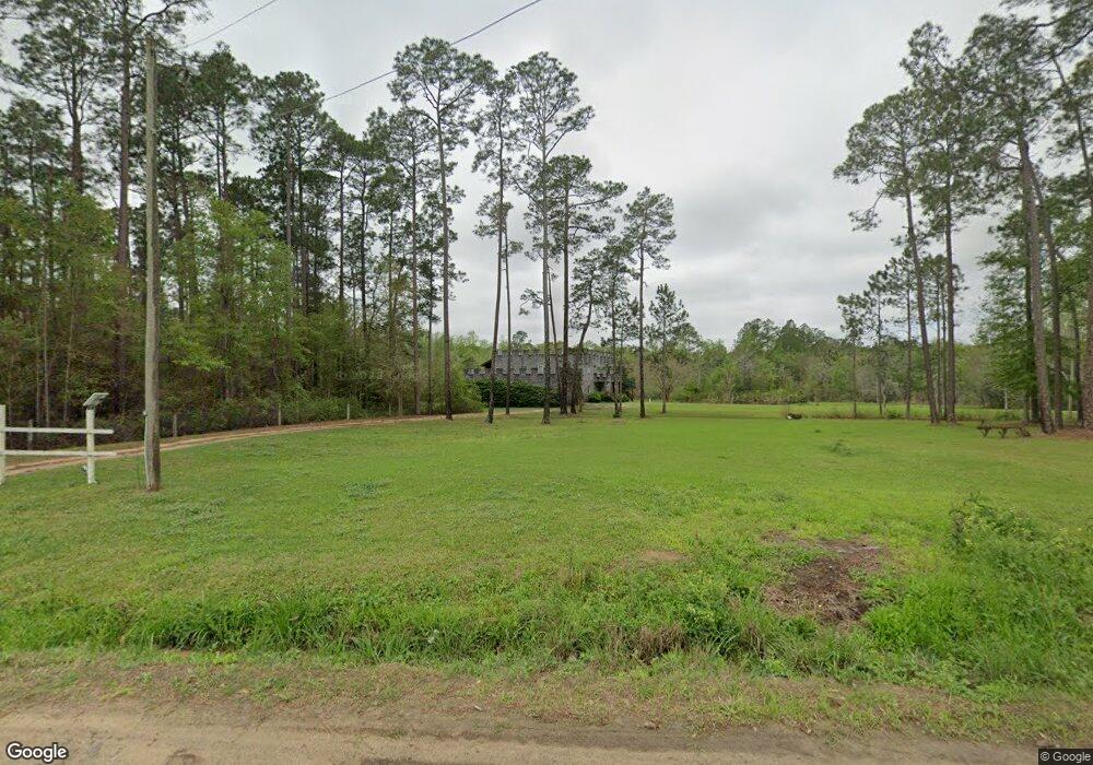
This home is located at 225 Howard Bennett Rd, Adel, GA 31620 and is currently estimated at $587,538, approximately $115 per square foot. 225 Howard Bennett Rd is a home located in Cook County with nearby schools including Cook Primary School, Cook Elementary School, and Cook County Middle School.
Ownership History
Date
Name
Owned For
Owner Type
Purchase Details
Closed on
Jul 23, 2020
Sold by
Fulp Carl Grover
Bought by
Buynack Stephen
Current Estimated Value
Home Financials for this Owner
Home Financials are based on the most recent Mortgage that was taken out on this home.
Original Mortgage
$327,360
Outstanding Balance
$290,281
Interest Rate
3.1%
Mortgage Type
VA
Estimated Equity
$297,257
Create a Home Valuation Report for This Property
The Home Valuation Report is an in-depth analysis detailing your home's value as well as a comparison with similar homes in the area
Home Values in the Area
Average Home Value in this Area
Purchase History
| Date | Buyer | Sale Price | Title Company |
|---|---|---|---|
| Buynack Stephen | $320,000 | -- |
Source: Public Records
Mortgage History
| Date | Status | Borrower | Loan Amount |
|---|---|---|---|
| Open | Buynack Stephen | $327,360 |
Source: Public Records
Tax History
| Year | Tax Paid | Tax Assessment Tax Assessment Total Assessment is a certain percentage of the fair market value that is determined by local assessors to be the total taxable value of land and additions on the property. | Land | Improvement |
|---|---|---|---|---|
| 2024 | $4,317 | $160,265 | $10,923 | $149,342 |
| 2023 | $3,747 | $139,118 | $10,923 | $128,195 |
| 2022 | $3,716 | $137,947 | $9,752 | $128,195 |
| 2021 | $3,298 | $114,227 | $9,752 | $104,475 |
| 2020 | $2,130 | $81,303 | $9,752 | $71,551 |
| 2019 | $2,294 | $81,303 | $9,752 | $71,551 |
| 2018 | $2,351 | $81,303 | $9,752 | $71,551 |
| 2017 | $2,295 | $81,303 | $9,752 | $71,551 |
| 2016 | $2,299 | $81,303 | $9,752 | $71,551 |
| 2015 | $937 | $34,270 | $9,752 | $24,517 |
| 2014 | $937 | $34,270 | $9,752 | $24,517 |
| 2013 | -- | $130,596 | $10,836 | $119,760 |
Source: Public Records
Map
Nearby Homes
- 131 Lakeview Ct
- 13.89 ac Lumby Smith & Hwy 37
- 169 Lumby Smith Rd
- 0 Lumby Smith Rd
- 10580 Georgia 76
- 02 Lakeridge Dr
- 01 Lakeridge Dr
- 146 Lakeridge Dr
- 423 Indian Creek Cir
- 2601 Massee Post Rd
- 9285 Georgia 37
- 2603 Dianne St
- 625 Coxstill Rd
- 2304 Thomas St
- 2302 Thomas St
- 2698 Woodland Dr
- 0 Mclendon Rd
- 284 Barrett Rd
- 1402 Bear Creek Rd
- 1715 Jimmy St
- 253 Howard Bennett Rd
- 1614 Boone Rd
- 85 Howard Bennett Rd
- 48 Math Chaney Rd
- 3464 Hutchinson Parrish Rd
- 1550 Boone Rd
- 1991 Boone Rd
- 3982 Hutchinson Parrish Rd
- 2001 Boone Rd
- 0 Howard Bennett Rd
- 71 Math Chaney Rd
- 1420 Boone Rd
- 3332 Hutchinson Parrish Rd
- 3265 Hutchinson Parrish Rd
- 3953 Hutchinson Parrish Rd
- 3983 Hutchinson Parrish Rd
- 111 Nikki Ln
- 1356 Boone Rd
- 3194 Hutchinson Parrish Rd
- 1294 Boone Rd
Your Personal Tour Guide
Ask me questions while you tour the home.