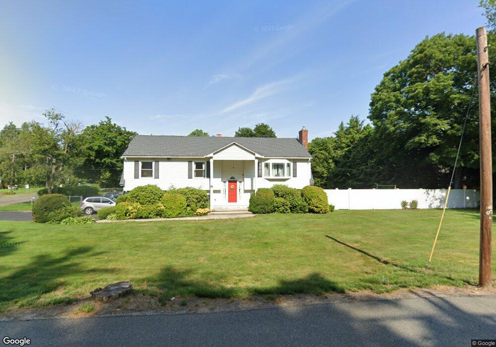
225 Main St Wilbraham, MA 01095
Estimated Value: $447,315 - $593,000
3
Beds
3
Baths
1,490
Sq Ft
$340/Sq Ft
Est. Value
About This Home
This home is located at 225 Main St, Wilbraham, MA 01095 and is currently estimated at $507,329, approximately $340 per square foot. 225 Main St is a home located in Hampden County with nearby schools including Minnechaug Regional High School, Springfield International Charter School, and Wilbraham & Monson Academy.
Ownership History
Date
Name
Owned For
Owner Type
Purchase Details
Closed on
Oct 30, 1992
Sold by
Choquette Anthony B and Choquette Judith B
Bought by
Perry Deborah M and Perry John W
Current Estimated Value
Create a Home Valuation Report for This Property
The Home Valuation Report is an in-depth analysis detailing your home's value as well as a comparison with similar homes in the area
Home Values in the Area
Average Home Value in this Area
Purchase History
| Date | Buyer | Sale Price | Title Company |
|---|---|---|---|
| Perry Deborah M | $164,900 | -- |
Source: Public Records
Mortgage History
| Date | Status | Borrower | Loan Amount |
|---|---|---|---|
| Open | Perry Deborah M | $180,000 | |
| Closed | Perry Deborah M | $140,000 |
Source: Public Records
Tax History Compared to Growth
Tax History
| Year | Tax Paid | Tax Assessment Tax Assessment Total Assessment is a certain percentage of the fair market value that is determined by local assessors to be the total taxable value of land and additions on the property. | Land | Improvement |
|---|---|---|---|---|
| 2025 | $7,531 | $421,200 | $78,700 | $342,500 |
| 2024 | $7,039 | $380,500 | $78,700 | $301,800 |
| 2023 | $6,188 | $354,400 | $78,700 | $275,700 |
| 2022 | $6,188 | $302,000 | $78,700 | $223,300 |
| 2021 | $6,130 | $267,000 | $84,800 | $182,200 |
| 2020 | $5,975 | $267,000 | $84,800 | $182,200 |
| 2019 | $5,821 | $267,000 | $84,800 | $182,200 |
| 2018 | $5,805 | $256,400 | $84,800 | $171,600 |
| 2017 | $5,641 | $256,400 | $84,800 | $171,600 |
| 2016 | $5,203 | $240,900 | $94,100 | $146,800 |
| 2015 | $5,030 | $240,900 | $94,100 | $146,800 |
Source: Public Records
Map
Nearby Homes
- 79 High Pine Cir
- 69 High Pine Cir
- 54 High Pine Cir
- 28 Decorie Dr
- 20 Old Orchard Rd
- 2 Bayberry Dr Unit 51
- 2 Vista Rd
- 35 Lake Dr
- 4 Hillcrest Dr
- 474 Mountain Rd
- 8 Patriot Ridge Ln
- 474-480 Mountain Rd
- 46 Washington Rd
- 182 Mountain Rd
- 6 Hilltop Park
- 6 Teak Terrace Unit 24
- 99 Sandalwood Dr Unit site 00
- 103 Sandalwood Dr Unit site 00
- 57 Sandalwood Dr Unit site 61
- 68 Monson Rd