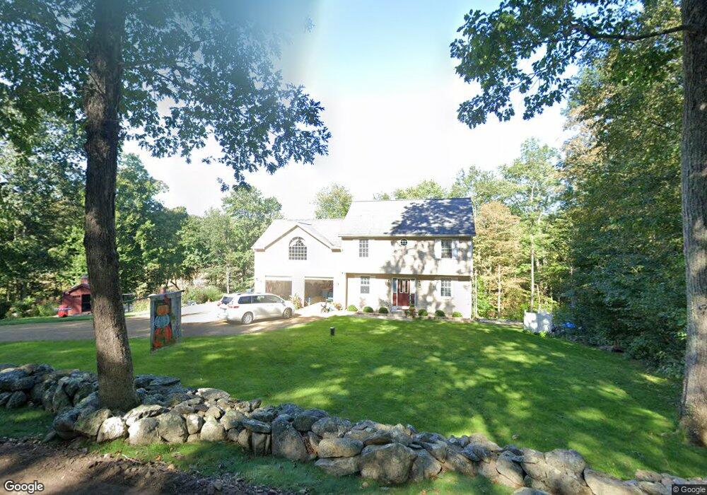
225 Mulberry Rd Mansfield Center, CT 06250
Estimated Value: $497,000 - $604,000
3
Beds
3
Baths
2,126
Sq Ft
$249/Sq Ft
Est. Value
About This Home
This home is located at 225 Mulberry Rd, Mansfield Center, CT 06250 and is currently estimated at $529,192, approximately $248 per square foot. 225 Mulberry Rd is a home located in Tolland County with nearby schools including Mansfield Elementary School, Mansfield Middle School, and E.O. Smith High School.
Ownership History
Date
Name
Owned For
Owner Type
Purchase Details
Closed on
May 8, 2006
Sold by
Lytyn Construction Llc
Bought by
Hanka Erik E and Hanka Ingrid F
Current Estimated Value
Create a Home Valuation Report for This Property
The Home Valuation Report is an in-depth analysis detailing your home's value as well as a comparison with similar homes in the area
Home Values in the Area
Average Home Value in this Area
Purchase History
| Date | Buyer | Sale Price | Title Company |
|---|---|---|---|
| Hanka Erik E | $330,000 | -- | |
| Hanka Erik E | $330,000 | -- |
Source: Public Records
Mortgage History
| Date | Status | Borrower | Loan Amount |
|---|---|---|---|
| Open | Hanka Erik E | $60,000 | |
| Closed | Hanka Erik E | $15,000 | |
| Open | Hanka Erik E | $245,000 |
Source: Public Records
Tax History Compared to Growth
Tax History
| Year | Tax Paid | Tax Assessment Tax Assessment Total Assessment is a certain percentage of the fair market value that is determined by local assessors to be the total taxable value of land and additions on the property. | Land | Improvement |
|---|---|---|---|---|
| 2025 | $6,184 | $309,200 | $58,900 | $250,300 |
| 2024 | $6,101 | $199,900 | $55,500 | $144,400 |
| 2023 | $6,301 | $199,900 | $55,500 | $144,400 |
| 2022 | $6,073 | $199,900 | $55,500 | $144,400 |
| 2021 | $6,273 | $199,900 | $55,500 | $144,400 |
| 2020 | $6,273 | $199,900 | $55,500 | $144,400 |
| 2019 | $6,085 | $193,900 | $58,400 | $135,500 |
| 2018 | $5,988 | $193,900 | $58,400 | $135,500 |
| 2017 | $5,918 | $193,200 | $58,400 | $134,800 |
| 2016 | $5,756 | $192,700 | $58,400 | $134,300 |
| 2015 | $5,756 | $192,700 | $58,400 | $134,300 |
| 2014 | $5,465 | $195,510 | $63,280 | $132,230 |
Source: Public Records
Map
Nearby Homes
- 241 Wormwood Hill Rd
- 67 Mulberry Rd
- 368 Warrenville Rd
- 934 Storrs Rd
- 985 Storrs Rd
- 685 Wormwood Hill Rd
- 124 Spring Hill Rd
- 69 N Bedlam Rd
- 140 Federal Rd
- 48 Monticello Ln
- 283 Tower Hill Rd
- 412 Storrs Rd
- 408 Storrs Rd
- 21 Silo Rd W Unit 21
- 0 Mansfield City Rd Unit LOT 2
- 60 Chaplin St
- 0 Hampton Rd Unit 170523717
- 144 Phoenixville Rd
- 30 Wyllys Farm Rd
- 29 Wyllys Farm Rd
- 233 Mulberry Rd
- 234 Mulberry Rd
- 241 Mulberry Rd
- 240 Mulberry Rd
- 199 Mulberry Rd
- 251 Mulberry Rd
- 261 Mulberry Rd
- 260 Mulberry Rd
- 187 Wormwood Hill Rd
- 221 Wormwood Hill Rd
- 231 Wormwood Hill Rd
- 249 Wormwood Hill Rd
- 255 Wormwood Hill Rd
- 222 Wormwood Hill Rd
- 269 Wormwood Hill Rd
- 263 Wormwood Hill Rd
- 214 Wormwood Hill Rd
- 230 Mulberry Rd
- 254 Wormwood Hill Rd
- 268 Wormwood Hill Rd