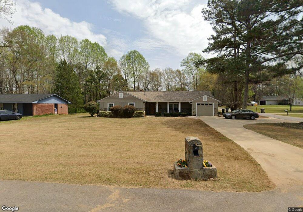
225 Nevada St Lagrange, GA 30241
Estimated Value: $233,000 - $292,000
4
Beds
3
Baths
2,337
Sq Ft
$115/Sq Ft
Est. Value
About This Home
This home is located at 225 Nevada St, Lagrange, GA 30241 and is currently estimated at $269,113, approximately $115 per square foot. 225 Nevada St is a home located in Troup County with nearby schools including Whitesville Road Elementary School, Berta Weathersbee Elementary School, and Rosemont Elementary School.
Ownership History
Date
Name
Owned For
Owner Type
Purchase Details
Closed on
Nov 1, 1985
Sold by
Jimmy R Moncus
Bought by
Boswell Edward W
Current Estimated Value
Purchase Details
Closed on
May 1, 1985
Sold by
Nellie R Moncus
Bought by
Jimmy R Moncus
Purchase Details
Closed on
Jul 29, 1974
Sold by
A E Mallory & Son
Bought by
Nellie R Moncus
Create a Home Valuation Report for This Property
The Home Valuation Report is an in-depth analysis detailing your home's value as well as a comparison with similar homes in the area
Purchase History
| Date | Buyer | Sale Price | Title Company |
|---|---|---|---|
| Boswell Edward W | $57,000 | -- | |
| Jimmy R Moncus | -- | -- | |
| Nellie R Moncus | -- | -- |
Source: Public Records
Tax History
| Year | Tax Paid | Tax Assessment Tax Assessment Total Assessment is a certain percentage of the fair market value that is determined by local assessors to be the total taxable value of land and additions on the property. | Land | Improvement |
|---|---|---|---|---|
| 2025 | $2,517 | $95,400 | $5,560 | $89,840 |
| 2024 | $2,460 | $92,200 | $5,560 | $86,640 |
| 2023 | $2,286 | $85,800 | $5,560 | $80,240 |
| 2022 | $1,733 | $64,080 | $5,560 | $58,520 |
| 2021 | $1,605 | $55,200 | $5,560 | $49,640 |
| 2020 | $1,605 | $55,200 | $5,560 | $49,640 |
| 2019 | $1,477 | $50,960 | $5,560 | $45,400 |
| 2018 | $1,477 | $50,960 | $5,560 | $45,400 |
| 2017 | $1,318 | $45,672 | $5,552 | $40,120 |
| 2016 | $1,323 | $45,851 | $5,552 | $40,299 |
| 2015 | $1,325 | $45,851 | $5,552 | $40,299 |
| 2014 | $1,171 | $40,676 | $5,552 | $35,124 |
| 2013 | -- | $42,173 | $5,552 | $36,621 |
Source: Public Records
Map
Nearby Homes
- 924 New Mexico St
- 319 Cooley Rd
- 137 Edgewood Ave
- LOT 15 Edgewood Ave
- 1604 S Davis Rd
- 0 Kelley St Unit 10550311
- 957 Kelley St
- 459 Merrywood Dr
- 206 Clearview Ct
- 1017 Mason St
- 213 Euclid Ave
- 216 Euclid Ave
- 0 Lanett Ave
- 0 Upper Big Springs Rd Unit 10545622
- 130 Edgewood Ave
- 626 Smoot St
- 510 Smoot St
- 0 Brown St Unit 10550761
- 0 Brown St Unit 10550754
- 439 Cooley Rd
- 223 Nevada St
- 905 New Mexico St
- 906 New Mexico St
- 904 New Mexico St
- 908 New Mexico St
- 902 New Mexico St
- 911 New Mexico St
- 475 Edgewood Ave
- 222 Nevada St
- 906 Utah St
- 925 New Mexico St
- 900 New Mexico St
- 920 New Mexico St
- 218 Nevada St
- 453 Edgewood Ave
- 928 Utah St
- 923 New Mexico St
- 214 Nevada St
- 922 New Mexico St
- 922 New Mexico St
Your Personal Tour Guide
Ask me questions while you tour the home.