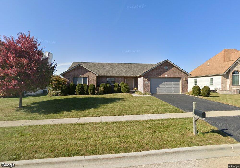
225 Parfive Dr Dekalb, IL 60115
Estimated Value: $268,000 - $338,000
3
Beds
2
Baths
1,668
Sq Ft
$188/Sq Ft
Est. Value
About This Home
This home is located at 225 Parfive Dr, Dekalb, IL 60115 and is currently estimated at $313,307, approximately $187 per square foot. 225 Parfive Dr is a home located in DeKalb County with nearby schools including Lincoln Elementary School, Huntley Middle School, and De Kalb High School.
Ownership History
Date
Name
Owned For
Owner Type
Purchase Details
Closed on
Jul 19, 2023
Sold by
Lothson Luella J
Bought by
Goodenough Olivia A
Current Estimated Value
Home Financials for this Owner
Home Financials are based on the most recent Mortgage that was taken out on this home.
Original Mortgage
$125,000
Outstanding Balance
$121,974
Interest Rate
6.71%
Mortgage Type
New Conventional
Estimated Equity
$191,333
Create a Home Valuation Report for This Property
The Home Valuation Report is an in-depth analysis detailing your home's value as well as a comparison with similar homes in the area
Home Values in the Area
Average Home Value in this Area
Purchase History
| Date | Buyer | Sale Price | Title Company |
|---|---|---|---|
| Goodenough Olivia A | $285,000 | None Listed On Document | |
| Lothson Luella J | -- | None Listed On Document |
Source: Public Records
Mortgage History
| Date | Status | Borrower | Loan Amount |
|---|---|---|---|
| Open | Goodenough Olivia A | $125,000 |
Source: Public Records
Tax History
| Year | Tax Paid | Tax Assessment Tax Assessment Total Assessment is a certain percentage of the fair market value that is determined by local assessors to be the total taxable value of land and additions on the property. | Land | Improvement |
|---|---|---|---|---|
| 2024 | $4,336 | $85,575 | $16,437 | $69,138 |
| 2023 | $4,774 | $78,258 | $15,032 | $63,226 |
| 2022 | $4,774 | $77,155 | $14,820 | $62,335 |
| 2021 | $5,272 | $72,270 | $13,882 | $58,388 |
| 2020 | $5,460 | $68,476 | $13,153 | $55,323 |
| 2019 | $5,628 | $65,905 | $12,659 | $53,246 |
| 2018 | $5,687 | $67,073 | $12,130 | $54,943 |
| 2017 | $5,971 | $63,038 | $11,400 | $51,638 |
| 2016 | $6,058 | $60,544 | $10,949 | $49,595 |
| 2015 | -- | $57,117 | $10,329 | $46,788 |
| 2014 | -- | $56,619 | $10,239 | $46,380 |
| 2013 | -- | $58,268 | $10,537 | $47,731 |
Source: Public Records
Map
Nearby Homes
- 235 Saint Andrews Dr
- 253 Bent Grass Cir
- 255 Bent Grass Cir
- Lot 77 Pebble Beach Ct
- Lot 78 Pebble Beach Ct
- Lot 66 Pebble Beach Ct
- 8750 Gurler Rd
- TBD Peace Rd
- 18.6 Acre Lot Fairview Dr
- TBD Fairview Dr
- 340 Manning Dr
- TBD 8.67 Acres Fairview Dr
- 527 Fairlane Ave
- 216 Pardridge Place
- 623 Colonial Dr
- 532 - 534 College Ave
- 1212 Bellevue Dr
- 1205 S 1st St
- 1177 Golf Ct
- 100 Warren Place
- 221 Parfive Dr
- 229 Parfive Dr
- 215 St Andrews Dr
- 223 Saint Andrews Dr
- 3653 Eagle Ct
- 211 Saint Andrews Dr
- 216 Saint Andrews Dr
- 3675 Eagle Ct
- 220 Saint Andrews Dr
- 207 Grand Ave
- 207 Saint Andrews Dr
- Lot 1 Saint Andrews Dr
- 224 Saint Andrews Dr
- 238 Parfive Dr
- 228 Saint Andrews Dr
- 203 Saint Andrews Dr
- 3697 Eagle Ct
- 204 Saint Andrews Dr
- 235 Saint Andrews Dr
- 3668 Eagle Ct
Your Personal Tour Guide
Ask me questions while you tour the home.