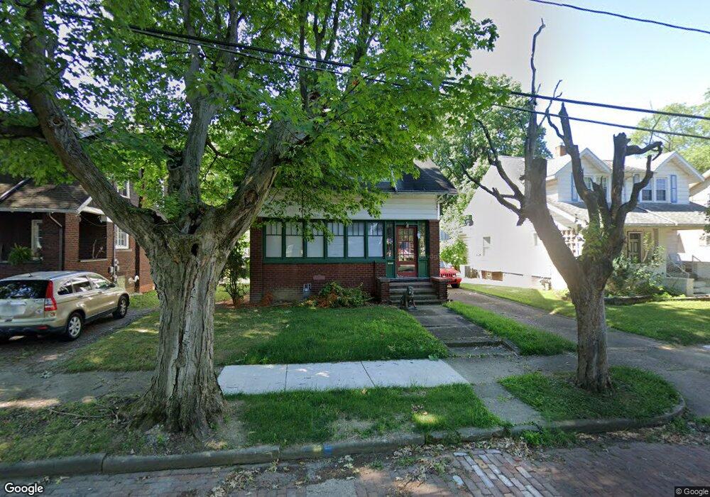
225 Shadyside Ct Alliance, OH 44601
Estimated Value: $77,000 - $171,000
3
Beds
1
Bath
1,422
Sq Ft
$76/Sq Ft
Est. Value
About This Home
This home is located at 225 Shadyside Ct, Alliance, OH 44601 and is currently estimated at $108,370, approximately $76 per square foot. 225 Shadyside Ct is a home located in Stark County with nearby schools including Alliance Elementary School at Rockhill, Alliance Intermediate School at Northside, and Alliance Middle School.
Ownership History
Date
Name
Owned For
Owner Type
Purchase Details
Closed on
May 30, 2025
Sold by
Roman Christopher A
Bought by
Ws Capital Group Llc
Current Estimated Value
Home Financials for this Owner
Home Financials are based on the most recent Mortgage that was taken out on this home.
Original Mortgage
$57,920
Outstanding Balance
$57,770
Interest Rate
6.76%
Mortgage Type
Credit Line Revolving
Estimated Equity
$50,600
Purchase Details
Closed on
Mar 4, 2008
Sold by
Oesch Nancy A
Bought by
Reeder James A
Home Financials for this Owner
Home Financials are based on the most recent Mortgage that was taken out on this home.
Original Mortgage
$76,302
Interest Rate
5.75%
Mortgage Type
Purchase Money Mortgage
Purchase Details
Closed on
Jul 21, 2004
Sold by
Oesch Alfred E and Oesch Nancy A
Bought by
Oesch Alfred E and Oesch Nancy A
Purchase Details
Closed on
Sep 29, 1988
Create a Home Valuation Report for This Property
The Home Valuation Report is an in-depth analysis detailing your home's value as well as a comparison with similar homes in the area
Home Values in the Area
Average Home Value in this Area
Purchase History
| Date | Buyer | Sale Price | Title Company |
|---|---|---|---|
| Ws Capital Group Llc | $72,400 | None Listed On Document | |
| Reeder James A | $77,500 | Attorney | |
| Oesch Alfred E | -- | -- | |
| -- | $26,000 | -- |
Source: Public Records
Mortgage History
| Date | Status | Borrower | Loan Amount |
|---|---|---|---|
| Open | Ws Capital Group Llc | $57,920 | |
| Previous Owner | Reeder James A | $76,302 |
Source: Public Records
Tax History Compared to Growth
Tax History
| Year | Tax Paid | Tax Assessment Tax Assessment Total Assessment is a certain percentage of the fair market value that is determined by local assessors to be the total taxable value of land and additions on the property. | Land | Improvement |
|---|---|---|---|---|
| 2025 | -- | $23,490 | $3,610 | $19,880 |
| 2024 | -- | $23,490 | $3,610 | $19,880 |
| 2023 | $691 | $17,190 | $3,540 | $13,650 |
| 2022 | $348 | $17,190 | $3,540 | $13,650 |
| 2021 | $696 | $17,190 | $3,540 | $13,650 |
| 2020 | $677 | $15,620 | $3,050 | $12,570 |
| 2019 | $668 | $15,620 | $3,050 | $12,570 |
| 2018 | $671 | $15,620 | $3,050 | $12,570 |
| 2017 | $590 | $13,520 | $2,560 | $10,960 |
| 2016 | $595 | $13,520 | $2,560 | $10,960 |
| 2015 | $603 | $13,590 | $2,560 | $11,030 |
| 2014 | $653 | $14,010 | $2,630 | $11,380 |
| 2013 | $326 | $14,010 | $2,630 | $11,380 |
Source: Public Records
Map
Nearby Homes
- 1475 Chatauqua Ct
- 1437 S Linden Ave
- 112 E College St
- 390 E College St
- 551 South St
- 729 Waugh St
- 1846 S Freedom Ave
- 1005 S Freedom Ave
- 815 Grace St
- 1395 S Webb Ave
- 317 E State St
- 1044 S Liberty Ave
- 807 S Union Ave
- 814 Milner St
- 203 Glamorgan St
- 2218 S Freedom Ave
- 1233 Woodland Ave
- 452 E Summit St
- 140 W Summit St
- 831 Wade Ave
- 217 Shadyside Ct
- 233 Shadyside Ct
- 205 Shadyside Ct
- 245 Shadyside Ct
- 165 Shadyside Ct
- 255 Shadyside Ct
- 224 Shadyside Ct
- 216 Shadyside Ct
- 236 Shadyside Ct
- 155 Shadyside Ct
- 1477 S Arch Ave
- 204 Shadyside Ct
- 246 Shadyside Ct
- 164 Shadyside Ct
- 1465 S Arch Ave
- 1495 S Arch Ave
- 1507 S Arch Ave
- 251 Madison Ct
- 140 Shadyside Ct
- 1555 S Arch Ave