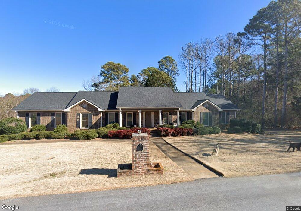
225 Swanson Dr Athens, GA 30606
Kingswood NeighborhoodEstimated Value: $351,000 - $606,000
--
Bed
--
Bath
4,074
Sq Ft
$119/Sq Ft
Est. Value
About This Home
This home is located at 225 Swanson Dr, Athens, GA 30606 and is currently estimated at $484,303, approximately $118 per square foot. 225 Swanson Dr is a home located in Clarke County with nearby schools including Timothy Elementary School, Clarke Middle School, and Clarke Central High School.
Ownership History
Date
Name
Owned For
Owner Type
Purchase Details
Closed on
Jun 29, 2011
Sold by
Ireland Elizabeth
Bought by
Gantt Julius L
Current Estimated Value
Home Financials for this Owner
Home Financials are based on the most recent Mortgage that was taken out on this home.
Original Mortgage
$187,132
Outstanding Balance
$128,479
Interest Rate
4.62%
Mortgage Type
FHA
Estimated Equity
$355,824
Create a Home Valuation Report for This Property
The Home Valuation Report is an in-depth analysis detailing your home's value as well as a comparison with similar homes in the area
Home Values in the Area
Average Home Value in this Area
Purchase History
| Date | Buyer | Sale Price | Title Company |
|---|---|---|---|
| Gantt Julius L | $192,000 | -- |
Source: Public Records
Mortgage History
| Date | Status | Borrower | Loan Amount |
|---|---|---|---|
| Open | Gantt Julius L | $187,132 |
Source: Public Records
Tax History Compared to Growth
Tax History
| Year | Tax Paid | Tax Assessment Tax Assessment Total Assessment is a certain percentage of the fair market value that is determined by local assessors to be the total taxable value of land and additions on the property. | Land | Improvement |
|---|---|---|---|---|
| 2025 | $4,111 | $150,838 | $24,000 | $126,838 |
| 2024 | $4,111 | $144,472 | $24,000 | $120,472 |
| 2023 | $4,016 | $135,202 | $24,000 | $111,202 |
| 2022 | $3,332 | $114,451 | $24,000 | $90,451 |
| 2021 | $2,254 | $76,888 | $12,880 | $64,008 |
| 2020 | $2,236 | $76,358 | $12,880 | $63,478 |
| 2019 | $2,202 | $74,862 | $12,880 | $61,982 |
| 2018 | $2,085 | $71,399 | $9,200 | $62,199 |
| 2017 | $1,996 | $68,803 | $9,200 | $59,603 |
| 2016 | $1,975 | $68,170 | $8,280 | $59,890 |
| 2015 | $1,987 | $68,444 | $8,280 | $60,164 |
| 2014 | $2,000 | $68,707 | $8,280 | $60,427 |
Source: Public Records
Map
Nearby Homes
- 190 Kirkwood Dr
- 1771 Timothy Rd
- 461 Oglethorpe Ave
- 1845 Olympus Ct
- 1847 Olympus Ct
- 1842 Olympus Ct
- 137 Timothy Park Ln
- 136 Timothy Park Ln
- 114 Telfair Place
- 780 Kings Rd
- 101 Wood Lake Dr Unit 307
- 125 Wood Lake Dr Unit 210
- 140 Cypress Manor Ln
- 158 Mallard Pointe Way
- 245 Mallard Pointe Way
- 320 Wilde Oak Place
- 292 Wood Lake Dr
- 230 Swanson Dr
- 220 Swanson Dr
- 100 Swanson Cir
- 240 Swanson Dr
- 210 Swanson Dr
- 160 Swanson Cir
- 165 Swanson Cir
- 131 Jones Dr Unit Drive
- 131 Jones Dr
- 100 Jones Dr
- 1681 Timothy Rd
- 115 Jones Dr
- 122 Jones Ct
- 110 Jones Dr
- 112 Jones Ct
- 1695 Timothy Rd
- 0 Jones Ct Unit 8849013
- 0 Jones Ct Unit 8895443
- 0 Jones Ct Unit 8795908
- 0 Jones Ct Unit 8813142