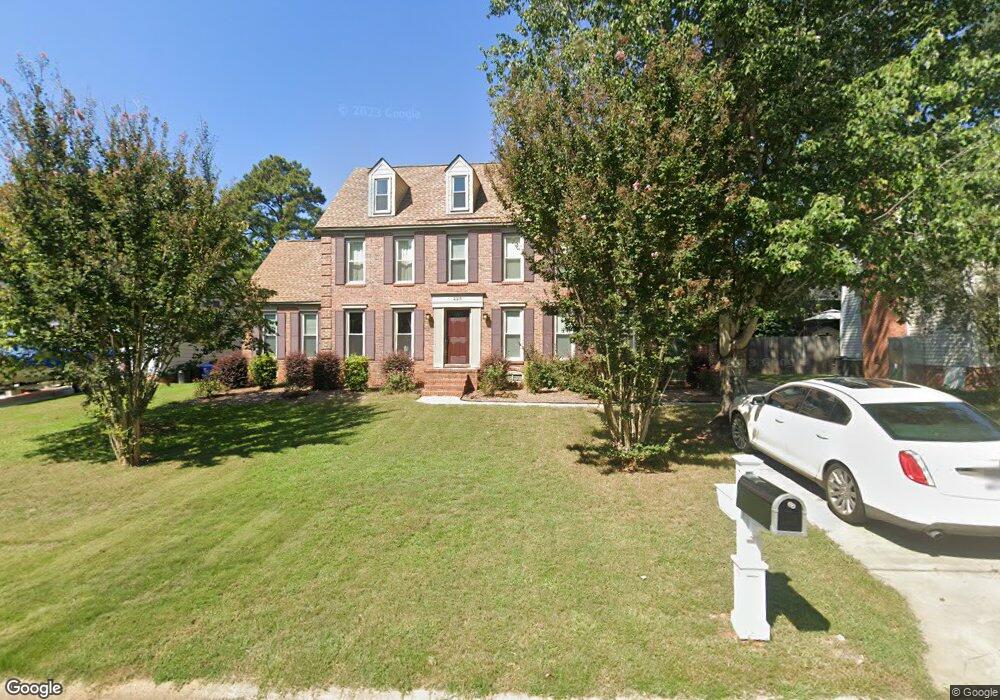
225 Tolson Ln Columbia, SC 29212
Northwest Columbia NeighborhoodEstimated Value: $299,000 - $320,000
4
Beds
3
Baths
2,200
Sq Ft
$140/Sq Ft
Est. Value
About This Home
This home is located at 225 Tolson Ln, Columbia, SC 29212 and is currently estimated at $308,981, approximately $140 per square foot. 225 Tolson Ln is a home located in Lexington County with nearby schools including Irmo Middle, Irmo High, and Green Charter School Of The Midlands.
Ownership History
Date
Name
Owned For
Owner Type
Purchase Details
Closed on
Apr 30, 2021
Sold by
Wade Charles B and Wade Deborah S
Bought by
Soyke Jon Verell
Current Estimated Value
Home Financials for this Owner
Home Financials are based on the most recent Mortgage that was taken out on this home.
Original Mortgage
$239,000
Outstanding Balance
$216,255
Interest Rate
3%
Mortgage Type
VA
Estimated Equity
$92,726
Purchase Details
Closed on
Oct 12, 2012
Sold by
Mortenson Jason L and Mortenson Susan B
Bought by
Wade Charles B and Wade Deborah S
Home Financials for this Owner
Home Financials are based on the most recent Mortgage that was taken out on this home.
Original Mortgage
$150,228
Interest Rate
3.25%
Mortgage Type
FHA
Purchase Details
Closed on
Mar 30, 2000
Sold by
Thompson Catherine R
Bought by
Thompson Tommy D
Create a Home Valuation Report for This Property
The Home Valuation Report is an in-depth analysis detailing your home's value as well as a comparison with similar homes in the area
Home Values in the Area
Average Home Value in this Area
Purchase History
| Date | Buyer | Sale Price | Title Company |
|---|---|---|---|
| Soyke Jon Verell | $239,000 | None Available | |
| Wade Charles B | $153,000 | -- | |
| Thompson Tommy D | $66,667 | -- |
Source: Public Records
Mortgage History
| Date | Status | Borrower | Loan Amount |
|---|---|---|---|
| Open | Soyke Jon Verell | $239,000 | |
| Previous Owner | Wade Charles B | $150,228 |
Source: Public Records
Tax History Compared to Growth
Tax History
| Year | Tax Paid | Tax Assessment Tax Assessment Total Assessment is a certain percentage of the fair market value that is determined by local assessors to be the total taxable value of land and additions on the property. | Land | Improvement |
|---|---|---|---|---|
| 2024 | $6,405 | $14,340 | $1,800 | $12,540 |
| 2023 | $6,216 | $9,560 | $1,200 | $8,360 |
| 2022 | $1,080 | $9,560 | $1,200 | $8,360 |
| 2020 | $1,080 | $6,627 | $1,200 | $5,427 |
| 2019 | $980 | $5,904 | $1,200 | $4,704 |
| 2018 | $861 | $5,904 | $1,200 | $4,704 |
| 2017 | $838 | $5,904 | $1,200 | $4,704 |
| 2016 | $3,617 | $8,856 | $1,800 | $7,056 |
| 2014 | $3,607 | $9,179 | $2,100 | $7,079 |
| 2013 | -- | $9,180 | $2,100 | $7,080 |
Source: Public Records
Map
Nearby Homes
- 248 Conrad Cir
- 6607 Nursery Rd
- 329 Old Wood Dr
- 345 Old Wood Dr
- 430 Sterling Bridge Rd
- 0 Wescott Rd
- 123 Stephenson Ln
- 111 Rusty Barn Rd
- 525 Smiths Market Rd
- 215 Wilton Hill Rd
- 270 Danby Ct
- 251 Danby Ct
- 104 Devonwood Ct
- 5839 Corley St
- 400 Emory Ln
- 110 Bilton Rd
- 612 Rapids Rd
- 140 Old Pond Ln
- 6009 Wescott Rd
- 105 Thornhill Rd