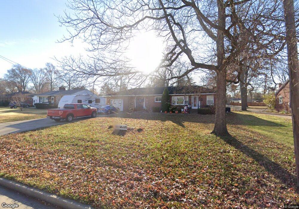
225 W Airline Dr East Alton, IL 62024
Estimated Value: $158,000 - $220,000
3
Beds
2
Baths
1,620
Sq Ft
$109/Sq Ft
Est. Value
About This Home
This home is located at 225 W Airline Dr, East Alton, IL 62024 and is currently estimated at $177,311, approximately $109 per square foot. 225 W Airline Dr is a home located in Madison County with nearby schools including Eastwood Elementary School, East Alton Middle School, and East Alton-Wood River High School.
Ownership History
Date
Name
Owned For
Owner Type
Purchase Details
Closed on
Mar 1, 2024
Sold by
Barringer Janet and Phillips Joe D
Bought by
Woelfel Donald and Woelfel Brenda
Current Estimated Value
Purchase Details
Closed on
Nov 30, 2012
Sold by
Davis Brian A
Bought by
Barringer Janet and Phillips Joe D
Home Financials for this Owner
Home Financials are based on the most recent Mortgage that was taken out on this home.
Original Mortgage
$78,850
Interest Rate
3.38%
Mortgage Type
New Conventional
Purchase Details
Closed on
Oct 3, 2007
Sold by
Citibank Na
Bought by
Bt Davis Properties Inc
Purchase Details
Closed on
Jun 4, 2007
Sold by
Raghel Omar A
Bought by
Citibank Na
Create a Home Valuation Report for This Property
The Home Valuation Report is an in-depth analysis detailing your home's value as well as a comparison with similar homes in the area
Home Values in the Area
Average Home Value in this Area
Purchase History
| Date | Buyer | Sale Price | Title Company |
|---|---|---|---|
| Woelfel Donald | $100,000 | Community Title & Escrow | |
| Barringer Janet | $83,000 | Serenity Title & Escrow Ltd | |
| Bt Davis Properties Inc | $75,000 | Fatic | |
| Citibank Na | -- | None Available |
Source: Public Records
Mortgage History
| Date | Status | Borrower | Loan Amount |
|---|---|---|---|
| Previous Owner | Barringer Janet | $78,850 |
Source: Public Records
Tax History Compared to Growth
Tax History
| Year | Tax Paid | Tax Assessment Tax Assessment Total Assessment is a certain percentage of the fair market value that is determined by local assessors to be the total taxable value of land and additions on the property. | Land | Improvement |
|---|---|---|---|---|
| 2024 | $2,673 | $37,530 | $7,480 | $30,050 |
| 2023 | $2,673 | $34,980 | $6,970 | $28,010 |
| 2022 | $1,546 | $32,280 | $6,430 | $25,850 |
| 2021 | $1,705 | $30,080 | $5,990 | $24,090 |
| 2020 | $1,717 | $28,970 | $5,770 | $23,200 |
| 2019 | $1,753 | $28,110 | $5,600 | $22,510 |
| 2018 | $1,750 | $26,710 | $5,320 | $21,390 |
| 2017 | $1,805 | $26,070 | $5,190 | $20,880 |
| 2016 | $1,726 | $26,070 | $5,190 | $20,880 |
| 2015 | $1,654 | $25,800 | $5,140 | $20,660 |
| 2014 | $1,654 | $25,800 | $5,140 | $20,660 |
| 2013 | $1,654 | $26,170 | $5,210 | $20,960 |
Source: Public Records
Map
Nearby Homes
- 250 Hi Pointe Place
- 283 Hi Pointe Place
- 141 S 9th St
- 144 S 9th St
- 211 S 9th St
- 14 Dell Ave
- 604 Wood River Ave
- 345 Illinois Ave
- 417 California Ave
- 225 Lakeside Ave
- 523 Lincoln Ave
- 959 Cedar Dr
- 104 Whitelaw Ave
- 121 Whitelaw Ave
- 523 Wilson Ave
- 519 Sullivan St
- 98 Wood River Ave
- 420 Bowman Ave
- 207 Stolze Dr
- 133 Lincoln Ave
- 217 W Airline Dr
- 233 W Airline Dr
- 203 W Airline Dr
- 101 Riverwoods Cove
- 241 W Airline Dr
- 254 W Airline Dr
- 216 W Haller Dr
- 228 W Haller Dr
- 105 Riverwoods Cove
- 249 W Airline Dr
- 204 W Haller Dr
- 256 W Airline Dr
- 258 W Airline Dr
- 240 W Haller Dr
- 187 W Airline Dr
- 106 Riverwoods Cove
- 109 Riverwoods Cove
- 251 W Airline Dr
- 7 N Circle Dr
- 252 W Haller Dr