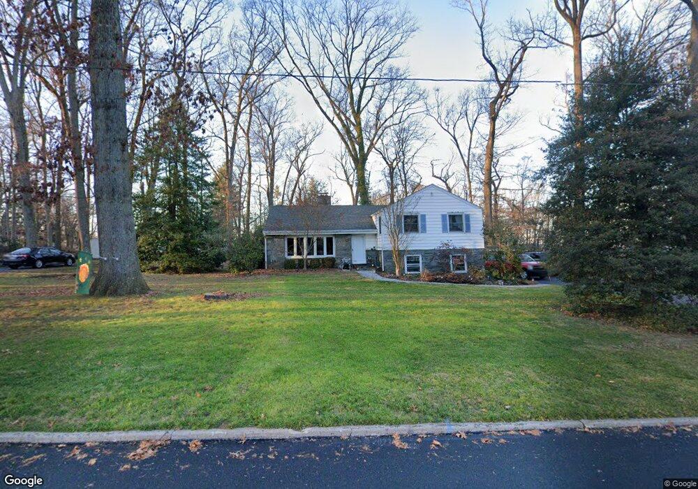
225 Wooded Way Berwyn, PA 19312
Estimated Value: $744,104 - $807,000
3
Beds
3
Baths
1,607
Sq Ft
$477/Sq Ft
Est. Value
About This Home
This home is located at 225 Wooded Way, Berwyn, PA 19312 and is currently estimated at $766,526, approximately $476 per square foot. 225 Wooded Way is a home located in Chester County with nearby schools including Hillside Elementary School, Valley Forge Middle School, and Conestoga Senior High School.
Ownership History
Date
Name
Owned For
Owner Type
Purchase Details
Closed on
Aug 10, 2007
Sold by
Coldev Associates Lp
Bought by
Norcini Edward and Ward Kristine
Current Estimated Value
Home Financials for this Owner
Home Financials are based on the most recent Mortgage that was taken out on this home.
Original Mortgage
$300,000
Outstanding Balance
$189,654
Interest Rate
6.63%
Mortgage Type
Purchase Money Mortgage
Estimated Equity
$576,872
Purchase Details
Closed on
Apr 28, 2006
Sold by
Pratte Oden I and Pratte Donna C
Bought by
Coldev Associates Lp
Purchase Details
Closed on
Oct 17, 2002
Sold by
Pratte Oden I
Bought by
Pratte Oden I and Pratte Donna C
Home Financials for this Owner
Home Financials are based on the most recent Mortgage that was taken out on this home.
Original Mortgage
$220,000
Interest Rate
5.52%
Mortgage Type
Stand Alone First
Create a Home Valuation Report for This Property
The Home Valuation Report is an in-depth analysis detailing your home's value as well as a comparison with similar homes in the area
Home Values in the Area
Average Home Value in this Area
Purchase History
| Date | Buyer | Sale Price | Title Company |
|---|---|---|---|
| Norcini Edward | $375,000 | None Available | |
| Coldev Associates Lp | $390,000 | None Available | |
| Pratte Oden I | -- | -- |
Source: Public Records
Mortgage History
| Date | Status | Borrower | Loan Amount |
|---|---|---|---|
| Open | Norcini Edward | $300,000 | |
| Previous Owner | Pratte Oden I | $220,000 |
Source: Public Records
Tax History Compared to Growth
Tax History
| Year | Tax Paid | Tax Assessment Tax Assessment Total Assessment is a certain percentage of the fair market value that is determined by local assessors to be the total taxable value of land and additions on the property. | Land | Improvement |
|---|---|---|---|---|
| 2025 | $6,861 | $194,780 | $62,890 | $131,890 |
| 2024 | $6,861 | $194,780 | $62,890 | $131,890 |
| 2023 | $6,445 | $194,780 | $62,890 | $131,890 |
| 2022 | $6,278 | $194,780 | $62,890 | $131,890 |
| 2021 | $6,159 | $194,780 | $62,890 | $131,890 |
| 2020 | $5,989 | $194,780 | $62,890 | $131,890 |
| 2019 | $5,800 | $194,780 | $62,890 | $131,890 |
| 2018 | $5,685 | $194,780 | $62,890 | $131,890 |
| 2017 | $5,550 | $194,780 | $62,890 | $131,890 |
| 2016 | -- | $194,780 | $62,890 | $131,890 |
| 2015 | -- | $194,780 | $62,890 | $131,890 |
| 2014 | -- | $185,320 | $62,890 | $122,430 |
Source: Public Records
Map
Nearby Homes
- 446 Irish Rd
- 875 Old State Rd
- 395 Bair Rd
- 433 Donalyn Ln
- 530 Bair Rd
- 909 Old Lancaster Rd
- 45 Orchard Ln
- 1242 Old Lancaster Rd
- 71 Oak Knoll Dr
- 53 Branch Ave
- 52 Aiken Ave
- 81 Oak Knoll Dr Unit J81
- 1 Lfleur Unit 1
- 91 Central Ave
- 5 Kent Ln
- 387 Devonshire Rd
- 553 Woodside Ave
- 406 Brighton Cir
- 1250 Swedesford Rd
- 41 Greenlawn Rd