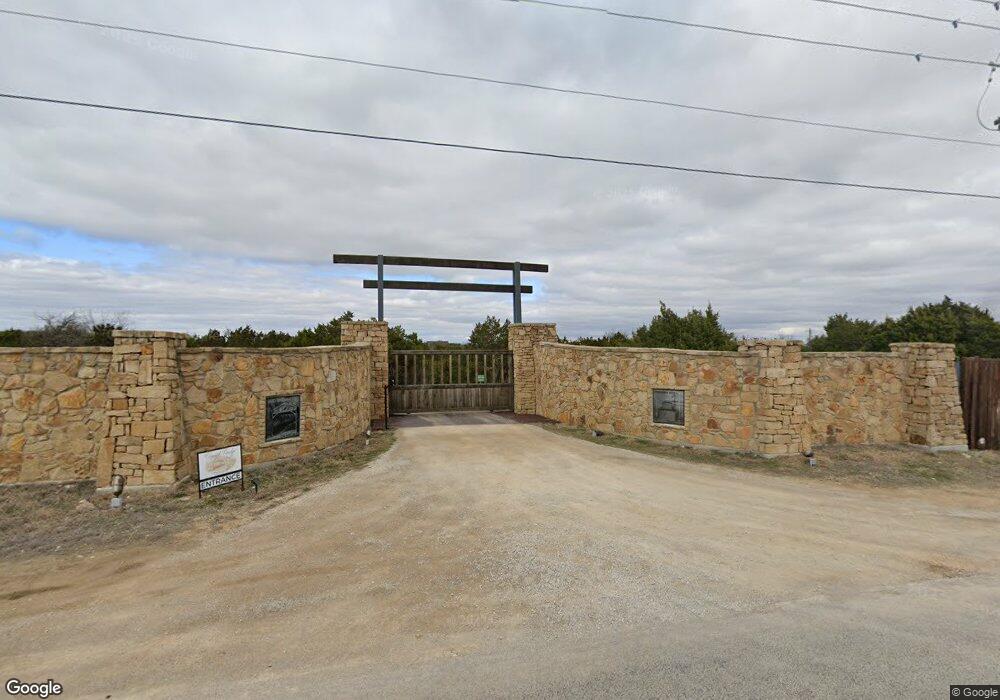
2250 Agnes Cir Springtown, TX 76082
Estimated Value: $557,000
--
Bed
--
Bath
2,674
Sq Ft
$208/Sq Ft
Est. Value
About This Home
This home is located at 2250 Agnes Cir, Springtown, TX 76082 and is currently estimated at $557,000, approximately $208 per square foot. 2250 Agnes Cir is a home with nearby schools including Goshen Creek Elementary School, Springtown Middle School, and Springtown Intermediate School.
Ownership History
Date
Name
Owned For
Owner Type
Purchase Details
Closed on
Jun 25, 2018
Sold by
Jacobs Jeffrey and Jacobs Kimberly
Bought by
Dauenhauer Rebecca
Current Estimated Value
Home Financials for this Owner
Home Financials are based on the most recent Mortgage that was taken out on this home.
Original Mortgage
$63,750
Interest Rate
4.5%
Mortgage Type
Purchase Money Mortgage
Purchase Details
Closed on
Aug 28, 2014
Sold by
Purdy Terry and Purdy Beverly
Bought by
Powell Brian and Powell Teather
Create a Home Valuation Report for This Property
The Home Valuation Report is an in-depth analysis detailing your home's value as well as a comparison with similar homes in the area
Home Values in the Area
Average Home Value in this Area
Purchase History
| Date | Buyer | Sale Price | Title Company |
|---|---|---|---|
| Dauenhauer Rebecca | -- | Fidelity National Title | |
| Powell Brian | -- | None Available |
Source: Public Records
Mortgage History
| Date | Status | Borrower | Loan Amount |
|---|---|---|---|
| Closed | Dauenhauer Rebecca | $63,750 |
Source: Public Records
Tax History Compared to Growth
Tax History
| Year | Tax Paid | Tax Assessment Tax Assessment Total Assessment is a certain percentage of the fair market value that is determined by local assessors to be the total taxable value of land and additions on the property. | Land | Improvement |
|---|---|---|---|---|
| 2025 | $6,446 | $530,260 | $23,000 | $507,260 |
| 2024 | $6,446 | $415,770 | $15,000 | $400,770 |
| 2023 | $6,446 | $415,770 | $15,000 | $400,770 |
| 2022 | $7,390 | $414,430 | $10,000 | $404,430 |
| 2021 | $8,022 | $414,430 | $10,000 | $404,430 |
| 2020 | $6,623 | $343,290 | $7,000 | $336,290 |
| 2019 | $7,119 | $343,290 | $7,000 | $336,290 |
| 2018 | $6,285 | $302,150 | $3,500 | $298,650 |
| 2017 | $6,586 | $302,150 | $3,500 | $298,650 |
| 2016 | $5,865 | $269,100 | $3,500 | $265,600 |
| 2015 | $4,939 | $229,700 | $3,500 | $226,200 |
Source: Public Records
Map
Nearby Homes
- 124 Stanford Ln
- 317 Palo Alto Dr
- 223 Columbia Ct
- 235 Columbia Ct
- TBD Candis Ct
- 104 Candis Ct
- 252 Harvard Ln
- 391 Red Bird Dr
- 2801 Agnes Cir
- 447 Red Bird Dr
- 363 Red Bird Dr
- 144 Brady Coleman Ln
- 8950 Prather Rd
- 137 Brady Coleman Ln
- 1028 Gatlin Cir
- 1021 Gatlin Cir
- 1020 Gatlin Cir
- 8830 Prather Rd
- 1016 Gatlin Cir
- Caleb Plan at Rocky Top Ranch
- 2606 Agnes Cir
- 2498 Agnes Cir
- 2221 Agnes Cir
- 140 Stanford Ln
- 128 Stanford Ln
- 132 Stanford Ln
- 136 Stanford Ln
- 120 Stanford Ln
- 144 Stanford Ln
- 116 Stanford Ln
- 148 Stanford Ln
- 112 Stanford Ln
- 152 Stanford Ln
- 108 Stanford Ln
- 1700 Agnes Cir
- 104 Stanford Ln
- 135 Stanford Ln
- 131 Stanford Ln
- 127 Stanford Ln
- 139 Stanford Ln
