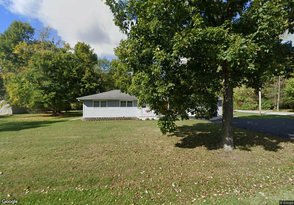
2250 Dearing Rd Spring Arbor, MI 49283
Estimated Value: $166,269 - $283,000
Studio
--
Bath
1,196
Sq Ft
$183/Sq Ft
Est. Value
About This Home
This home is located at 2250 Dearing Rd, Spring Arbor, MI 49283 and is currently estimated at $219,067, approximately $183 per square foot. 2250 Dearing Rd is a home located in Jackson County with nearby schools including Western High School, Paragon Charter Academy, and Trinity Lutheran School.
Ownership History
Date
Name
Owned For
Owner Type
Purchase Details
Closed on
Sep 23, 2002
Sold by
Goldsmith Merlin L and Elaine Goldsmith A
Bought by
Schaub Ronald L and Schaub Linda I
Current Estimated Value
Home Financials for this Owner
Home Financials are based on the most recent Mortgage that was taken out on this home.
Original Mortgage
$75,000
Interest Rate
6.32%
Purchase Details
Closed on
Aug 11, 1997
Bought by
Goldsmith Mike and Goldsmith Elaine
Purchase Details
Closed on
Aug 1, 1997
Bought by
Goldsmith Mike and Goldsmith Elaine
Create a Home Valuation Report for This Property
The Home Valuation Report is an in-depth analysis detailing your home's value as well as a comparison with similar homes in the area
Purchase History
| Date | Buyer | Sale Price | Title Company |
|---|---|---|---|
| Schaub Ronald L | $70,000 | -- | |
| Goldsmith Mike | $70,000 | -- | |
| Goldsmith Mike | $70,000 | -- |
Source: Public Records
Mortgage History
| Date | Status | Borrower | Loan Amount |
|---|---|---|---|
| Closed | Schaub Ronald L | $75,000 |
Source: Public Records
Tax History
| Year | Tax Paid | Tax Assessment Tax Assessment Total Assessment is a certain percentage of the fair market value that is determined by local assessors to be the total taxable value of land and additions on the property. | Land | Improvement |
|---|---|---|---|---|
| 2025 | $2,115 | $91,500 | $0 | $0 |
| 2024 | $13 | $80,300 | $0 | $0 |
| 2023 | $1,255 | $74,100 | $0 | $0 |
| 2022 | $1,919 | $60,500 | $0 | $0 |
| 2021 | $1,884 | $58,380 | $0 | $0 |
| 2020 | $1,862 | $52,550 | $0 | $0 |
| 2019 | $1,770 | $47,150 | $0 | $0 |
| 2018 | $1,763 | $50,020 | $5,610 | $44,410 |
| 2017 | $1,670 | $49,310 | $0 | $0 |
| 2016 | $1,066 | $49,270 | $49,270 | $0 |
| 2015 | $43,809 | $47,510 | $47,510 | $0 |
| 2014 | $43,809 | $45,220 | $45,220 | $0 |
| 2013 | -- | $45,220 | $45,220 | $0 |
Source: Public Records
Map
Nearby Homes
- 2503 Milford Rd
- 7315 King Rd
- 7969 Brandon Dr
- 6728 King Rd
- 1864 Chapel Rd
- V/L S Dearing Rd Unit 40 Acres Vacant Land
- 0 King Rd Unit 25060444
- 1570 Chapel Rd
- 2635 S Dearing Rd
- 2625 S Dearing Rd
- 1126 Chapel Rd
- 68 Dickens St
- 4920 Slayton Rd
- 4055 Mathews Rd
- 4894 Indian Creek Dr
- 28 Engelhardt Strasse
- 2659 Fairway Dr
- 4540 Westbrook Dr Unit 45
- 2431 N Dearing Rd
- 1956 Trinity Ln
- 2178 Dearing Rd
- 2182 S Dearing Rd
- 2264 Dearing Rd
- 7233 Monarch Dr
- 2188 Dearing Rd
- 2188 S Dearing Rd
- 2171 Dearing Rd
- 2171 Dearing Rd
- 7237 Monarch Dr
- 2251 S Dearing Rd
- 2251 Dearing Rd
- 2155 Dearing Rd
- 2170 Dearing Rd
- 2171 S Dearing Rd
- 2192 Dearing Rd
- 2192 S Dearing Rd
- 2150 S Dearing Rd
- 2150 Dearing Rd
- 2196 Dearing Rd
- 1730 Dearing Rd
Your Personal Tour Guide
Ask me questions while you tour the home.