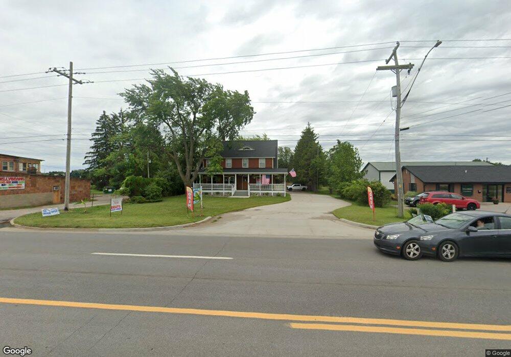
2250 E M 21 Owosso, MI 48867
Estimated Value: $176,000 - $264,000
3
Beds
2
Baths
2,070
Sq Ft
$111/Sq Ft
Est. Value
About This Home
This home is located at 2250 E M 21, Owosso, MI 48867 and is currently estimated at $229,637, approximately $110 per square foot. 2250 E M 21 is a home located in Shiawassee County with nearby schools including Corunna High School, St. Paul Catholic School, and St. Joseph School.
Ownership History
Date
Name
Owned For
Owner Type
Purchase Details
Closed on
Mar 6, 2023
Sold by
Rasmussen Todd and Rasmussen Jacqueline
Bought by
Route 21 Properties And Investments Llc
Current Estimated Value
Purchase Details
Closed on
Aug 8, 2017
Sold by
Chemical Bank and Plichta Catherine
Bought by
Rasmussen Todd and Rasmussen Jacqueline
Purchase Details
Closed on
Feb 22, 2016
Sold by
Scott Mildred E
Bought by
Chemical Bank
Create a Home Valuation Report for This Property
The Home Valuation Report is an in-depth analysis detailing your home's value as well as a comparison with similar homes in the area
Home Values in the Area
Average Home Value in this Area
Purchase History
| Date | Buyer | Sale Price | Title Company |
|---|---|---|---|
| Route 21 Properties And Investments Llc | -- | -- | |
| Route 21 Properties And Investments Llc | -- | None Listed On Document | |
| Rasmussen Todd | $80,000 | None Available | |
| Chemical Bank | $63,750 | None Available |
Source: Public Records
Tax History
| Year | Tax Paid | Tax Assessment Tax Assessment Total Assessment is a certain percentage of the fair market value that is determined by local assessors to be the total taxable value of land and additions on the property. | Land | Improvement |
|---|---|---|---|---|
| 2025 | $5,838 | $101,600 | $0 | $0 |
| 2024 | $4,337 | $98,700 | $0 | $0 |
| 2023 | $2,016 | $74,400 | $0 | $0 |
| 2022 | $1,813 | $66,800 | $0 | $0 |
| 2021 | $3,107 | $54,800 | $0 | $0 |
| 2020 | $3,307 | $58,000 | $0 | $0 |
| 2019 | $3,204 | $86,700 | $0 | $0 |
| 2018 | $5,049 | $106,900 | $0 | $0 |
| 2017 | $6,370 | $108,800 | $0 | $0 |
| 2016 | $5,553 | $108,800 | $0 | $0 |
| 2015 | $5,553 | $109,600 | $0 | $0 |
| 2014 | $26 | $100,900 | $0 | $0 |
Source: Public Records
Map
Nearby Homes
- V/L E Main St
- 230 Elizabeth Dr
- V/L E M 21
- 1859 Big Bear Dr
- 1845 Fawn Cir
- 215 Stanley Dr
- 205 Ferry St
- 215 Sylvia Dr
- 121 Mill St
- 304 W Corunna Ave
- 1926 Kilbourn Ave
- 408 W Mcarthur St
- 415 W Mcarthur St
- Vacant Copas Rd
- 607 E King St
- V/L Short St
- 302 E State St
- 212 W State St
- 219 S Mizner St
- 1605 Corunna Ave
Your Personal Tour Guide
Ask me questions while you tour the home.