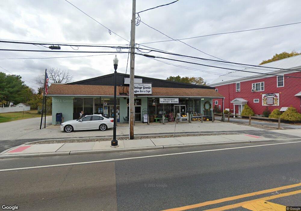
2250 Route 50 Tuckahoe, NJ 08250
Estimated Value: $344,216
--
Bed
--
Bath
100
Sq Ft
$3,442/Sq Ft
Est. Value
About This Home
This home is located at 2250 Route 50, Tuckahoe, NJ 08250 and is currently estimated at $344,216, approximately $3,442 per square foot. 2250 Route 50 is a home located in Cape May County with nearby schools including Upper Township Primary School, Upper Township Elementary School, and Upper Township Middle School.
Ownership History
Date
Name
Owned For
Owner Type
Purchase Details
Closed on
Mar 15, 2017
Sold by
Bluth Mark J and Bluth Doris A
Bought by
Ron And Christine Llc
Current Estimated Value
Home Financials for this Owner
Home Financials are based on the most recent Mortgage that was taken out on this home.
Original Mortgage
$135,000
Interest Rate
4.15%
Mortgage Type
Commercial
Purchase Details
Closed on
Jan 16, 2004
Sold by
Valcich Thomas
Bought by
Bluth Mark J and Bluth Doris A
Home Financials for this Owner
Home Financials are based on the most recent Mortgage that was taken out on this home.
Original Mortgage
$150,000
Interest Rate
5.67%
Mortgage Type
Commercial
Purchase Details
Closed on
Jun 18, 1993
Sold by
Horner Jacqueline
Bought by
Valcich Thomas F and Valcich Olga
Create a Home Valuation Report for This Property
The Home Valuation Report is an in-depth analysis detailing your home's value as well as a comparison with similar homes in the area
Home Values in the Area
Average Home Value in this Area
Purchase History
| Date | Buyer | Sale Price | Title Company |
|---|---|---|---|
| Ron And Christine Llc | $170,000 | None Available | |
| Bluth Mark J | $200,000 | -- | |
| Bluth Mark J | $200,000 | Congress Title Division | |
| Valcich Thomas F | $205,000 | -- |
Source: Public Records
Mortgage History
| Date | Status | Borrower | Loan Amount |
|---|---|---|---|
| Closed | Ron And Christine Llc | $135,000 | |
| Previous Owner | Bluth Mark J | $150,000 |
Source: Public Records
Tax History Compared to Growth
Tax History
| Year | Tax Paid | Tax Assessment Tax Assessment Total Assessment is a certain percentage of the fair market value that is determined by local assessors to be the total taxable value of land and additions on the property. | Land | Improvement |
|---|---|---|---|---|
| 2025 | $4,559 | $193,600 | $92,100 | $101,500 |
| 2024 | $4,559 | $193,600 | $92,100 | $101,500 |
| 2023 | $4,342 | $193,600 | $92,100 | $101,500 |
| 2022 | $4,209 | $193,600 | $92,100 | $101,500 |
| 2021 | $3,011 | $193,600 | $92,100 | $101,500 |
| 2020 | $3,917 | $193,600 | $92,100 | $101,500 |
| 2019 | $3,827 | $193,600 | $92,100 | $101,500 |
| 2018 | $3,731 | $193,600 | $92,100 | $101,500 |
| 2017 | $6,166 | $324,000 | $92,100 | $231,900 |
| 2016 | $6,266 | $324,000 | $92,100 | $231,900 |
| 2015 | $6,081 | $324,000 | $92,100 | $231,900 |
| 2014 | $4,795 | $314,000 | $80,500 | $233,500 |
Source: Public Records
Map
Nearby Homes
- 50 School House Ln
- 2334 Route 50
- 101 Whitman Ln
- 27 Cedar Ave
- 115 Rte 50
- 17 Deerfield Trail
- 8 Deerfield Trail
- 000 New Jersey 49
- 1520 Route 50
- 104 Church Rd
- 104 Head of River Rd
- 120 W Poplar Ave
- 116 Head of River Rd
- 120 Head of River Rd
- 1081 Route 50
- 126 Buck Hill Rd
- 1981 Tuckahoe Rd
- 465 Route 49 Unit 118
- 104 Reading Ave
- 104 Reading Ave
- 1836 Mt Pleasant Rd
- 2234 New Jersey 50
- 2240 Route 50
- 2240 Rte 50
- 111 Reading Ave
- 1830 Mt Pleasant Rd
- 1826 Mt Pleasant Rd
- 118 Reading Ave
- 2235 Route 50
- 1820 Mt Pleasant Rd
- 2245 Route 50
- 1811 Mt Pleasant Rd
- 2251 Route 50
- 117 Reading Ave
- 2256 Route 50
- 2251 New Jersey 50
- 2251 Route 50
- 1800 Mt Pleasant Rd