Estimated Value: $888,000 - $1,026,000
3
Beds
4
Baths
3,280
Sq Ft
$292/Sq Ft
Est. Value
About This Home
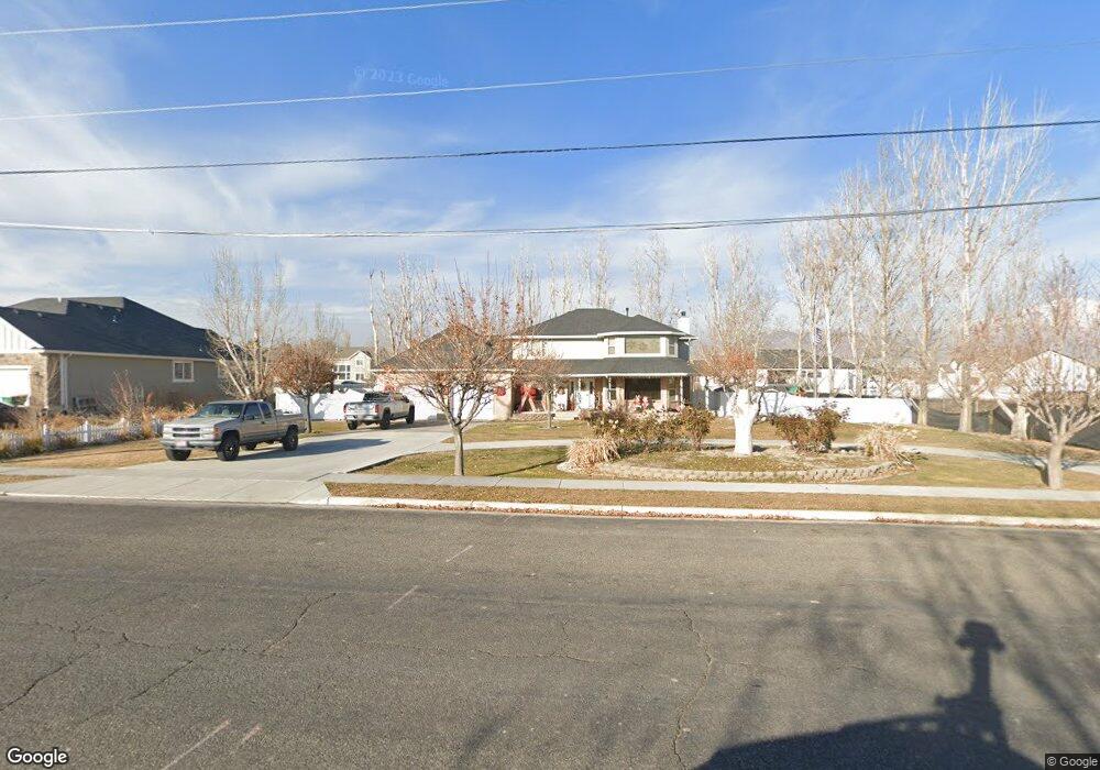
This home is located at 2250 W 900 N, Lehi, UT 84043 and is currently estimated at $958,536, approximately $292 per square foot. 2250 W 900 N is a home located in Utah County with nearby schools including North Point Elementary School, Willowcreek Middle School, and Lehi High School.
Ownership History
Date
Name
Owned For
Owner Type
Purchase Details
Closed on
Jan 18, 2017
Sold by
Bingham Marc C and Bingham Deborah H
Bought by
Bunker Danielle and Bunker Richard
Current Estimated Value
Home Financials for this Owner
Home Financials are based on the most recent Mortgage that was taken out on this home.
Original Mortgage
$279,200
Outstanding Balance
$230,152
Interest Rate
4.13%
Mortgage Type
New Conventional
Estimated Equity
$728,384
Purchase Details
Closed on
Jan 10, 2017
Sold by
Bringham Lehi Llc
Bought by
Bingham Marc C and Bingham Deborah H
Home Financials for this Owner
Home Financials are based on the most recent Mortgage that was taken out on this home.
Original Mortgage
$279,200
Outstanding Balance
$230,152
Interest Rate
4.13%
Mortgage Type
New Conventional
Estimated Equity
$728,384
Create a Home Valuation Report for This Property
The Home Valuation Report is an in-depth analysis detailing your home's value as well as a comparison with similar homes in the area
Home Values in the Area
Average Home Value in this Area
Purchase History
| Date | Buyer | Sale Price | Title Company |
|---|---|---|---|
| Bunker Danielle | -- | First American Title1 Ins Co | |
| Bingham Marc C | -- | First American Title Ins Age |
Source: Public Records
Mortgage History
| Date | Status | Borrower | Loan Amount |
|---|---|---|---|
| Open | Bunker Danielle | $279,200 |
Source: Public Records
Tax History Compared to Growth
Tax History
| Year | Tax Paid | Tax Assessment Tax Assessment Total Assessment is a certain percentage of the fair market value that is determined by local assessors to be the total taxable value of land and additions on the property. | Land | Improvement |
|---|---|---|---|---|
| 2025 | $3,308 | $417,230 | $330,600 | $428,000 |
| 2024 | $3,308 | $387,145 | $0 | $0 |
| 2023 | $3,084 | $391,820 | $0 | $0 |
| 2022 | $2,972 | $366,080 | $0 | $0 |
| 2021 | $2,601 | $484,300 | $191,300 | $293,000 |
| 2020 | $2,449 | $450,900 | $177,100 | $273,800 |
| 2019 | $2,320 | $443,900 | $177,100 | $266,800 |
| 2018 | $2,314 | $418,600 | $151,800 | $266,800 |
| 2017 | $2,346 | $225,610 | $0 | $0 |
| 2016 | $2,528 | $225,610 | $0 | $0 |
Source: Public Records
Map
Nearby Homes
- 1302 N 2450 W
- 2512 W 610 N Unit 99
- Accord Plan at Riverwalk
- Interlude Plan at Riverwalk
- Trio Plan at Riverwalk
- Fortissimo Plan at Riverwalk
- Ballad Plan at Riverwalk
- Tenor Plan at Riverwalk
- Madrigal Plan at Riverwalk
- Timpani Plan at Riverwalk
- Canon Plan at Riverwalk
- Browning Plan at Riverwalk
- Octave Plan at Riverwalk
- Adagio Plan at Riverwalk
- Bravo Plan at Riverwalk
- Princeton Plan at Riverwalk
- Anthem Plan at Riverwalk
- Yalecrest Plan at Riverwalk
- Prelude Plan at Riverwalk
- 1185 N 2650 W
- 923 N 2200 W Unit 101
- 2274 W 900 N Unit 102
- 918 N 2200 W
- 2212 900 N
- 2219 W Bingham Farms Ln Unit 105
- 2241 W Bingham Farms Ln Unit 104
- 2255 W 900 N Unit 2
- 2255 W 900 N
- 2233 W 900 N
- 947 N 2200 W
- 2277 W 900 N Unit 1
- 2212 W Bingham Farms Ln
- 2263 W Bingham Farms Ln Unit 103
- 2211 W 900 N
- 923 N 2300 W
- 922 N 2200 W
- 2014 W 900 N
- 934 N 2200 W
- 925 N 2300 W
- 2222 W Bingham Farms Ln