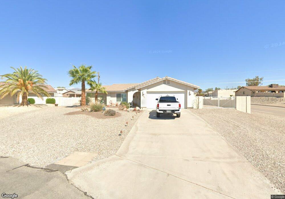
2251 Keith Ln Lake Havasu City, AZ 86403
Estimated Value: $353,016 - $421,000
--
Bed
1
Bath
1,338
Sq Ft
$293/Sq Ft
Est. Value
About This Home
This home is located at 2251 Keith Ln, Lake Havasu City, AZ 86403 and is currently estimated at $392,254, approximately $293 per square foot. 2251 Keith Ln is a home located in Mohave County with nearby schools including Havasupai Elementary School, Thunderbolt Middle School, and Lake Havasu High School.
Ownership History
Date
Name
Owned For
Owner Type
Purchase Details
Closed on
Aug 4, 2021
Sold by
Colman Amy
Bought by
Colman Amy and Gloshen Elizabeth A
Current Estimated Value
Purchase Details
Closed on
Jul 15, 2002
Sold by
Mascola Marie F
Bought by
Colman Leonard W and Colman Amy
Home Financials for this Owner
Home Financials are based on the most recent Mortgage that was taken out on this home.
Original Mortgage
$64,500
Interest Rate
6.16%
Mortgage Type
New Conventional
Create a Home Valuation Report for This Property
The Home Valuation Report is an in-depth analysis detailing your home's value as well as a comparison with similar homes in the area
Home Values in the Area
Average Home Value in this Area
Purchase History
| Date | Buyer | Sale Price | Title Company |
|---|---|---|---|
| Colman Amy | -- | None Listed On Document | |
| Colman Leonard W | $109,500 | Capital Title Agency Inc |
Source: Public Records
Mortgage History
| Date | Status | Borrower | Loan Amount |
|---|---|---|---|
| Previous Owner | Colman Leonard W | $64,500 |
Source: Public Records
Tax History Compared to Growth
Tax History
| Year | Tax Paid | Tax Assessment Tax Assessment Total Assessment is a certain percentage of the fair market value that is determined by local assessors to be the total taxable value of land and additions on the property. | Land | Improvement |
|---|---|---|---|---|
| 2026 | -- | -- | -- | -- |
| 2025 | $987 | $28,973 | $0 | $0 |
| 2024 | $987 | $31,804 | $0 | $0 |
| 2023 | $987 | $27,133 | $0 | $0 |
| 2022 | $950 | $20,061 | $0 | $0 |
| 2021 | $1,126 | $18,527 | $0 | $0 |
| 2019 | $1,073 | $15,468 | $0 | $0 |
| 2018 | $1,039 | $14,150 | $0 | $0 |
| 2017 | $1,022 | $13,329 | $0 | $0 |
| 2016 | $911 | $12,132 | $0 | $0 |
| 2015 | $889 | $10,493 | $0 | $0 |
Source: Public Records
Map
Nearby Homes
- 532 Acoma Blvd N
- 675 Knobhill Ln
- 2311 Rainbow Ave N
- 2200 Clarke Dr
- 640 Acoma Blvd N
- 583 Robin Ln
- 2349 Clarke Dr
- 2270 Constellation Dr
- 2301 Sahara Dr
- 2305 Cosnina Dr
- 2295 Cosnina Dr
- 1790 Rainbow Ave S
- 660 Wayside Dr
- 2416 Fannin Dr
- 2450 Clarke Dr
- 1986 Bahama Ave
- 2537 Everglades Dr
- 2490 Fannin Dr
- 2294 Pheasant Ln
- 2524 Fannin Dr
- 2247 Keith Ln
- 2261 Rainbow Ave N
- 615 Knobhill Ln
- 2245 Keith Ln
- 600 Agate Ln
- 2243 Keith Ln
- 2241 Rainbow Ave N
- 625 Knobhill Ln
- 658 Lookout Ln
- 648 Lookout Ln
- 590 Agate Ln
- 605 Agate Ln
- 599 Knobhill Dr
- 678 Lookout Ln
- 605 Agate Ln
- 678 Lookout Ln
- 645 Knobhill Ln
- 2271 Rainbow Ave N
- 620 Lookout Ln
- 610 Knobhill Ln