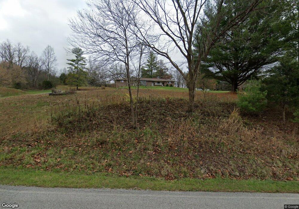
22512 State Route 7 Greenup, KY 41144
Estimated Value: $139,000 - $198,000
3
Beds
2
Baths
2,276
Sq Ft
$74/Sq Ft
Est. Value
About This Home
This home is located at 22512 State Route 7, Greenup, KY 41144 and is currently estimated at $168,023, approximately $73 per square foot. 22512 State Route 7 is a home located in Greenup County with nearby schools including Greenup County High School.
Ownership History
Date
Name
Owned For
Owner Type
Purchase Details
Closed on
Jul 30, 2024
Sold by
Via Donna
Bought by
Short Jacob and Eldridge Emily
Current Estimated Value
Home Financials for this Owner
Home Financials are based on the most recent Mortgage that was taken out on this home.
Original Mortgage
$151,515
Outstanding Balance
$149,800
Interest Rate
6.87%
Mortgage Type
New Conventional
Estimated Equity
$18,223
Purchase Details
Closed on
Dec 16, 2013
Sold by
Collins Zachary Scott and Collins Katelan Adelle
Bought by
Via Baxter and Via Donna
Home Financials for this Owner
Home Financials are based on the most recent Mortgage that was taken out on this home.
Original Mortgage
$87,300
Interest Rate
3.2%
Mortgage Type
Adjustable Rate Mortgage/ARM
Purchase Details
Closed on
Feb 14, 2008
Sold by
Fraley Gerald Gregory
Bought by
Collins Scottie Lee
Home Financials for this Owner
Home Financials are based on the most recent Mortgage that was taken out on this home.
Original Mortgage
$74,325
Interest Rate
5.65%
Create a Home Valuation Report for This Property
The Home Valuation Report is an in-depth analysis detailing your home's value as well as a comparison with similar homes in the area
Home Values in the Area
Average Home Value in this Area
Purchase History
| Date | Buyer | Sale Price | Title Company |
|---|---|---|---|
| Short Jacob | $148,400 | None Listed On Document | |
| Via Baxter | $90,000 | -- | |
| Collins Scottie Lee | $73,000 | -- |
Source: Public Records
Mortgage History
| Date | Status | Borrower | Loan Amount |
|---|---|---|---|
| Open | Short Jacob | $151,515 | |
| Previous Owner | Via Baxter | $87,300 | |
| Previous Owner | Collins Scottie Lee | $74,325 |
Source: Public Records
Tax History Compared to Growth
Tax History
| Year | Tax Paid | Tax Assessment Tax Assessment Total Assessment is a certain percentage of the fair market value that is determined by local assessors to be the total taxable value of land and additions on the property. | Land | Improvement |
|---|---|---|---|---|
| 2024 | -- | $148,400 | $20,000 | $128,400 |
| 2023 | $701 | $90,000 | $15,000 | $75,000 |
| 2022 | $770 | $90,000 | $15,000 | $75,000 |
| 2021 | $1,394 | $90,000 | $15,000 | $75,000 |
| 2020 | $1,372 | $90,000 | $15,000 | $75,000 |
| 2019 | $1,384 | $90,000 | $15,000 | $75,000 |
| 2018 | $1,418 | $90,000 | $15,000 | $75,000 |
| 2017 | $1,365 | $90,000 | $15,000 | $75,000 |
| 2016 | $1,365 | $90,000 | $15,000 | $75,000 |
| 2015 | $1,355 | $90,000 | $15,000 | $75,000 |
| 2014 | $1,343 | $90,000 | $15,000 | $75,000 |
| 2011 | -- | $73,000 | $8,000 | $65,000 |
Source: Public Records
Map
Nearby Homes
- 127 Neace
- 0 Copperhead Rd
- 572 Clydesdale
- 598 Cooper Rd
- 1834 Howe Hollow Hoods Run Rd
- 3567 Leatherwood Rd
- 439 Mud Lick Rd
- 4506 Leatherwood Rd
- 68 Furnace Ln
- 18 Hurricane Branch
- 0 Brushy Creek Rd
- 107 McGuire Cemetery Rd
- 305 Spring Hill Dr
- 99 Peaceful Lazy B Ln
- 1552 Claylick Creek
- 0 Claylick Creek
- 0000 Emma Kay Blvd
- 0 Bourbon Street Lots 20 & 21
- 00 Blackbird Branch
- Wurtland 0
- 10 Carla Way
- 22547 State Route 7
- 231 Raini Summit
- 69 Joes Branch
- 43 Joes Branch
- 24 Joes Branch
- 22337 State Route 7
- 8 Joes Branch
- 267 Evener Hill
- 249 Carla Way
- 22258 State Route 7
- 335 Evener Hill
- 17948 State Route 7
- 22183 State Route 7
- 77 Evener Hill
- 2424 Speedens Crossing
- 707 Evener Hill
- 23210 State Route 7
- 115 Logan Cemetery Rd
- 150 Logan Rd
