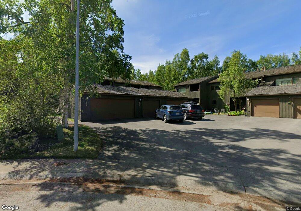
2252 Knoll Cir Unit 11 Anchorage, AK 99501
Airport Heights NeighborhoodEstimated Value: $240,000 - $390,530
3
Beds
3
Baths
1,567
Sq Ft
$212/Sq Ft
Est. Value
About This Home
This home is located at 2252 Knoll Cir Unit 11, Anchorage, AK 99501 and is currently estimated at $332,510, approximately $212 per square foot. 2252 Knoll Cir Unit 11 is a home located in Anchorage Municipality with nearby schools including Airport Heights Elementary School, Wendler Middle School, and Bettye Davis East Anchorage High School.
Ownership History
Date
Name
Owned For
Owner Type
Purchase Details
Closed on
Jan 30, 2003
Sold by
Walton Eddie J and Frazier Rosyland R
Bought by
Krebs Edwin C and Krebs Debroah L
Current Estimated Value
Home Financials for this Owner
Home Financials are based on the most recent Mortgage that was taken out on this home.
Original Mortgage
$165,560
Outstanding Balance
$69,733
Interest Rate
5.97%
Mortgage Type
FHA
Estimated Equity
$262,777
Purchase Details
Closed on
Jan 29, 2003
Sold by
Walton Eddie J and Frazier Rosyland R
Bought by
Krebs Edwin C and Krebs Deborah L
Home Financials for this Owner
Home Financials are based on the most recent Mortgage that was taken out on this home.
Original Mortgage
$165,560
Outstanding Balance
$69,733
Interest Rate
5.97%
Mortgage Type
FHA
Estimated Equity
$262,777
Create a Home Valuation Report for This Property
The Home Valuation Report is an in-depth analysis detailing your home's value as well as a comparison with similar homes in the area
Home Values in the Area
Average Home Value in this Area
Purchase History
| Date | Buyer | Sale Price | Title Company |
|---|---|---|---|
| Krebs Edwin C | -- | -- | |
| Krebs Edwin C | -- | First American Title Of Alas |
Source: Public Records
Mortgage History
| Date | Status | Borrower | Loan Amount |
|---|---|---|---|
| Open | Krebs Edwin C | $165,560 | |
| Closed | Krebs Edwin C | $165,560 |
Source: Public Records
Tax History Compared to Growth
Tax History
| Year | Tax Paid | Tax Assessment Tax Assessment Total Assessment is a certain percentage of the fair market value that is determined by local assessors to be the total taxable value of land and additions on the property. | Land | Improvement |
|---|---|---|---|---|
| 2025 | $4,645 | $384,400 | -- | $384,400 |
| 2024 | $4,645 | $362,700 | $0 | $362,700 |
| 2023 | $5,346 | $313,900 | $0 | $313,900 |
| 2022 | $3,971 | $285,800 | $0 | $285,800 |
| 2021 | $4,896 | $271,700 | $0 | $271,700 |
| 2020 | $3,579 | $260,800 | $0 | $260,800 |
| 2019 | $3,630 | $271,900 | $0 | $271,900 |
| 2018 | $3,138 | $239,200 | $0 | $239,200 |
| 2017 | $3,619 | $251,100 | $0 | $251,100 |
| 2016 | $3,253 | $266,300 | $0 | $266,300 |
| 2015 | $3,253 | $260,800 | $0 | $260,800 |
| 2014 | $3,253 | $244,200 | $0 | $244,200 |
Source: Public Records
Map
Nearby Homes
- 2068 Cliffside Dr Unit 11
- 1833 Parkside Dr
- 1760 Eastridge Dr
- 2124 Sorbus Way
- 1811 Talkeetna St
- 2215 Sunburst Cir
- 1803 Parkside Dr
- 2028 Shepherdia Dr
- 2553 Lovejoy Dr
- 1625 Sitka St Unit 103
- 1701 Aleutian St
- 2624 Darby Cir
- 1826 E 27th Ave
- 000 Tr A Thurston
- 2456 Cottonwood St
- 1421 E 17th Ave Unit 3
- 1414 Airport Heights Dr
- 1403 Nelchina St
- 1201 Elegante Ln
- 1220 E 16th Ave Unit 15
- 2256 Knoll Cir Unit 13
- 2254 Knoll Cir Unit 12
- 2250 Knoll Cir Unit 10
- 2248 Knoll Cir Unit 9
- 2246 Knoll Cir Unit 8
- 2258 Knoll Cir Unit 14
- 2270 Knoll Cir Unit 20
- 2268 Knoll Cir Unit 19
- 2264 Knoll Cir Unit 17
- 2262 Knoll Cir Unit 16
- 2260 Knoll Cir Unit 15
- 2268 Knoll Cir
- 2264 Knoll Cir Unit 1
- 2266 Knoll Cir Unit 18
- 2067 Eastridge Dr Unit 35
- 2069 Eastridge Dr Unit 34
- 2071 Eastridge Dr Unit 33
- 2075 Eastridge Dr Unit 31
- 2071 Eastridge Dr Unit 33B-7
- 2075 Eastridge Dr Unit 1