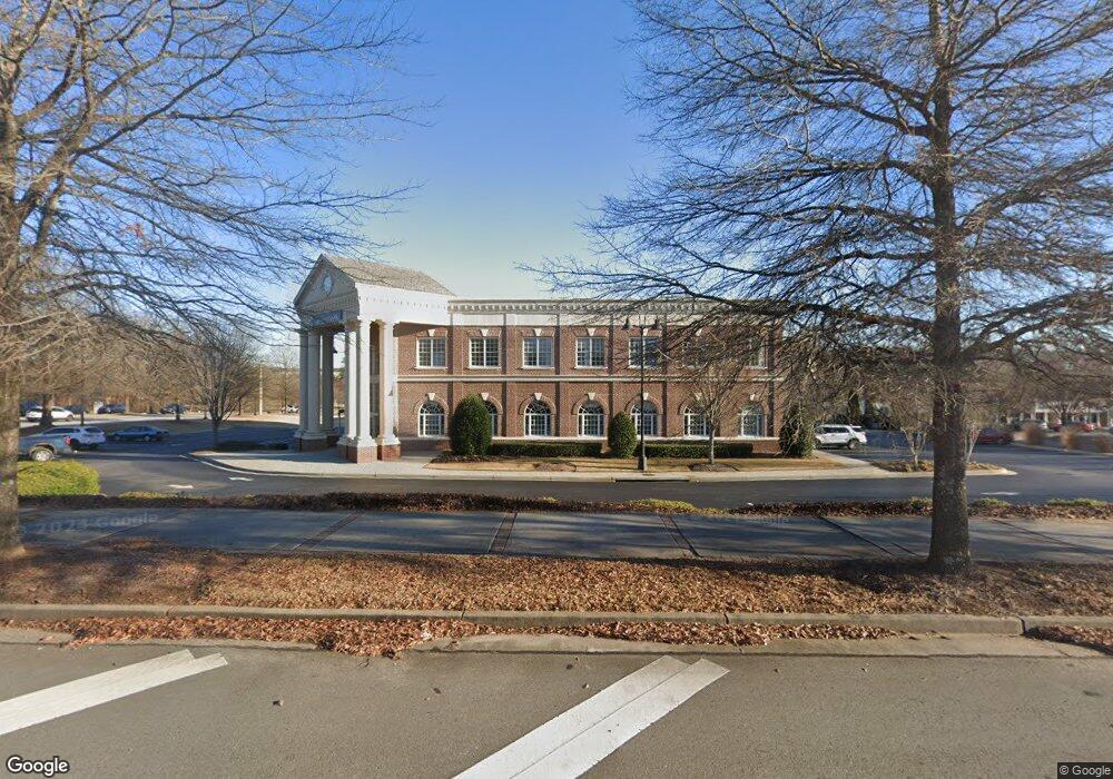
2255 Buford Hwy Buford, GA 30518
Estimated Value: $3,696,009
--
Bed
5
Baths
12,777
Sq Ft
$289/Sq Ft
Est. Value
About This Home
This home is located at 2255 Buford Hwy, Buford, GA 30518 and is currently estimated at $3,696,009, approximately $289 per square foot. 2255 Buford Hwy is a home located in Gwinnett County with nearby schools including Buford Elementary School, Buford Senior Academy, and Buford Academy.
Ownership History
Date
Name
Owned For
Owner Type
Purchase Details
Closed on
Oct 5, 2023
Sold by
Renasant Bank
Bought by
Direct Residential Communities Of Clarke
Current Estimated Value
Purchase Details
Closed on
Feb 3, 2023
Sold by
Buford Brand Ii Llc
Bought by
Renasant Bank
Purchase Details
Closed on
Sep 14, 2006
Sold by
Buford Village Llc
Bought by
Buford Brand Ii Llc
Home Financials for this Owner
Home Financials are based on the most recent Mortgage that was taken out on this home.
Original Mortgage
$3,400,000
Interest Rate
6.58%
Mortgage Type
New Conventional
Create a Home Valuation Report for This Property
The Home Valuation Report is an in-depth analysis detailing your home's value as well as a comparison with similar homes in the area
Home Values in the Area
Average Home Value in this Area
Purchase History
| Date | Buyer | Sale Price | Title Company |
|---|---|---|---|
| Direct Residential Communities Of Clarke | -- | -- | |
| Renasant Bank | $3,350,000 | -- | |
| Renasant Bank | -- | -- | |
| Buford Brand Ii Llc | $750,000 | -- |
Source: Public Records
Mortgage History
| Date | Status | Borrower | Loan Amount |
|---|---|---|---|
| Previous Owner | Buford Brand Ii Llc | $3,400,000 |
Source: Public Records
Tax History Compared to Growth
Tax History
| Year | Tax Paid | Tax Assessment Tax Assessment Total Assessment is a certain percentage of the fair market value that is determined by local assessors to be the total taxable value of land and additions on the property. | Land | Improvement |
|---|---|---|---|---|
| 2024 | $14,781 | $1,030,000 | $240,440 | $789,560 |
| 2023 | $14,781 | $1,030,000 | $240,440 | $789,560 |
| 2022 | $11,480 | $1,093,200 | $240,440 | $852,760 |
| 2021 | $11,480 | $800,000 | $280,520 | $519,480 |
| 2020 | $11,480 | $800,000 | $280,520 | $519,480 |
| 2019 | $10,367 | $1,378,520 | $280,520 | $1,098,000 |
| 2018 | $6,739 | $520,000 | $222,680 | $297,320 |
| 2016 | $6,664 | $520,000 | $222,680 | $297,320 |
| 2015 | $6,900 | $520,000 | $222,680 | $297,320 |
| 2014 | -- | $520,000 | $222,680 | $297,320 |
Source: Public Records
Map
Nearby Homes
- 2255 Buford Hwy
- 2255 Buford Hwy
- 21 Buford Village Walk
- 18 Buford Village Walk
- 2051 Harvester Ln
- 4831 Miller Hill Rd
- 2267 Pink Hawthorn Dr
- 480 S Hill St
- 4895 Sterling Close
- 5065 Cooper Farm Dr
- 449 S Hill St
- 401 Pirkle Ave
- 585 Briard Dr
- 4817 Cooper Farm Dr
- 27 Morgan St
- 25 Morgan St
- 460 Espy St
- 489 Williams St
- 425 Church St
- 149 South St
- 0 Buford Village Way Unit 8930077
- 0 Buford Village Way Unit 8797209
- 139 Buford Village Way Unit 139
- 2216 Pale Hawthorn St
- 2206 Pale Hawthorn St
- 2196 Pale Hawthorn St
- 2266 Pale Hawthorn St Unit 1
- 2236 Pale Hawthorn St
- 2226 Pale Hawthorn St
- 2206 Pale Hawthorn St
- 2196 Pale Hawthorn St
- 2226 Pale Hawthorn St Unit LOT 5
- 2266 Pale Hawthorn St
- 2256 Pale Hawthorn St
- 2236 Pale Hawthorn St
- 2246 Pale Hawthorn St
- 24 Buford Village Walk
- 19 Buford Village Walk
- 20 Buford Village Walk
- 24 Buford Village Walk Unit 24