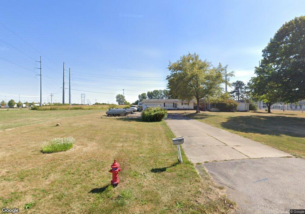
2255 Fair Rd Sidney, OH 45365
Estimated Value: $313,000 - $336,117
3
Beds
2
Baths
2,428
Sq Ft
$135/Sq Ft
Est. Value
About This Home
This home is located at 2255 Fair Rd, Sidney, OH 45365 and is currently estimated at $327,529, approximately $134 per square foot. 2255 Fair Rd is a home located in Shelby County with nearby schools including Sidney High School, Holy Angels Catholic School, and Christian Academy Schools.
Ownership History
Date
Name
Owned For
Owner Type
Purchase Details
Closed on
Dec 29, 2025
Sold by
Mckee Todd A and Mckee Dina L
Bought by
Dayton Power And Light Company and Aes Ohio
Current Estimated Value
Purchase Details
Closed on
Oct 28, 2024
Sold by
Mckee Todd A and Mckee Dina L
Bought by
Mckee Family Trust and Mckee
Purchase Details
Closed on
Jun 29, 1993
Bought by
Stockstill Jam
Create a Home Valuation Report for This Property
The Home Valuation Report is an in-depth analysis detailing your home's value as well as a comparison with similar homes in the area
Home Values in the Area
Average Home Value in this Area
Purchase History
| Date | Buyer | Sale Price | Title Company |
|---|---|---|---|
| Dayton Power And Light Company | $335,000 | Northwest Union Title Llc | |
| Mckee Family Trust | -- | None Listed On Document | |
| Mckee Family Trust | -- | None Listed On Document | |
| Mckee Family Trust | -- | None Listed On Document | |
| Stockstill Jam | -- | -- |
Source: Public Records
Tax History
| Year | Tax Paid | Tax Assessment Tax Assessment Total Assessment is a certain percentage of the fair market value that is determined by local assessors to be the total taxable value of land and additions on the property. | Land | Improvement |
|---|---|---|---|---|
| 2024 | $2,357 | $68,680 | $11,410 | $57,270 |
| 2023 | $2,390 | $68,680 | $11,410 | $57,270 |
| 2022 | $2,112 | $53,260 | $9,260 | $44,000 |
| 2021 | $2,130 | $53,260 | $9,260 | $44,000 |
| 2020 | $2,130 | $53,260 | $9,260 | $44,000 |
| 2019 | $1,766 | $44,350 | $7,690 | $36,660 |
| 2018 | $1,739 | $44,350 | $7,690 | $36,660 |
| 2017 | $1,743 | $44,350 | $7,690 | $36,660 |
| 2016 | $1,522 | $38,670 | $6,390 | $32,280 |
| 2015 | $1,527 | $38,670 | $6,390 | $32,280 |
| 2014 | $1,527 | $38,670 | $6,390 | $32,280 |
| 2013 | $1,602 | $37,490 | $6,390 | $31,100 |
Source: Public Records
Map
Nearby Homes
- 2423 Cole Ct
- 2417 Cole Ct
- Lot 6737 Creekside Ct
- Lot 6744 Creekside Ct
- Lot 6742 Creekside Ct
- Lot 7511 Creekside Ct
- Lot 6740 Creekside Ct
- Lot 6739 Creekside Ct
- Lot 7510 Creekside Ct
- Lot 6743 Creekside Ct
- Lot 6741 Creekside Ct
- Lot 6738 Creekside Ct
- 1780 Creekside Ct
- 1756 Creekside Ct
- 1788 Creekside Ct
- 1768 Creekside Ct
- 1774 Creekside Ct
- 1502 Cumberland Ave
- 00 Fair Rd
- 1216 Superior Ct
- 1440 S Vandemark Rd
- 2345 W Millcreek Rd
- 2361 W Millcreek Rd
- 2379 W Millcreek Rd
- 2330 Fair Rd
- 2399 W Millcreek Rd
- 2411 W Millcreek Rd
- 2345 Fair Rd
- 2433 W Millcreek Rd
- 2417/2423 Cole Ct
- 2360 Fair Rd
- 1786 Creekside Ct
- 1762 Creekside Ct
- 2515 W Millcreek Rd
- 2401 Fair Rd
- 2401 Fair Rd
- 2583 W Millcreek Rd
- 1691 Cumberland Ave
- 1701 Cumberland Ave
Your Personal Tour Guide
Ask me questions while you tour the home.