Estimated Value: $192,000 - $250,692
2
Beds
2
Baths
1,080
Sq Ft
$214/Sq Ft
Est. Value
About This Home
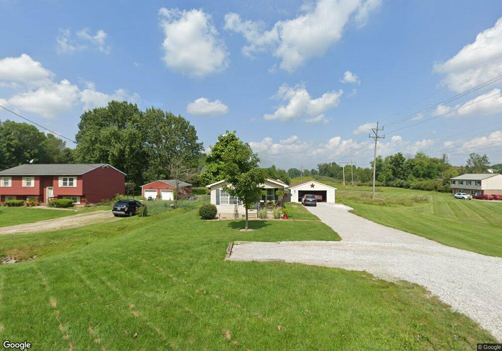
This home is located at 2255 Meloy Rd, Kent, OH 44240 and is currently estimated at $230,673, approximately $213 per square foot. 2255 Meloy Rd is a home located in Portage County with nearby schools including Brimfield Elementary School, Field Middle School, and Field High School.
Ownership History
Date
Name
Owned For
Owner Type
Purchase Details
Closed on
Aug 17, 2004
Sold by
Annevar Namkrow Ltd
Bought by
Gurnish Nathanael J and Gurnish Rachel M
Current Estimated Value
Purchase Details
Closed on
Aug 3, 2004
Sold by
Gurnish Nathanael J and Gurnish Rachel M
Bought by
Annevar Namkrow Ltd
Purchase Details
Closed on
Jul 23, 2004
Sold by
Gurnish Nathanael J
Bought by
Annevar Namkrow Ltd
Create a Home Valuation Report for This Property
The Home Valuation Report is an in-depth analysis detailing your home's value as well as a comparison with similar homes in the area
Home Values in the Area
Average Home Value in this Area
Purchase History
| Date | Buyer | Sale Price | Title Company |
|---|---|---|---|
| Gurnish Nathanael J | -- | Central Title Of Kent | |
| Annevar Namkrow Ltd | -- | Central Title Of Kent | |
| Annevar Namkrow Ltd | -- | Central Title Of Kent | |
| Gurnish Nathanael J | $100,000 | Central Title Of Kent |
Source: Public Records
Tax History Compared to Growth
Tax History
| Year | Tax Paid | Tax Assessment Tax Assessment Total Assessment is a certain percentage of the fair market value that is determined by local assessors to be the total taxable value of land and additions on the property. | Land | Improvement |
|---|---|---|---|---|
| 2024 | $3,335 | $68,670 | $9,940 | $58,730 |
| 2023 | $3,422 | $56,810 | $8,370 | $48,440 |
| 2022 | $3,432 | $56,810 | $8,370 | $48,440 |
| 2021 | $3,348 | $56,810 | $8,370 | $48,440 |
| 2020 | $2,909 | $44,530 | $8,370 | $36,160 |
| 2019 | $2,873 | $44,530 | $8,370 | $36,160 |
| 2018 | $2,331 | $42,150 | $8,370 | $33,780 |
| 2017 | $2,331 | $42,150 | $8,370 | $33,780 |
| 2016 | $2,307 | $42,150 | $8,370 | $33,780 |
| 2015 | $2,259 | $42,150 | $8,370 | $33,780 |
| 2014 | $2,191 | $42,150 | $8,370 | $33,780 |
| 2013 | $2,194 | $42,150 | $8,370 | $33,780 |
Source: Public Records
Map
Nearby Homes
- 1997 Sugar Maple Dr
- 2014 Sugar Maple Dr
- 2105 Sugar Maple Dr
- 2092 Sugar Maple Dr
- 4832 Raspberry Cir
- 5205 Cline Rd Unit A
- 5123 Troyer Dr
- 2312 Cranberry Creek Rd
- 5032 Blackberry Ln
- 2464 Hazelnut Rd
- 2694 Sandy Lake Rd
- 1024E Cedar Ridge Dr
- 1024A Cedar Ridge Dr
- 5044 Sherman Wood Dr
- 1523 Whitehall Blvd
- 2216 - 2218 Roberts Journey
- 2262 Willyard Ave
- 1426 Loop Rd Unit 1426
- 3123 Clearview Rd
- 0 Meloy Rd Unit 5162435
- 2245 Meloy Rd
- 2271 Meloy Rd
- 2269 Meloy Rd
- 2235 Meloy Rd
- 2242 Dorchester Dr
- 2263 Meloy Rd
- 2263 Meloy Rd
- 2250 Dorchester Dr
- 2234 Dorchester Dr
- 2225 Meloy Rd
- 2226 Dorchester Dr
- 49 Briarhill Dr
- S/L 8 Dorchester Dr
- S/L 10 Dorchester Dr
- S/L 1 Dorchester Dr
- S/L 6 Dorchester Dr
- S/L 5 Dorchester Dr
- 2337 Dorchester Dr
- 2241 Dorchester Dr
- 2215 Meloy Rd