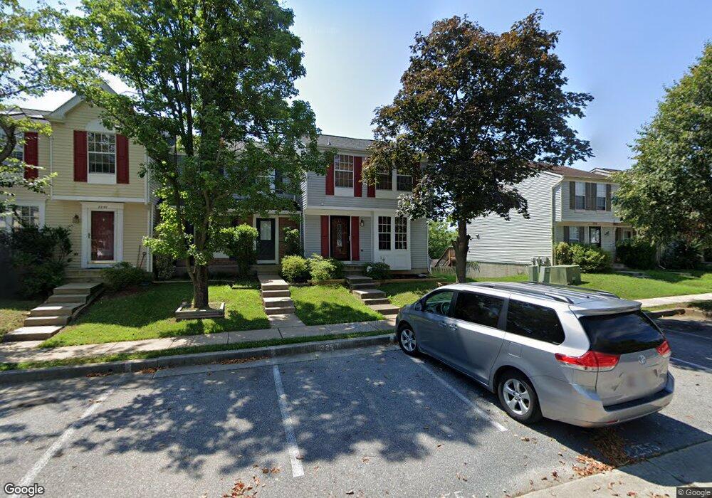
2255 Riding Crop Way Windsor Mill, MD 21244
Estimated Value: $268,000 - $324,000
--
Bed
2
Baths
1,165
Sq Ft
$256/Sq Ft
Est. Value
About This Home
This home is located at 2255 Riding Crop Way, Windsor Mill, MD 21244 and is currently estimated at $298,177, approximately $255 per square foot. 2255 Riding Crop Way is a home located in Baltimore County with nearby schools including Dogwood Elementary School, Windsor Mill Middle School, and Woodlawn High School.
Ownership History
Date
Name
Owned For
Owner Type
Purchase Details
Closed on
Dec 17, 2004
Sold by
Fennell Toye L
Bought by
Teraso Alemu
Current Estimated Value
Purchase Details
Closed on
Oct 9, 2004
Sold by
Fennell Toye L
Bought by
Teraso Alemu
Purchase Details
Closed on
Mar 6, 2001
Sold by
Stern Alice H
Bought by
Fennell Toye L
Purchase Details
Closed on
May 27, 1994
Sold by
Assoc Relocation Mgmt
Bought by
Stern Alice H
Home Financials for this Owner
Home Financials are based on the most recent Mortgage that was taken out on this home.
Original Mortgage
$98,100
Interest Rate
8.22%
Purchase Details
Closed on
Nov 24, 1993
Sold by
Obrien T T
Bought by
Assocs Reloc Mgmt Co
Create a Home Valuation Report for This Property
The Home Valuation Report is an in-depth analysis detailing your home's value as well as a comparison with similar homes in the area
Home Values in the Area
Average Home Value in this Area
Purchase History
| Date | Buyer | Sale Price | Title Company |
|---|---|---|---|
| Teraso Alemu | $170,500 | -- | |
| Teraso Alemu | $170,500 | -- | |
| Fennell Toye L | $108,000 | -- | |
| Stern Alice H | $99,900 | -- | |
| Assocs Reloc Mgmt Co | $108,750 | -- |
Source: Public Records
Mortgage History
| Date | Status | Borrower | Loan Amount |
|---|---|---|---|
| Previous Owner | Assocs Reloc Mgmt Co | $98,100 |
Source: Public Records
Tax History Compared to Growth
Tax History
| Year | Tax Paid | Tax Assessment Tax Assessment Total Assessment is a certain percentage of the fair market value that is determined by local assessors to be the total taxable value of land and additions on the property. | Land | Improvement |
|---|---|---|---|---|
| 2025 | $3,704 | $234,333 | -- | -- |
| 2024 | $3,704 | $207,600 | $70,000 | $137,600 |
| 2023 | $1,822 | $202,000 | $0 | $0 |
| 2022 | $3,421 | $196,400 | $0 | $0 |
| 2021 | $3,120 | $190,800 | $70,000 | $120,800 |
| 2020 | $3,120 | $181,833 | $0 | $0 |
| 2019 | $2,986 | $172,867 | $0 | $0 |
| 2018 | $2,777 | $163,900 | $52,400 | $111,500 |
| 2017 | $2,603 | $159,233 | $0 | $0 |
| 2016 | $2,290 | $154,567 | $0 | $0 |
| 2015 | $2,290 | $149,900 | $0 | $0 |
| 2014 | $2,290 | $149,900 | $0 | $0 |
Source: Public Records
Map
Nearby Homes
- 2254 Riding Crop Way
- 2213 Riding Crop Way
- 2200 Riding Crop Way
- 2116 Amber Way
- 2047 Riding Crop Way
- 7711 Cornerstone Way
- 7603 River Reach Rd
- 7605 River Reach Rd
- Ellicott Rear Load Garage Plan at Patapsco Glen - Collection
- Tydings II Front Load Garage Plan at Patapsco Glen - Collection
- Arcadia Rear Load Garage Plan at Patapsco Glen - Collection
- Arcadia Front Load Garage Plan at Patapsco Glen - East Collection
- Arcadia Rear Load Garage Plan at Patapsco Glen - East Collection
- Easton Rear Load Garage Plan at Patapsco Glen - East Collection
- Easton Front Load Garage Plan at Patapsco Glen - East Collection
- 2 Gemstone Ct
- 2009 Riding Crop Way
- 11 Gemstone Ct
- 2407 Woodlands Rd
- 2045 Ivory Brook Rd
- 2257 Riding Crop Way
- 2253 Riding Crop Way
- 2259 Riding Crop Way
- 2251 Riding Crop Way
- 2261 Riding Crop Way
- 2249 Riding Crop Way
- 2247 Riding Crop Way
- 2263 Riding Crop Way
- 2245 Riding Crop Way
- 2243 Riding Crop Way
- 2265 Riding Crop Way
- 2239 Riding Crop Way
- 2237 Riding Crop Way
- 2252 Riding Crop Way
- 2250 Riding Crop Way
- 2248 Riding Crop Way
- 2256 Riding Crop Way
- 2246 Riding Crop Way
- 2258 Riding Crop Way
- 2235 Riding Crop Way