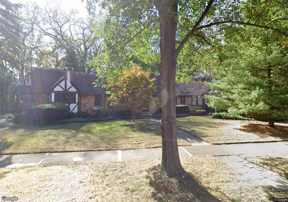
2259 Avon Ln Birmingham, MI 48009
Estimated Value: $802,000 - $1,159,000
4
Beds
4
Baths
2,630
Sq Ft
$345/Sq Ft
Est. Value
About This Home
This home is located at 2259 Avon Ln, Birmingham, MI 48009 and is currently estimated at $906,501, approximately $344 per square foot. 2259 Avon Ln is a home located in Oakland County with nearby schools including Pierce Elementary School, Derby Middle School, and Ernest W. Seaholm High School.
Ownership History
Date
Name
Owned For
Owner Type
Purchase Details
Closed on
Aug 1, 2008
Sold by
Kelly Ann C and Caldwell John M
Bought by
Caldwell Aaron and Caldwell Dawn
Current Estimated Value
Home Financials for this Owner
Home Financials are based on the most recent Mortgage that was taken out on this home.
Original Mortgage
$304,000
Interest Rate
6.57%
Mortgage Type
Purchase Money Mortgage
Purchase Details
Closed on
Aug 29, 1994
Sold by
Caldwell John R
Bought by
John R Caldwell Tr
Create a Home Valuation Report for This Property
The Home Valuation Report is an in-depth analysis detailing your home's value as well as a comparison with similar homes in the area
Home Values in the Area
Average Home Value in this Area
Purchase History
| Date | Buyer | Sale Price | Title Company |
|---|---|---|---|
| Caldwell Aaron | $380,000 | Crossroads Title Agency | |
| John R Caldwell Tr | -- | -- |
Source: Public Records
Mortgage History
| Date | Status | Borrower | Loan Amount |
|---|---|---|---|
| Previous Owner | Caldwell Aaron | $304,000 |
Source: Public Records
Tax History
| Year | Tax Paid | Tax Assessment Tax Assessment Total Assessment is a certain percentage of the fair market value that is determined by local assessors to be the total taxable value of land and additions on the property. | Land | Improvement |
|---|---|---|---|---|
| 2025 | $9,297 | $416,210 | $0 | $0 |
| 2024 | $8,207 | $371,530 | $0 | $0 |
| 2023 | $7,865 | $364,770 | $0 | $0 |
| 2022 | $8,433 | $330,700 | $0 | $0 |
| 2021 | $8,327 | $320,260 | $0 | $0 |
| 2020 | $7,420 | $299,300 | $0 | $0 |
| 2019 | $8,397 | $295,520 | $0 | $0 |
| 2018 | $8,333 | $282,150 | $0 | $0 |
| 2017 | $8,319 | $277,080 | $0 | $0 |
| 2016 | $8,334 | $272,370 | $0 | $0 |
| 2015 | -- | $253,720 | $0 | $0 |
| 2014 | -- | $212,250 | $0 | $0 |
| 2011 | -- | $174,570 | $0 | $0 |
Source: Public Records
Map
Nearby Homes
- 169 N Glenhurst Dr
- 394 S Glenhurst Dr
- 488 Bryn Mawr St
- 345 Kimberly St
- 757 Woodlea Ct
- 186 Hamilton Rd
- 520 Pleasant St
- 2802 Heathfield Rd
- 2820 Heathfield Rd
- 786 S Cranbrook Rd
- 1171 Arden Ln
- 180 Pilgrim Ave
- 956 Westwood Dr
- 100 Overhill Rd
- 2330 Fairway Dr
- 999 Pleasant Ave
- 3249 Bradway Blvd
- 231 Wadsworth Ln
- 1120 Lyonhurst St
- 1057 Arlington St
- 290 Berwyn St
- 2215 Avon Ln
- 2276 Avon Ln
- 325 Wellesley St
- 340 Wellesley St
- 2300 Avon Ln
- 2210 Avon Ln
- 320 Berwyn St
- 23221 Argyle Berwyn St
- 271 Berwyn St
- 285 Berwyn St
- 361 Wellesley St
- 2283 W Maple Rd
- 2261 W Maple Rd
- 243 Berwyn St
- 2247 W Maple Rd
- 293 Berwyn St
- 2371 Radnor St Unit Bldg-Unit
- 2371 Radnor St
- 2338 Radnor St
Your Personal Tour Guide
Ask me questions while you tour the home.