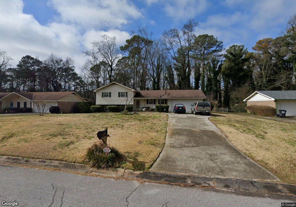
2259 Cannon Hill Rd SW Unit 2 Lilburn, GA 30047
Estimated Value: $297,532 - $339,000
3
Beds
2
Baths
1,186
Sq Ft
$275/Sq Ft
Est. Value
About This Home
This home is located at 2259 Cannon Hill Rd SW Unit 2, Lilburn, GA 30047 and is currently estimated at $326,133, approximately $274 per square foot. 2259 Cannon Hill Rd SW Unit 2 is a home located in Gwinnett County with nearby schools including Shiloh Elementary School, Shiloh Middle School, and Shiloh High School.
Ownership History
Date
Name
Owned For
Owner Type
Purchase Details
Closed on
Oct 30, 1998
Sold by
Mitchell Patricia N and Mitchell Emmitt
Bought by
Mitchell Patricia N and Jr Emi
Current Estimated Value
Home Financials for this Owner
Home Financials are based on the most recent Mortgage that was taken out on this home.
Original Mortgage
$110,021
Outstanding Balance
$22,993
Interest Rate
6.65%
Mortgage Type
FHA
Estimated Equity
$303,140
Create a Home Valuation Report for This Property
The Home Valuation Report is an in-depth analysis detailing your home's value as well as a comparison with similar homes in the area
Home Values in the Area
Average Home Value in this Area
Purchase History
| Date | Buyer | Sale Price | Title Company |
|---|---|---|---|
| Mitchell Patricia N | -- | -- | |
| Mitchell Patricia N | $112,000 | -- |
Source: Public Records
Mortgage History
| Date | Status | Borrower | Loan Amount |
|---|---|---|---|
| Open | Mitchell Patricia N | $110,021 |
Source: Public Records
Tax History Compared to Growth
Tax History
| Year | Tax Paid | Tax Assessment Tax Assessment Total Assessment is a certain percentage of the fair market value that is determined by local assessors to be the total taxable value of land and additions on the property. | Land | Improvement |
|---|---|---|---|---|
| 2025 | $714 | $96,560 | $24,000 | $72,560 |
| 2024 | $715 | $96,560 | $24,000 | $72,560 |
| 2023 | $715 | $103,640 | $24,000 | $79,640 |
| 2022 | $2,515 | $90,160 | $20,000 | $70,160 |
| 2021 | $2,145 | $71,000 | $17,200 | $53,800 |
| 2020 | $1,931 | $60,400 | $12,000 | $48,400 |
| 2019 | $1,795 | $56,040 | $12,000 | $44,040 |
| 2018 | $1,628 | $48,480 | $9,600 | $38,880 |
| 2016 | $1,499 | $41,480 | $9,600 | $31,880 |
| 2015 | $1,049 | $25,840 | $8,000 | $17,840 |
| 2014 | $1,052 | $25,840 | $8,000 | $17,840 |
Source: Public Records
Map
Nearby Homes
- 2291 Rodao Dr SW
- 2251 Colonial Oak Way
- 2390 Stone Dr SW
- 5015 Shadow Path Ln SW
- 0 Hudson Dr Unit 7586860
- 4922 Signal Ct SW
- 2224 Hudson Dr SW
- 4806 Dean Ln SW
- 2158 Vivid Ct
- 2421 Rockbridge Rd SW
- 4882 Rock Haven Dr SW
- 5263 Pounds Dr N
- 2170 Thorndale Dr SW
- 1949 Pucketts Dr SW
- 1937 Pucketts Dr SW
- 5018 Castlewood Dr SW
- 5334 Pounds Dr N
- 4656 Matterhorn Dr SW
- 5315 Pounds Dr S Unit 5
- 4774 Saint Bernard Dr SW
- 2249 Cannon Hill Rd SW Unit 2
- 2269 Cannon Hill Rd SW
- 2239 Cannon Hill Rd SW
- 2279 Cannon Hill Rd SW
- 2258 Cannon Hill Rd SW
- 2248 Cannon Hill Rd SW Unit 11
- 2248 Cannon Hill Rd SW
- 2268 Cannon Hill Rd SW
- 2229 Cannon Hill Rd SW Unit 6
- 2289 Cannon Hill Rd SW Unit 2
- 2238 Cannon Hill Rd SW
- 2278 Cannon Hill Rd SW
- 2228 Cannon Hill Rd SW
- 2281 Rodao Dr SW
- 2219 Cannon Hill Rd SW
- 2288 Cannon Hill Rd SW
- 2299 Cannon Hill Rd SW
- 2271 Rodao Dr SW
- 2218 Cannon Hill Rd SW
- 2196 Camp Cir SW