Estimated Value: $177,687 - $193,000
3
Beds
1
Bath
1,097
Sq Ft
$169/Sq Ft
Est. Value
About This Home
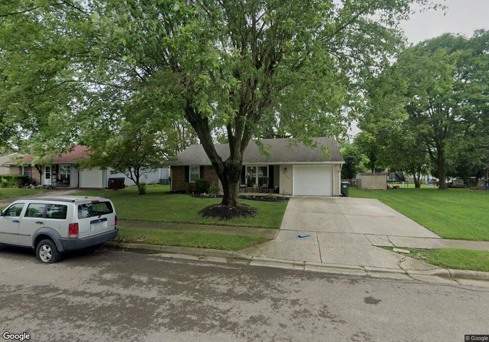
This home is located at 2259 Drummond Dr, Xenia, OH 45385 and is currently estimated at $185,922, approximately $169 per square foot. 2259 Drummond Dr is a home located in Greene County with nearby schools including Xenia High School, Summit Academy Community School for Alternative Learners - Xenia, and Legacy Christian Academy.
Ownership History
Date
Name
Owned For
Owner Type
Purchase Details
Closed on
May 8, 2009
Sold by
Evans James H and Evans Elizabeth K
Bought by
Evans James H and Evans Elizabeth K
Current Estimated Value
Purchase Details
Closed on
Apr 17, 2009
Sold by
Fannie Mae
Bought by
Evans James H and Evans Elizabeth K
Purchase Details
Closed on
Aug 14, 2006
Sold by
Drumm Christopher T and Drumm Patricia A
Bought by
Ezerski Carla A
Home Financials for this Owner
Home Financials are based on the most recent Mortgage that was taken out on this home.
Original Mortgage
$75,460
Interest Rate
7.37%
Mortgage Type
Unknown
Purchase Details
Closed on
Jul 27, 2005
Sold by
Household Realty Corp
Bought by
Drumm Christopher T and Drumm Patricia A
Purchase Details
Closed on
Jun 2, 2005
Sold by
Butler Avada S
Bought by
Household Realty Corp
Create a Home Valuation Report for This Property
The Home Valuation Report is an in-depth analysis detailing your home's value as well as a comparison with similar homes in the area
Home Values in the Area
Average Home Value in this Area
Purchase History
| Date | Buyer | Sale Price | Title Company |
|---|---|---|---|
| Evans James H | -- | Attorney | |
| Evans James H | $59,000 | None Available | |
| Ezerski Carla A | $94,400 | None Available | |
| Drumm Christopher T | $66,000 | -- | |
| Household Realty Corp | $75,000 | -- |
Source: Public Records
Mortgage History
| Date | Status | Borrower | Loan Amount |
|---|---|---|---|
| Previous Owner | Ezerski Carla A | $75,460 |
Source: Public Records
Tax History Compared to Growth
Tax History
| Year | Tax Paid | Tax Assessment Tax Assessment Total Assessment is a certain percentage of the fair market value that is determined by local assessors to be the total taxable value of land and additions on the property. | Land | Improvement |
|---|---|---|---|---|
| 2024 | $1,889 | $44,150 | $11,490 | $32,660 |
| 2023 | $1,889 | $44,150 | $11,490 | $32,660 |
| 2022 | $1,560 | $31,100 | $6,760 | $24,340 |
| 2021 | $1,581 | $31,100 | $6,760 | $24,340 |
| 2020 | $1,515 | $31,100 | $6,760 | $24,340 |
| 2019 | $1,205 | $26,990 | $6,480 | $20,510 |
| 2018 | $1,402 | $26,990 | $6,480 | $20,510 |
| 2017 | $1,291 | $26,990 | $6,480 | $20,510 |
| 2016 | $1,291 | $24,390 | $6,480 | $17,910 |
| 2015 | $1,295 | $24,390 | $6,480 | $17,910 |
| 2014 | $1,240 | $24,390 | $6,480 | $17,910 |
Source: Public Records
Map
Nearby Homes
- 1255 Colorado Dr
- 1107 Arkansas Dr
- 1908 Whitt St
- 1866 Roxbury Dr
- 2499 Jenny Marie Dr
- 1829 Gayhart Dr
- 2540 Jenny Marie Dr
- 2421 Louisiana Dr
- 1403 Texas Dr
- 2540 Cornwall Dr
- 1769 Gayhart Dr
- 2345 Tennessee Dr
- 0 Berkshire Dr Unit 942854
- 1778 Arapaho Dr
- 2257 Maryland Dr
- 2142 Michigan Dr
- 2144 Tandem Dr
- 910 Wright Ave
- 1653 Seneca Dr
- 2784 Greystoke Dr
- 2245 Drummond Dr
- 2285 Drummond Dr
- 2109 Westbury Ct
- 1325 Colorado Dr
- 2233 Drummond Dr
- 1337 Colorado Dr
- 2125 Westbury Ct
- 2040 Roxbury Dr
- 1351 Colorado Dr
- 2049 Roxbury Dr
- 2065 Westbury Ct
- 2112 Westbury Ct
- 2096 Westbury Ct
- 2218 Drummond Dr
- 2020 Roxbury Dr
- 1271 Colorado Dr
- 2035 Roxbury Dr
- 2078 Westbury Ct
- 1316 Colorado Dr
- 1330 Colorado Dr