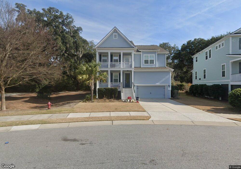
2259 Skyler Dr Mount Pleasant, SC 29466
Oyster Point NeighborhoodEstimated Value: $1,162,000 - $1,303,000
4
Beds
3
Baths
3,129
Sq Ft
$390/Sq Ft
Est. Value
About This Home
This home is located at 2259 Skyler Dr, Mount Pleasant, SC 29466 and is currently estimated at $1,220,787, approximately $390 per square foot. 2259 Skyler Dr is a home located in Charleston County with nearby schools including Mamie Whitesides Elementary School, Moultrie Middle School, and Wando High School.
Ownership History
Date
Name
Owned For
Owner Type
Purchase Details
Closed on
Nov 25, 2020
Sold by
Parham Laura R
Bought by
Parham Laura R and Laura Rae Budde Living Trust
Current Estimated Value
Purchase Details
Closed on
Aug 6, 2020
Sold by
Parham William C
Bought by
Parham Laura R
Purchase Details
Closed on
Sep 28, 2016
Sold by
Dr Horton Inc
Bought by
Parham William C and Parham Laura R
Home Financials for this Owner
Home Financials are based on the most recent Mortgage that was taken out on this home.
Original Mortgage
$512,976
Outstanding Balance
$411,246
Interest Rate
3.46%
Mortgage Type
New Conventional
Estimated Equity
$809,541
Create a Home Valuation Report for This Property
The Home Valuation Report is an in-depth analysis detailing your home's value as well as a comparison with similar homes in the area
Home Values in the Area
Average Home Value in this Area
Purchase History
| Date | Buyer | Sale Price | Title Company |
|---|---|---|---|
| Parham Laura R | -- | None Available | |
| Parham Laura R | -- | None Available | |
| Parham William C | $641,220 | -- |
Source: Public Records
Mortgage History
| Date | Status | Borrower | Loan Amount |
|---|---|---|---|
| Open | Parham William C | $512,976 |
Source: Public Records
Tax History Compared to Growth
Tax History
| Year | Tax Paid | Tax Assessment Tax Assessment Total Assessment is a certain percentage of the fair market value that is determined by local assessors to be the total taxable value of land and additions on the property. | Land | Improvement |
|---|---|---|---|---|
| 2024 | $2,577 | $26,320 | $0 | $0 |
| 2023 | $2,577 | $26,320 | $0 | $0 |
| 2022 | $2,382 | $26,320 | $0 | $0 |
| 2021 | $2,625 | $26,320 | $0 | $0 |
| 2020 | $2,716 | $26,320 | $0 | $0 |
| 2019 | $2,628 | $25,640 | $0 | $0 |
| 2017 | $2,590 | $25,640 | $0 | $0 |
Source: Public Records
Map
Nearby Homes
- 2242 Dewees Creek Dr
- 1509 W Palmetto Fort Dr
- 1515 N Lakeshore Dr
- 1554 N Lakeshore Dr
- 1494 N Lakeshore Dr
- 3116 Sandy Pearl Way
- 3104 Sandy Pearl Way
- 1613 Fort Palmetto Cir
- 1536 Keshi Pearl Dr
- 1553 Cultivation Ln
- 0 Rifle Range Rd Unit (Lot 2)
- 0 Rifle Range Rd Unit (Lot 1)
- Wando Plan at Liberty Hill Farm
- Copahee Plan at Liberty Hill Farm
- Capers Plan at Liberty Hill Farm
- Hamlin Plan at Liberty Hill Farm
- Stono Plan at Liberty Hill Farm
- Kiawah Plan at Liberty Hill Farm
- 1684 Siloh Dr Unit 468
- 2324 Minifarm Way Unit 510
- 2255 Skyler Dr
- 2251 Skyler Dr
- 2267 Skyler Dr
- 2271 Skyler Dr
- 2245 Dewees Creek Dr
- 1521 W Palmetto Fort Dr
- 270 Skyler Dr
- 2250 Dewees Creek Dr
- 2275 Skyler Dr
- 2240 Skyler Dr
- 2246 Dewees Creek Dr
- 1529 W Palmetto Fort Dr
- 2279 Skyler Dr
- 2237 Dewees Creek Dr
- 2243 Skyler Dr
- 2292 Skyler Dr
- 286 Skyler Dr
- 2236 Skyler Dr
- 1513 W Palmetto Fort Dr
- 2283 Skyler Dr