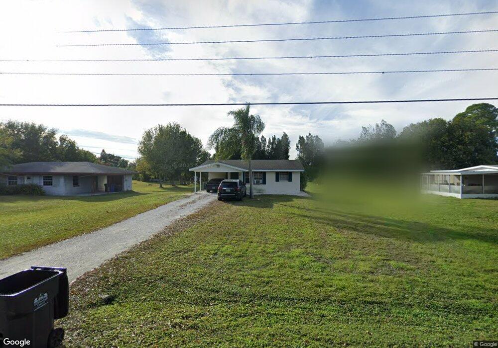
226 13th St NW Ruskin, FL 33570
Estimated Value: $252,350 - $314,000
2
Beds
2
Baths
930
Sq Ft
$302/Sq Ft
Est. Value
About This Home
This home is located at 226 13th St NW, Ruskin, FL 33570 and is currently estimated at $280,588, approximately $301 per square foot. 226 13th St NW is a home located in Hillsborough County with nearby schools including Thompson Elementary School, Shields Middle School, and Lennard High School.
Ownership History
Date
Name
Owned For
Owner Type
Purchase Details
Closed on
Apr 14, 2008
Sold by
Gurecki Dorothy L and Gurecki Leo H
Bought by
Desantis Philip
Current Estimated Value
Home Financials for this Owner
Home Financials are based on the most recent Mortgage that was taken out on this home.
Original Mortgage
$137,837
Outstanding Balance
$87,587
Interest Rate
6.03%
Mortgage Type
FHA
Estimated Equity
$193,001
Create a Home Valuation Report for This Property
The Home Valuation Report is an in-depth analysis detailing your home's value as well as a comparison with similar homes in the area
Home Values in the Area
Average Home Value in this Area
Purchase History
| Date | Buyer | Sale Price | Title Company |
|---|---|---|---|
| Desantis Philip | $140,000 | Hillsborough Title Of Brando |
Source: Public Records
Mortgage History
| Date | Status | Borrower | Loan Amount |
|---|---|---|---|
| Open | Desantis Philip | $137,837 |
Source: Public Records
Tax History Compared to Growth
Tax History
| Year | Tax Paid | Tax Assessment Tax Assessment Total Assessment is a certain percentage of the fair market value that is determined by local assessors to be the total taxable value of land and additions on the property. | Land | Improvement |
|---|---|---|---|---|
| 2024 | $1,180 | $79,988 | -- | -- |
| 2023 | $1,101 | $77,658 | $0 | $0 |
| 2022 | $979 | $75,396 | $0 | $0 |
| 2021 | $978 | $73,200 | $0 | $0 |
| 2020 | $915 | $72,189 | $0 | $0 |
| 2019 | $858 | $70,566 | $0 | $0 |
| 2018 | $858 | $69,250 | $0 | $0 |
| 2017 | $851 | $104,554 | $0 | $0 |
| 2016 | $844 | $66,431 | $0 | $0 |
| 2015 | $855 | $65,969 | $0 | $0 |
| 2014 | $838 | $65,445 | $0 | $0 |
| 2013 | -- | $64,478 | $0 | $0 |
Source: Public Records
Map
Nearby Homes
- 1112 W Shell Point Rd Unit 207
- 1112 W Shell Point Rd Unit 107
- 1112 W Shell Point Rd Unit 511
- 1112 W Shell Point Rd Unit 504
- 566 Sunlit Coral St
- 1603 W Shell Point Rd
- 0 Sable Cove Unit MFRTB8439435
- 304 14th St SW
- 105 E North Branch Rd
- 105 12th St SW
- 821 White Heron Blvd
- 817 2nd Ave NW
- 1027 Ocean Spray Dr
- 829 Blue Heron Blvd
- 106 W North Branch Rd
- 0 11th St SW Unit MFRTB8366394
- 1203 7th Ave NW
- 102 W North Branch Rd
- 119 18th St NW
- 828 Blue Heron Blvd
- 1302 W Shell Point Rd
- 224 13th St NW
- 222 13th St NW
- 1308 W Shell Point Rd
- 218 13th St NW
- 225 13th St NW Unit NW
- 1202 W Shell Point Rd
- 223 13th St NW
- 1404 W Shell Point Rd
- 1200 W Shell Point Rd
- 216 13th St NW
- 1401 Nethers Place
- 1142 W Shell Point Rd
- 215 13th St NW
- 1318 Ocean Spray Dr
- 212 13th St NW
- 1320 Ocean Spray Dr
- 1314 Ocean Spray Dr
- 1410 W Shell Point Rd
- 1322 Ocean Spray Dr