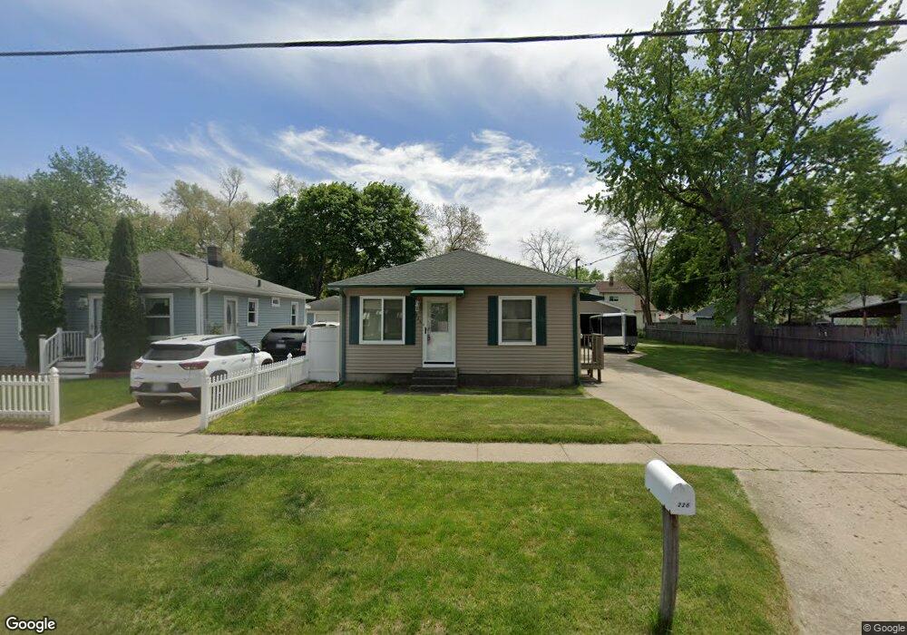
226 Abbie St SE Grand Rapids, MI 49548
Estimated Value: $204,000 - $220,334
2
Beds
1
Bath
720
Sq Ft
$294/Sq Ft
Est. Value
About This Home
This home is located at 226 Abbie St SE, Grand Rapids, MI 49548 and is currently estimated at $211,334, approximately $293 per square foot. 226 Abbie St SE is a home located in Kent County with nearby schools including Godwin Heights Senior High School, AnchorPoint Christian School, and West Michigan Lutheran High School.
Ownership History
Date
Name
Owned For
Owner Type
Purchase Details
Closed on
May 13, 2014
Sold by
Buist Dennis J and Buist Elizabeth
Bought by
Peterson Brian
Current Estimated Value
Home Financials for this Owner
Home Financials are based on the most recent Mortgage that was taken out on this home.
Original Mortgage
$78,508
Outstanding Balance
$60,011
Interest Rate
4.41%
Mortgage Type
VA
Estimated Equity
$151,323
Purchase Details
Closed on
Nov 19, 1985
Create a Home Valuation Report for This Property
The Home Valuation Report is an in-depth analysis detailing your home's value as well as a comparison with similar homes in the area
Home Values in the Area
Average Home Value in this Area
Purchase History
| Date | Buyer | Sale Price | Title Company |
|---|---|---|---|
| Peterson Brian | $76,000 | Chicago Title | |
| -- | $2,800 | -- |
Source: Public Records
Mortgage History
| Date | Status | Borrower | Loan Amount |
|---|---|---|---|
| Open | Peterson Brian | $78,508 |
Source: Public Records
Tax History Compared to Growth
Tax History
| Year | Tax Paid | Tax Assessment Tax Assessment Total Assessment is a certain percentage of the fair market value that is determined by local assessors to be the total taxable value of land and additions on the property. | Land | Improvement |
|---|---|---|---|---|
| 2025 | $1,440 | $94,600 | $0 | $0 |
| 2024 | $1,440 | $87,900 | $0 | $0 |
| 2023 | $1,599 | $76,200 | $0 | $0 |
| 2022 | $1,476 | $63,800 | $0 | $0 |
| 2021 | $1,442 | $57,200 | $0 | $0 |
| 2020 | $1,219 | $52,300 | $0 | $0 |
| 2019 | $1,183 | $46,300 | $0 | $0 |
| 2018 | $1,383 | $40,900 | $0 | $0 |
| 2017 | $1,348 | $39,100 | $0 | $0 |
| 2016 | $1,300 | $33,400 | $0 | $0 |
| 2015 | $1,270 | $33,400 | $0 | $0 |
| 2013 | -- | $30,700 | $0 | $0 |
Source: Public Records
Map
Nearby Homes
- 311 Walter St SE
- 344 Abbie St SE
- 339 Burt Ave SE
- 4104 Jefferson Ave SE
- 41 Wilbur St SE
- 4111 Woodstock Ave SE
- 4117 Woodstock Ave SE
- 251 43rd St SE
- 49 Thurston St SW
- 4060 Buchanan Ave SW
- 102 Murray St SE
- 350 Murray St SE
- 228 Floyd St SW
- 217 Maplelawn St SW
- 216 Maplelawn St SW
- 4438 Jefferson Ave SE
- 4503 Madison Ave SE
- 4509 Wilkshire Ave SW
- 301 Murray St SW
- 467 Stonehenge St SE
- 232 Abbie St SE
- 218 Abbie St SE
- 238 Abbie St SE
- 216 Abbie St SE
- 222 Abbie St SE
- 227 Walter St SE
- 242 Abbie St SE
- 219 Walter St SE
- 233 Walter St SE
- 213 Walter St SE
- 241 Walter St SE
- 209 Walter St SE
- 223 Abbie St SE
- 227 Abbie St SE
- 233 Abbie St SE
- 219 Abbie St SE
- 243 Walter St SE
- 243 Abbie St SE
- 248 Abbie St SE
- 215 Abbie St SE