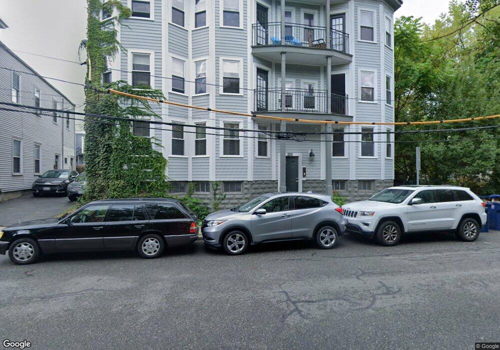
226 Banks St Unit 6 Cambridge, MA 02138
Riverside NeighborhoodEstimated Value: $719,630 - $931,000
2
Beds
1
Bath
750
Sq Ft
$1,089/Sq Ft
Est. Value
About This Home
This home is located at 226 Banks St Unit 6, Cambridge, MA 02138 and is currently estimated at $816,658, approximately $1,088 per square foot. 226 Banks St Unit 6 is a home located in Middlesex County with nearby schools including Saint Paul's Choir School and St Herman Of Alaska Christian School.
Ownership History
Date
Name
Owned For
Owner Type
Purchase Details
Closed on
Jun 22, 2015
Sold by
Rotem Itzhak and Rotem Hemda
Bought by
226 Bank St Llc
Current Estimated Value
Purchase Details
Closed on
Jun 27, 2013
Sold by
Armstrong Carey S
Bought by
Rotem Itzhak and Rotem Hemda
Purchase Details
Closed on
Jun 28, 2005
Sold by
Newmarket Mass Prop
Bought by
Schwaber Carey E
Home Financials for this Owner
Home Financials are based on the most recent Mortgage that was taken out on this home.
Original Mortgage
$306,500
Interest Rate
5.82%
Mortgage Type
Purchase Money Mortgage
Create a Home Valuation Report for This Property
The Home Valuation Report is an in-depth analysis detailing your home's value as well as a comparison with similar homes in the area
Home Values in the Area
Average Home Value in this Area
Purchase History
| Date | Buyer | Sale Price | Title Company |
|---|---|---|---|
| 226 Bank St Llc | -- | -- | |
| Rotem Itzhak | $455,000 | -- | |
| Schwaber Carey E | $424,000 | -- |
Source: Public Records
Mortgage History
| Date | Status | Borrower | Loan Amount |
|---|---|---|---|
| Previous Owner | Schwaber Carey E | $306,500 |
Source: Public Records
Tax History Compared to Growth
Tax History
| Year | Tax Paid | Tax Assessment Tax Assessment Total Assessment is a certain percentage of the fair market value that is determined by local assessors to be the total taxable value of land and additions on the property. | Land | Improvement |
|---|---|---|---|---|
| 2025 | $4,306 | $678,100 | $0 | $678,100 |
| 2024 | $3,914 | $661,100 | $0 | $661,100 |
| 2023 | $3,926 | $670,000 | $0 | $670,000 |
| 2022 | $4,125 | $696,800 | $0 | $696,800 |
| 2021 | $3,964 | $677,600 | $0 | $677,600 |
| 2020 | $3,852 | $669,900 | $0 | $669,900 |
| 2019 | $3,701 | $623,100 | $0 | $623,100 |
| 2018 | $3,698 | $573,700 | $0 | $573,700 |
| 2017 | $3,403 | $524,300 | $0 | $524,300 |
| 2016 | $3,228 | $461,800 | $0 | $461,800 |
| 2015 | $3,202 | $409,400 | $0 | $409,400 |
| 2014 | $3,172 | $378,500 | $0 | $378,500 |
Source: Public Records
Map
Nearby Homes
- 2 Hingham St
- 185 Putnam Ave Unit 185
- 20 Flagg St
- 65-67 Howard St Unit 1
- 498 Franklin St
- 515 Franklin St Unit 4
- 19 Fairmont Ave Unit 1
- 25-29 River St
- 512 Green St Unit 1D
- 516 Green St Unit 3D
- 45 Hancock St
- 950 Massachusetts Ave Unit 417
- 950 Massachusetts Ave Unit 512
- 950 Massachusetts Ave Unit 106
- 930 Massachusetts Ave
- 120 Pleasant St Unit 1
- 931 Massachusetts Ave Unit 902
- 931 Massachusetts Ave Unit 606
- 931 Massachusetts Ave Unit 1003
- 15 Fairmont St
- 226 Banks St Unit 5
- 226 Banks St Unit 3
- 226 Banks St Unit 1
- 226 Banks St Unit U 5
- 226 Banks St
- 226 Banks St Unit 4
- 226 Banks St Unit 2
- 224 Banks St
- 224 Banks St Unit 2205
- 224 Banks St Unit 220-1
- 224 Banks St Unit 1-224
- 224 Banks St Unit 222-6
- 224 Banks St Unit 6
- 224 Banks St Unit 5
- 224 Banks St
- 224 Banks St Unit 216-1
- 224 Banks St Unit 220-2
- 224 Banks St Unit 8
- 224 Banks St Unit 2
- 224 Banks St Unit 7