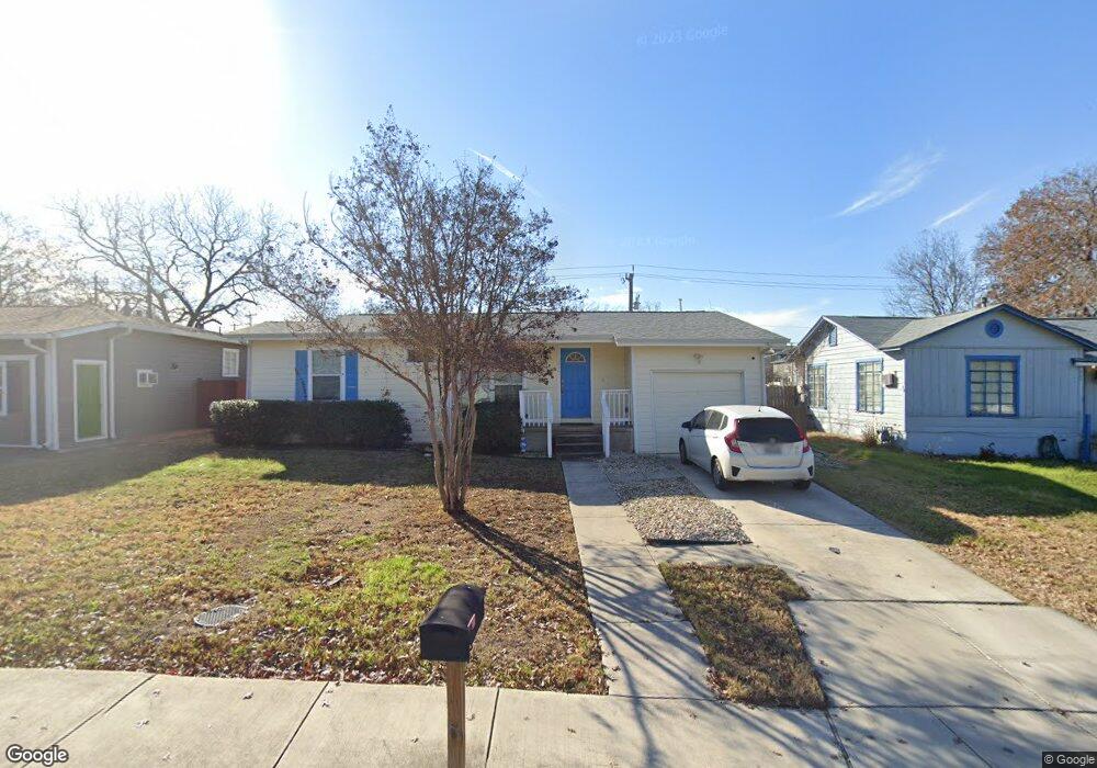
226 Belfast Dr San Antonio, TX 78209
Lincoln Heights NeighborhoodEstimated Value: $235,491 - $245,000
3
Beds
2
Baths
884
Sq Ft
$271/Sq Ft
Est. Value
About This Home
This home is located at 226 Belfast Dr, San Antonio, TX 78209 and is currently estimated at $239,873, approximately $271 per square foot. 226 Belfast Dr is a home located in Bexar County with nearby schools including Woodridge Elementary School, Alamo Heights Junior School, and Alamo Heights High School.
Ownership History
Date
Name
Owned For
Owner Type
Purchase Details
Closed on
Mar 6, 2017
Sold by
Marck Eugene W
Bought by
Paulissen Walter Leonard and Paulissen Barabara Hunt
Current Estimated Value
Home Financials for this Owner
Home Financials are based on the most recent Mortgage that was taken out on this home.
Original Mortgage
$124,000
Outstanding Balance
$63,112
Interest Rate
4.09%
Mortgage Type
New Conventional
Estimated Equity
$176,761
Purchase Details
Closed on
Jul 7, 2014
Sold by
Carter Judith
Bought by
Marck Eugene W
Purchase Details
Closed on
Jun 18, 2002
Sold by
Watson Dalton L
Bought by
Beggs Kathleen M
Create a Home Valuation Report for This Property
The Home Valuation Report is an in-depth analysis detailing your home's value as well as a comparison with similar homes in the area
Home Values in the Area
Average Home Value in this Area
Purchase History
| Date | Buyer | Sale Price | Title Company |
|---|---|---|---|
| Paulissen Walter Leonard | -- | First American Title | |
| Marck Eugene W | -- | Chicago Title | |
| Beggs Kathleen M | -- | -- |
Source: Public Records
Mortgage History
| Date | Status | Borrower | Loan Amount |
|---|---|---|---|
| Open | Paulissen Walter Leonard | $124,000 |
Source: Public Records
Tax History Compared to Growth
Tax History
| Year | Tax Paid | Tax Assessment Tax Assessment Total Assessment is a certain percentage of the fair market value that is determined by local assessors to be the total taxable value of land and additions on the property. | Land | Improvement |
|---|---|---|---|---|
| 2025 | $5,357 | $220,000 | $171,560 | $48,440 |
| 2024 | $5,357 | $238,000 | $171,560 | $66,440 |
| 2023 | $5,357 | $237,000 | $171,560 | $65,440 |
| 2022 | $4,479 | $185,000 | $118,480 | $66,520 |
| 2021 | $4,193 | $168,000 | $103,030 | $64,970 |
| 2020 | $4,122 | $165,000 | $82,980 | $82,020 |
| 2019 | $4,192 | $163,860 | $66,380 | $97,480 |
| 2018 | $3,848 | $153,620 | $66,380 | $87,240 |
| 2017 | $3,737 | $149,190 | $47,380 | $101,810 |
| 2016 | $2,244 | $89,590 | $40,680 | $48,910 |
| 2015 | $1,993 | $90,080 | $40,680 | $49,400 |
| 2014 | $1,993 | $78,840 | $0 | $0 |
Source: Public Records
Map
Nearby Homes
- 702 Everest Ave
- 1531 W Lawndale Dr
- 1511 E Sandalwood Ln
- 1618 W Lawndale Dr
- 647 Simple Way
- 222 Conway Dr
- 8109 Scottshill
- 8117 Scottshill
- 139 Belfast Dr
- 206 Ridgecrest Dr
- 8112 Scottshill
- 127 Belfast Dr
- 111 Belfast Dr
- 8058 Broadway Unit 138N
- 8058 Broadway Unit 251U
- 8058 Broadway Unit 247 U
- 8058 Broadway Unit 257T
- 8038 Broadway St Unit 225L
- 8038 Broadway St Unit 123
- 8038 Broadway St Unit 223
- 222 Belfast Dr
- 230 Belfast Dr
- 218 Belfast Dr
- 623 Everest St
- 234 Belfast Dr
- 619 Everest St
- 227 Belfast Dr
- 223 Belfast Dr
- 214 Belfast Dr
- 231 Belfast Dr
- 615 Everest St
- 219 Belfast Dr
- 235 Belfast Dr
- 210 Belfast Dr
- 1503 W Lawndale Dr
- 215 Belfast Dr
- 226 Colton Dr
- 211 Belfast Dr
- 222 Colton Dr
- 206 Belfast Dr