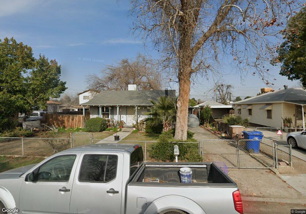
226 Bloomquist Dr Bakersfield, CA 93309
Southwest Bakersfield NeighborhoodEstimated Value: $192,000 - $279,000
2
Beds
1
Bath
765
Sq Ft
$305/Sq Ft
Est. Value
About This Home
This home is located at 226 Bloomquist Dr, Bakersfield, CA 93309 and is currently estimated at $233,433, approximately $305 per square foot. 226 Bloomquist Dr is a home located in Kern County with nearby schools including Munsey Elementary School, Curran Middle School, and West High School.
Ownership History
Date
Name
Owned For
Owner Type
Purchase Details
Closed on
Mar 12, 2004
Sold by
Gregory Manal M
Bought by
Gregory James T
Current Estimated Value
Home Financials for this Owner
Home Financials are based on the most recent Mortgage that was taken out on this home.
Original Mortgage
$50,344
Interest Rate
5.7%
Mortgage Type
FHA
Create a Home Valuation Report for This Property
The Home Valuation Report is an in-depth analysis detailing your home's value as well as a comparison with similar homes in the area
Home Values in the Area
Average Home Value in this Area
Purchase History
We collect this data history from publicly available records. To have your information removed, we recommend requesting removal directly through your county’s website.
| Date | Buyer | Sale Price | Title Company |
|---|---|---|---|
| Gregory James T | -- | -- |
Source: Public Records
Mortgage History
We collect this data history from publicly available records. To have your information removed, we recommend requesting removal directly through your county’s website.
| Date | Status | Borrower | Loan Amount |
|---|---|---|---|
| Closed | Gregory James T | $50,344 |
Source: Public Records
Tax History
| Year | Tax Paid | Tax Assessment Tax Assessment Total Assessment is a certain percentage of the fair market value that is determined by local assessors to be the total taxable value of land and additions on the property. | Land | Improvement |
|---|---|---|---|---|
| 2025 | $1,763 | $103,163 | $22,494 | $80,669 |
| 2024 | $1,763 | $101,141 | $22,053 | $79,088 |
| 2023 | $1,711 | $99,159 | $21,621 | $77,538 |
| 2022 | $1,637 | $97,216 | $21,198 | $76,018 |
| 2021 | $1,551 | $95,311 | $20,783 | $74,528 |
| 2020 | $1,508 | $94,334 | $20,570 | $73,764 |
| 2019 | $1,478 | $94,334 | $20,570 | $73,764 |
| 2018 | $1,431 | $90,672 | $19,772 | $70,900 |
| 2017 | $1,420 | $88,895 | $19,385 | $69,510 |
| 2016 | $1,117 | $70,000 | $18,000 | $52,000 |
| 2015 | $1,162 | $73,000 | $18,000 | $55,000 |
| 2014 | $889 | $50,000 | $13,000 | $37,000 |
Source: Public Records
Map
Nearby Homes
- 513 Prosser Ave
- 1001 McDonald Way Unit 40
- 402 Westwood St
- 4629 Fishering Dr
- 1017 Nimrod Ct
- 4428 Belle Terrace
- 4600 Randy Ave
- 4108 Wood Ln
- 4714 Frazier Ave
- 4010 Cork Ln
- 3820 Apache Ave
- 609 Taylor St
- 3600 Wood Ln
- 9 Dunlap St
- 700 New Stine Rd Unit 10
- 1437 Libra Ct
- 240 S Real Rd
- 5401 Burning Tree Ct
- 1317 Capricorn Ct
- 3613 Granada Ave
- 228 Bloomquist Dr
- 224 Bloomquist Dr
- 222 Bloomquist Dr
- 227 Fishering Dr
- 225 Fishering Dr
- 4315 Fishering Dr
- 223 Fishering Dr
- 220 Bloomquist Dr
- 4400 Bloomquist Dr
- 223 Bloomquist Dr
- 221 Fishering Dr
- 4401 Fishering Dr
- 218 Bloomquist Dr
- 221 Bloomquist Dr
- 4406 Bloomquist Dr
- 4401 Bloomquist Dr
- 217 Fishering Dr
- 4401 Blomquist Dr
- 4318 Fishering Dr
- 4300 Fishering Dr
Your Personal Tour Guide
Ask me questions while you tour the home.