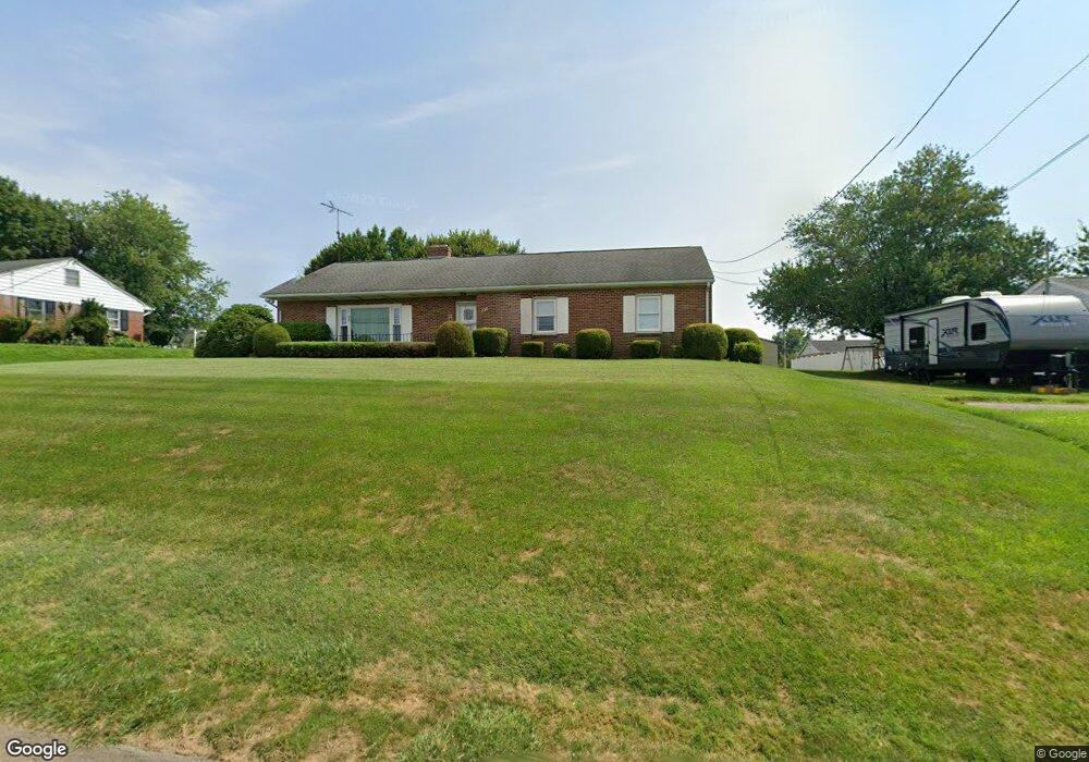
226 E Main St Fawn Grove, PA 17321
Estimated Value: $251,814 - $291,000
3
Beds
1
Bath
1,232
Sq Ft
$221/Sq Ft
Est. Value
About This Home
This home is located at 226 E Main St, Fawn Grove, PA 17321 and is currently estimated at $271,704, approximately $220 per square foot. 226 E Main St is a home located in York County with nearby schools including South Eastern Intermediate School, South Eastern Middle School, and Kennard-Dale High School.
Ownership History
Date
Name
Owned For
Owner Type
Purchase Details
Closed on
Mar 31, 2006
Sold by
Glackin David L and Glackin Margaret M
Bought by
Garrett Charles W
Current Estimated Value
Home Financials for this Owner
Home Financials are based on the most recent Mortgage that was taken out on this home.
Original Mortgage
$173,000
Outstanding Balance
$98,842
Interest Rate
6.26%
Mortgage Type
Purchase Money Mortgage
Estimated Equity
$172,862
Purchase Details
Closed on
Oct 1, 1983
Bought by
Glackin David L
Create a Home Valuation Report for This Property
The Home Valuation Report is an in-depth analysis detailing your home's value as well as a comparison with similar homes in the area
Home Values in the Area
Average Home Value in this Area
Purchase History
| Date | Buyer | Sale Price | Title Company |
|---|---|---|---|
| Garrett Charles W | $187,000 | None Available | |
| Glackin David L | $46,500 | -- |
Source: Public Records
Mortgage History
| Date | Status | Borrower | Loan Amount |
|---|---|---|---|
| Open | Garrett Charles W | $173,000 |
Source: Public Records
Tax History Compared to Growth
Tax History
| Year | Tax Paid | Tax Assessment Tax Assessment Total Assessment is a certain percentage of the fair market value that is determined by local assessors to be the total taxable value of land and additions on the property. | Land | Improvement |
|---|---|---|---|---|
| 2025 | $3,689 | $118,410 | $31,380 | $87,030 |
| 2024 | $3,689 | $118,410 | $31,380 | $87,030 |
| 2023 | $3,689 | $118,410 | $31,380 | $87,030 |
| 2022 | $3,689 | $118,410 | $31,380 | $87,030 |
| 2021 | $3,570 | $118,410 | $31,380 | $87,030 |
| 2020 | $3,570 | $118,410 | $31,380 | $87,030 |
| 2019 | $3,558 | $118,410 | $31,380 | $87,030 |
| 2018 | $3,558 | $118,410 | $31,380 | $87,030 |
| 2017 | $3,558 | $118,410 | $31,380 | $87,030 |
| 2016 | $0 | $118,410 | $31,380 | $87,030 |
| 2015 | -- | $118,410 | $31,380 | $87,030 |
| 2014 | -- | $118,410 | $31,380 | $87,030 |
Source: Public Records
Map
Nearby Homes
- 31 N Market St
- 1701 Scott Rd
- 54 Mitchell Rd
- 387 Garvine Mill Rd
- 194 Cook Rd
- 2913 Whiteford Rd
- 267 Cook Rd
- 2131 Channel Rd
- 101 Saint Marys Rd
- 257 Wiley Mill Rd
- 20 Carea Rd
- 415 Saint Marys Rd
- 1038 Woodshire Ln
- 216 Meadow Trail
- Lot C Bryansville Rd
- Parcel 859 Neill Run Rd
- 46 Corn Tassel Rd
- 402 Pylesville Rd
- 4816 Amos Rd
- 8290 Woodbine Rd