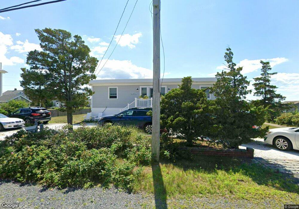
226 Gurnet Rd Duxbury, MA 02332
Green Harbor-Cedar Crest NeighborhoodEstimated Value: $711,000 - $1,085,303
2
Beds
1
Bath
1,472
Sq Ft
$648/Sq Ft
Est. Value
About This Home
This home is located at 226 Gurnet Rd, Duxbury, MA 02332 and is currently estimated at $954,076, approximately $648 per square foot. 226 Gurnet Rd is a home located in Plymouth County with nearby schools including Chandler Elementary School, Alden School, and Duxbury Middle School.
Ownership History
Date
Name
Owned For
Owner Type
Purchase Details
Closed on
Nov 18, 2010
Sold by
266 Gurnet Road Rt and Read Walter E
Bought by
Mcgowan Paul C and Mcgowan Susan E
Current Estimated Value
Home Financials for this Owner
Home Financials are based on the most recent Mortgage that was taken out on this home.
Original Mortgage
$156,500
Outstanding Balance
$103,414
Interest Rate
4.3%
Mortgage Type
Purchase Money Mortgage
Estimated Equity
$850,662
Create a Home Valuation Report for This Property
The Home Valuation Report is an in-depth analysis detailing your home's value as well as a comparison with similar homes in the area
Home Values in the Area
Average Home Value in this Area
Purchase History
| Date | Buyer | Sale Price | Title Company |
|---|---|---|---|
| Mcgowan Paul C | $259,000 | -- |
Source: Public Records
Mortgage History
| Date | Status | Borrower | Loan Amount |
|---|---|---|---|
| Open | Mcgowan Paul C | $156,500 |
Source: Public Records
Tax History Compared to Growth
Tax History
| Year | Tax Paid | Tax Assessment Tax Assessment Total Assessment is a certain percentage of the fair market value that is determined by local assessors to be the total taxable value of land and additions on the property. | Land | Improvement |
|---|---|---|---|---|
| 2025 | $9,475 | $934,400 | $725,300 | $209,100 |
| 2024 | $8,456 | $840,600 | $623,600 | $217,000 |
| 2023 | $7,879 | $737,000 | $503,300 | $233,700 |
| 2022 | $8,060 | $627,700 | $424,500 | $203,200 |
| 2021 | $8,006 | $552,900 | $351,800 | $201,100 |
| 2020 | $6,754 | $460,700 | $276,300 | $184,400 |
| 2019 | $7,046 | $480,000 | $317,800 | $162,200 |
| 2018 | $5,928 | $391,000 | $225,600 | $165,400 |
| 2017 | $5,808 | $374,500 | $216,100 | $158,400 |
| 2016 | $5,220 | $335,700 | $207,100 | $128,600 |
| 2015 | $4,597 | $294,700 | $207,100 | $87,600 |
Source: Public Records
Map
Nearby Homes
- 36 Ocean Rd N
- 71 Gurnet Rd
- 13 Brighton St
- 184 Bay Ave Unit 2
- 236 Powder Point Ave
- 39 Bay Pond Rd
- 64 Danforth St
- 106 Careswell St
- 76 Marginal St
- 74 Abrams Hill Rd
- 387 Lot 4A Old Cove Rd
- 387 Lot 2A Old Cove Rd
- 387 Lot 3A Old Cove Rd
- 5 Adelaide Way
- 57 Island St
- 53 Ocean St
- 590 Washington St
- 16 Red Pony Path Unit 16
- 535 Washington St
- 54 Chapel St
- 233 Gurnet Road (Paved Rd)
- 234 Gurnet Rd
- 219 Gurnet Rd
- 225 Gurnet Rd
- 229 Gurnet Rd
- 9 Marginal Rd
- 240 Gurnet Rd
- 11 Marginal Rd
- 233 Gurnet Rd
- 207 Gurnet Rd
- 223 Gurnet Rd
- 0 Gurnet Point
- 0 Gurnet Point Unit 21202590
- 0 Gurnet Point Unit 21405232
- 0 Gurnet Point Unit 71688403
- 0 Gurnet Point Unit 71520628
- 0 Gurnet Point Unit 71087920
- 0 Gurnet Point Unit 71072773
- 000 Gurnet Point
- 0 Gurnet Point Unit 71862972