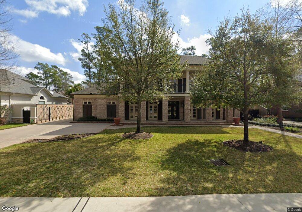
226 Kilts Dr Houston, TX 77024
Memorial NeighborhoodEstimated Value: $2,123,000 - $2,441,000
4
Beds
5
Baths
5,438
Sq Ft
$425/Sq Ft
Est. Value
About This Home
This home is located at 226 Kilts Dr, Houston, TX 77024 and is currently estimated at $2,311,526, approximately $425 per square foot. 226 Kilts Dr is a home located in Harris County with nearby schools including Frostwood Elementary School, Memorial Middle, and Memorial High School.
Ownership History
Date
Name
Owned For
Owner Type
Purchase Details
Closed on
Jul 1, 2002
Sold by
May Margaret Carol Evans
Bought by
Patton Alan and Patton Tammy
Current Estimated Value
Purchase Details
Closed on
Mar 1, 2002
Sold by
Evans Herbert Gordon
Bought by
Evans Grace Elizabeth Clark
Create a Home Valuation Report for This Property
The Home Valuation Report is an in-depth analysis detailing your home's value as well as a comparison with similar homes in the area
Home Values in the Area
Average Home Value in this Area
Purchase History
| Date | Buyer | Sale Price | Title Company |
|---|---|---|---|
| Patton Alan | -- | -- | |
| May Margaret Carol Evans | -- | -- | |
| Evans Grace Elizabeth Clark | -- | -- |
Source: Public Records
Tax History Compared to Growth
Tax History
| Year | Tax Paid | Tax Assessment Tax Assessment Total Assessment is a certain percentage of the fair market value that is determined by local assessors to be the total taxable value of land and additions on the property. | Land | Improvement |
|---|---|---|---|---|
| 2025 | $35,420 | $2,660,028 | $822,800 | $1,837,228 |
| 2024 | $35,420 | $2,254,140 | $786,500 | $1,467,640 |
| 2023 | $35,420 | $2,301,485 | $786,500 | $1,514,985 |
| 2022 | $42,460 | $2,042,035 | $786,500 | $1,255,535 |
| 2021 | $43,631 | $2,014,688 | $786,500 | $1,228,188 |
| 2020 | $43,174 | $1,949,425 | $786,500 | $1,162,925 |
| 2019 | $45,284 | $1,963,169 | $786,500 | $1,176,669 |
| 2018 | $10,153 | $1,998,000 | $750,200 | $1,247,800 |
| 2017 | $42,212 | $1,998,000 | $750,200 | $1,247,800 |
| 2016 | $38,374 | $1,851,000 | $750,200 | $1,100,800 |
| 2015 | $26,013 | $2,047,672 | $750,200 | $1,297,472 |
| 2014 | $26,013 | $1,600,000 | $689,700 | $910,300 |
Source: Public Records
Map
Nearby Homes
- 234 Plantation Rd
- 0 Gessner Rd
- 170 Haversham Dr
- 12327 Tunbridge Ln
- 150 Gessner Rd Unit 5A
- 201 Vanderpool Ln Unit 103
- 201 Vanderpool Ln Unit 65
- 201 Vanderpool Ln Unit 64
- 354 Tealwood Dr
- 358 Tealwood Dr
- 12334 Beauregard Dr
- 241 Litchfield Ln
- 271 Litchfield Ln
- 318 Litchfield Ln
- 259 Litchfield Ln Unit 66
- 336 Litchfield Ln
- 12003 Tall Oaks St
- 8 Woodstone St
- 201 Litchfield Ln
- 10 Warrenton Dr