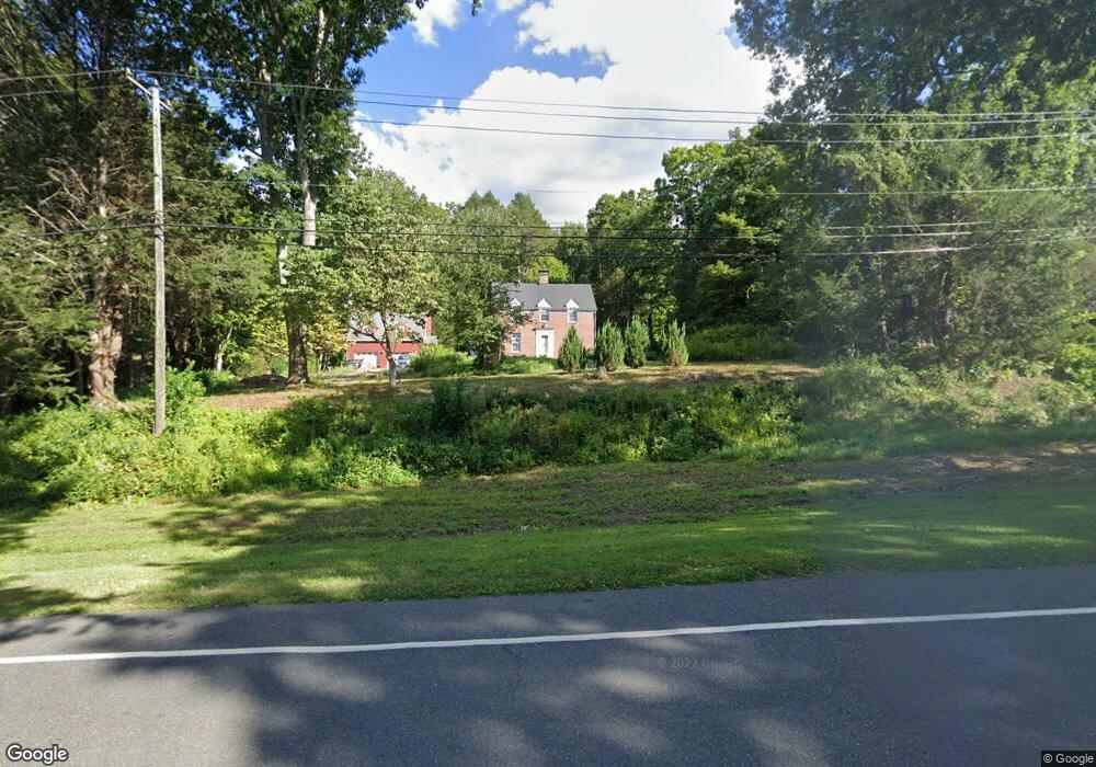
226 Litchfield Rd New Milford, CT 06776
Estimated Value: $521,000 - $633,000
--
Bed
2
Baths
--
Sq Ft
1.37
Acres
About This Home
This home is located at 226 Litchfield Rd, New Milford, CT 06776 and is currently estimated at $579,253. 226 Litchfield Rd is a home located in Litchfield County with nearby schools including Northville Elementary School, Sarah Noble Intermediate School, and Schaghticoke Middle School.
Ownership History
Date
Name
Owned For
Owner Type
Purchase Details
Closed on
Dec 20, 2024
Sold by
Crespan Lourdes G
Bought by
Crespan Lourdes G and Crespan Michael A
Current Estimated Value
Purchase Details
Closed on
Jul 3, 2013
Sold by
Crespan Michael A and Crespan Lourdes G
Bought by
Crespan Lourdes G
Purchase Details
Closed on
Sep 14, 1988
Sold by
Delnicario Joseph A
Bought by
Michael A+Crespon
Home Financials for this Owner
Home Financials are based on the most recent Mortgage that was taken out on this home.
Original Mortgage
$153,000
Interest Rate
10.43%
Mortgage Type
Purchase Money Mortgage
Create a Home Valuation Report for This Property
The Home Valuation Report is an in-depth analysis detailing your home's value as well as a comparison with similar homes in the area
Home Values in the Area
Average Home Value in this Area
Purchase History
| Date | Buyer | Sale Price | Title Company |
|---|---|---|---|
| Crespan Lourdes G | -- | None Available | |
| Crespan Lourdes G | -- | None Available | |
| Crespan Lourdes G | -- | -- | |
| Crespan Lourdes G | -- | -- | |
| Michael A+Crespon | $202,000 | -- |
Source: Public Records
Mortgage History
| Date | Status | Borrower | Loan Amount |
|---|---|---|---|
| Previous Owner | Michael A+Crespon | $25,000 | |
| Previous Owner | Michael A+Crespon | $136,000 | |
| Previous Owner | Michael A+Crespon | $148,000 | |
| Previous Owner | Michael A+Crespon | $153,000 |
Source: Public Records
Tax History Compared to Growth
Tax History
| Year | Tax Paid | Tax Assessment Tax Assessment Total Assessment is a certain percentage of the fair market value that is determined by local assessors to be the total taxable value of land and additions on the property. | Land | Improvement |
|---|---|---|---|---|
| 2025 | $10,624 | $348,320 | $65,660 | $282,660 |
| 2024 | $6,290 | $211,280 | $50,350 | $160,930 |
| 2023 | $6,123 | $211,280 | $50,350 | $160,930 |
| 2022 | $5,990 | $211,280 | $50,350 | $160,930 |
| 2021 | $5,910 | $211,280 | $50,350 | $160,930 |
| 2020 | $6,025 | $210,070 | $55,860 | $154,210 |
| 2019 | $5,937 | $206,850 | $55,860 | $150,990 |
| 2018 | $5,827 | $206,850 | $55,860 | $150,990 |
| 2017 | $5,618 | $206,150 | $55,860 | $150,290 |
| 2016 | $5,519 | $206,150 | $55,860 | $150,290 |
| 2015 | $5,558 | $207,760 | $55,860 | $151,900 |
| 2014 | $5,256 | $199,850 | $55,860 | $143,990 |
Source: Public Records
Map
Nearby Homes
- 4 High Trail
- 75 Buckingham Rd
- 5 Delivery Ln
- 4 Stone Oak Dr
- 326 Litchfield Rd
- 15 Harmony Trail
- 10 Harmony Trail
- 31 Sterling Dr
- 40 Mount Tom Rd
- 62 Big Bear Hill Rd
- 56 Big Bear Hill Rd
- 3 Belair Dr Unit 3
- 7 Mount Tom Rd
- 2 Chatfield Rd
- 85 Weathervane Dr
- 159 Merryall Rd
- 165 Merryall Rd
- 151 Guernsey Ln
- 0 Chestnut Land Rd Unit 24024843
- 0 Chestnut Land Rd Unit 24024823