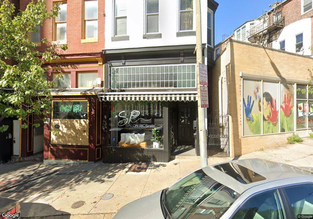
226 N Liberty St Baltimore, MD 21201
Downtown Baltimore NeighborhoodEstimated Value: $705,052
--
Bed
--
Bath
3,120
Sq Ft
$226/Sq Ft
Est. Value
About This Home
This home is located at 226 N Liberty St, Baltimore, MD 21201 and is currently estimated at $705,052, approximately $225 per square foot. 226 N Liberty St is a home located in Baltimore City with nearby schools including The Historic Samuel Coleridge-Taylor Elementary School, Booker T. Washington Middle School, and Paul Laurence Dunbar High School.
Ownership History
Date
Name
Owned For
Owner Type
Purchase Details
Closed on
Jan 18, 2006
Sold by
A J J and A Jo Ann
Bought by
Brooks Mazie L.L.C
Current Estimated Value
Home Financials for this Owner
Home Financials are based on the most recent Mortgage that was taken out on this home.
Original Mortgage
$300,000
Outstanding Balance
$176,592
Interest Rate
7.08%
Mortgage Type
Commercial
Estimated Equity
$528,460
Create a Home Valuation Report for This Property
The Home Valuation Report is an in-depth analysis detailing your home's value as well as a comparison with similar homes in the area
Home Values in the Area
Average Home Value in this Area
Purchase History
| Date | Buyer | Sale Price | Title Company |
|---|---|---|---|
| Brooks Mazie L.L.C | $300,000 | -- |
Source: Public Records
Mortgage History
| Date | Status | Borrower | Loan Amount |
|---|---|---|---|
| Open | Brooks Mazie L.L.C | $300,000 |
Source: Public Records
Tax History Compared to Growth
Tax History
| Year | Tax Paid | Tax Assessment Tax Assessment Total Assessment is a certain percentage of the fair market value that is determined by local assessors to be the total taxable value of land and additions on the property. | Land | Improvement |
|---|---|---|---|---|
| 2025 | $4,622 | $200,867 | -- | -- |
| 2024 | $4,622 | $196,800 | $64,000 | $132,800 |
| 2023 | $4,644 | $196,800 | $64,000 | $132,800 |
| 2022 | $4,644 | $196,800 | $64,000 | $132,800 |
| 2021 | $5,060 | $214,400 | $64,000 | $150,400 |
| 2020 | $5,060 | $214,400 | $64,000 | $150,400 |
| 2019 | $5,036 | $214,400 | $64,000 | $150,400 |
| 2018 | $5,246 | $222,300 | $64,000 | $158,300 |
| 2017 | $5,246 | $222,300 | $0 | $0 |
| 2016 | $7,079 | $222,300 | $0 | $0 |
| 2015 | $7,079 | $225,200 | $0 | $0 |
| 2014 | $7,079 | $255,200 | $0 | $0 |
Source: Public Records
Map
Nearby Homes
- 404 Saint Paul St
- 18 W Franklin St
- 523 N Charles St
- 319 N Paca St
- 3 W Mount Vernon Place Unit 1
- 328 N Paca St
- 503 W Lexington St
- 615 Jasper St
- 22 S Howard St Unit R201
- 216 W Monument St
- 234 Holliday St Unit 602
- 700 Washington Place Unit 2D
- 700 Washington Place Unit 1F
- 700 Washington Place Unit 4B
- 700 Washington Place Unit 3B
- 14 E Mount Vernon Place Unit 15 (B4)
- 15 E Branch Ln Unit 22
- 645 N Paca St
- 801 Park Ave Unit 2
- 10 W Madison St Unit 21
- 224 N Liberty St
- 224 N Liberty St Unit 3
- 224 N Liberty St Unit 2
- 222 N Liberty St Unit 3
- 222 N Liberty St
- 222 N Liberty St Unit 2
- 107 W Saratoga St
- 105 W Saratoga St Unit 3
- 105 W Saratoga St Unit 2
- 105 W Saratoga St
- 105 W Saratoga St Unit 1
- 109 W Saratoga St
- 220 N Liberty St
- 111 W Saratoga St
- 113 W Saratoga St
- 103 W Saratoga St
- 218 N Liberty St
- 115 W Saratoga St
- 131 W Saratoga St
- 106 Clay St